Last updated: October 10, 2024
Place
Fairyland Point
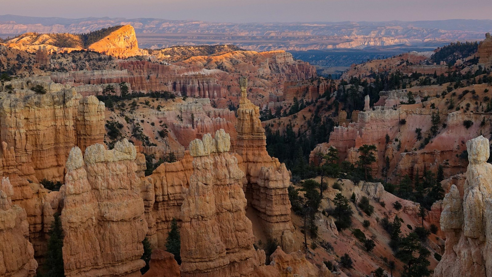
NPS Photo / Peter Densmore
Quick Facts
Location:
Just south of the park entrance at the end of a 1 mile spur road.
Significance:
The northernmost viewpoint along the rim of the plateau.
Amenities
3 listed
Bicycle - Rack, Picnic Table, Wheelchair Accessible
The road to this viewpoint is closed to vehicles in winter months to provide for winter activities like cross-country skiing and snowshoeing.
The shuttle does not provide service to Fairyland Point.
Fairyland Point is the northernmost viewpoint along the rim of the Paunsagunt Plateau within the park. The hoodoos (irregularly eroded rock spires) that fill Fairyland Canyon are younger than those further to the south in the main Bryce Amphitheater, and will be developed more fully as the erosional processes associated with the Paria River to the east continue to wear away the land in a north and westward direction. By contrast, immediately to the south is Campbell Canyon, where you can hike through a "hoodoo graveyard." In this region, all the hoodoos have eroded away leaving multicolored clay mounds, which like tombstones, mark their passing. Campbell Canyon can be reached by hiking the Fairyland Loop or Tower Bridge Trail, or overlooked along the Rim Trail.
Trails
The 5.5 mile (8.9 km) Rim Trail connects this view to Sunrise, Sunset, Inspiration, and Bryce Points to the south. The most popular section is the 0.5 mile (0.8 km) section between Sunrise and Sunset Points; this section is paved (and therefore permits leashed pets) and has minimal elevation changes. The Fairyland Loop Trail also descends from this viewpoint area.
Landscape Features
To the North
Travelling down the trail into Fairyland Canyon a short way will provide views to the northern end of the park, where erosion of the Paunsagunt Plateau associated with the Paria River to the east has been occurring for less time than areas of the park to the south. The area you are looking upon is the northern end of the Paria Valley.
Thrust faulting associated with the volcanic activity that also created the Black Mountains far to the north around 20 million years ago has created diagonal cracks within hoodoos here; if you look closely you may notice some hoodoos with older, Cretaceous-era rocks associated with the Grey Cliffs pushed up on top of hoodoos formed from the Eocene-era Claron Formation or Pink Cliffs. Driving along Highway 12 towards Mossy Cave provides a closer view of the smooth slickenslide surfaces created by these thrust faults.
To the East
Below the iron-oxide colored limey mudstones of the Pink Cliffs of Bryce Canyon, the valley of the Paria river exposes marine shales of the Grey Cliffs. At the point where these two rock types meet, Sinking Ship stands at about 30 degrees, tilted up by the faultline that runs along the eastern edge of the park. This fault, known as the Paunsagunt fault, was created over the last 20 million years by forces associated first with the uplift of this Colorado Plateau region, and later with the extension of Basin and Range faulting to the west in Nevada and California. This fault is a normal fault--bringing the eastern edge of the Paunsagunt Plateau down and away from rocks to the east and to the level of the softer marine Grey Cliffs that form the valley floor in this area. This arrangement is largely responsible for the creation of the amphitheaters along the edge of the plateau, as seasonal streams that run to the Paria River have formed within the Pink Cliffs, rather than far below them. To see what that arrangement would look like, look further east to the colorful Table Cliff plateau standing at 10,000 ft (3048 m) along the opposite side of the valley. This is the same rock layer seen within the park, however it remains at a height unaffected by the movement of the Paunsagunt fault.
To the West
The Paunsagunt Plateau begins to level off in this area, with ponderosa forests found along hills surrounded by meadows of grass and sage. Look for wildlife like pronghorn and mule deer within these meadows. Mountain lions have also been seen, though it's extremely rare.
To the South
To the south is the feature known as Boat Mesa. It capped with a resistant rock called the Conglomerate at Boat Mesa. These conglomerated pebbles and rocks formed in the period after the freshwater lakes that deposited the iron-rich Claron formation that forms the hoodoos below were replaced by large streams carrying water from volcanic mountains building to the north. Boat Mesa rises above the hoodoos of Fairyland Canyon to an elevation of 8073 feet. Beyond it is Campbell Canyon, and beyond that is the Bryce Amphitheater.