Last updated: July 18, 2023
Place
Saddle Mountain
©STEVE OLSON
Quick Facts
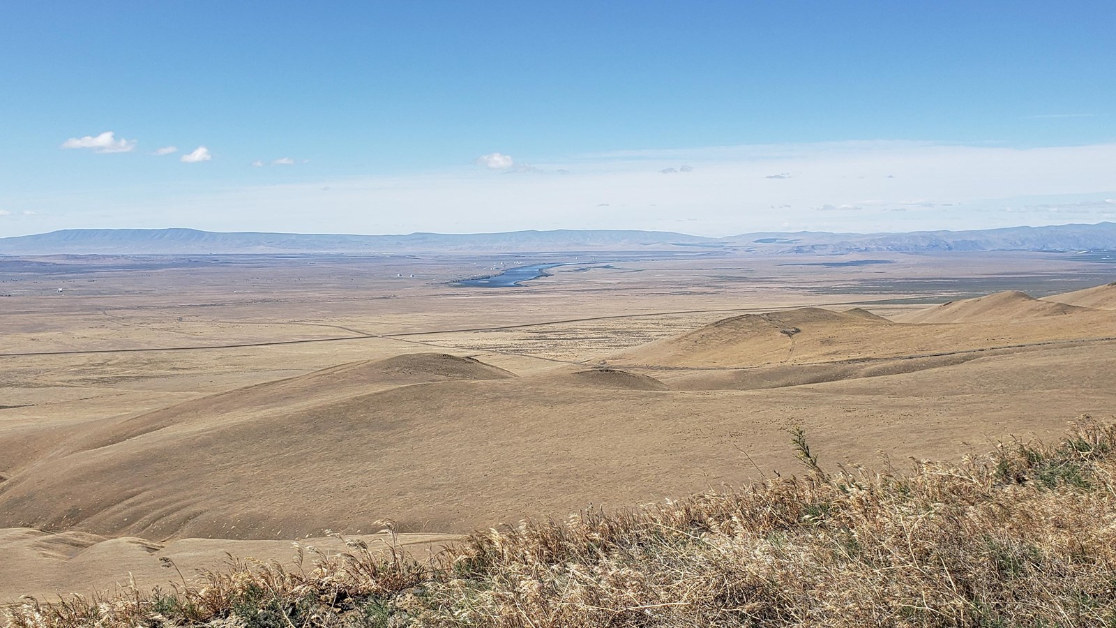
The summit of Saddle Mountain offers phenomenal views of the Hanford Site and the surrounding area. On a clear day, you can see B Reactor, T Plant, Richland, and the sites of the former towns of White Bluffs and Hanford from the summit. This vantage point provides a sense the vastness of the area the government appropriated for the Manhattan Project, the American effort to develop an atomic bomb.
In 1942, General Leslie R. Groves, military leader of the Manhattan Project, directed Lieutenant Colonel Franklin T. Matthias to search the United States for a place to produce plutonium. After viewing several locations, Matthias visited Hanford on December 22 and knew he found an ideal place to produce plutonium. Groves wanted a large, sparsely populated area with ready access to water and electricity. The towns of Hanford, White Bluffs, and Richland were near the site, but all were small farming communities. The Columbia River could supply the water needed to cool the nuclear reactors. The project could get the massive amounts of electric power required for plutonium production from Grand Coulee Dam, which began operating in 1942. Upon seeing this area, Matthias believed he “found the only place in the country that could match the requirements for a desirable site.” On January 16, 1943, Groves approved the Hanford Site as the center for plutonium production.
Still, the Hanford Site presented challenges as well as opportunities. Heavy windstorms inundated workers’ homes with sand. These storms were known as “termination winds” because they drove workers to resign. The site’s isolation enabled the Manhattan Project to maintain secrecy while limiting the health and safety impact of plutonium production on nearby residents. The Hanford Site’s rocky soil protected large industrial facilities safe from earthquake damage. These favorable conditions led the Atomic Energy Commission, which assumed management of the nation’s nuclear weapons program from the Army Corps of Engineers at the end of the World War II, to greatly expand Hanford’s plutonium production capacity during the Cold War. Plutonium production at the Hanford Site ended in 1987. Since then, the area has been the focus of extensive environmental cleanup work.
Today, Saddle Mountain lies within the Hanford Reach National Monument, administered by the US Fish and Wildlife Service. The Hanford Reach preserves the last free-flowing (not dammed) section of the Columbia River. From the top of Saddle Mountain, you can see the foundations of the military barracks where soldiers guarded the Hanford Site from potential aerial attack. These barracks were later abandoned when three Nike missile sites were built on the valley floor. Though no maintained trails exist to the summit of Saddle Mountain, hiking on informal trails and cross-country travel is permitted. Hiking, watersports, and other outdoor activities are available at numerous other locations within the national monument.
Continue Your Journey
The Department of Energy offers tours of the B Reactor and the Pre-War Historic Sites Tour that visit sites such as the Bruggemann Ranch, the White Bluffs Bank, Hanford High School, and the Allard Pumphouse where local people lived, worked, and came together as a tight-knit community prior to the arrival of the Manhattan Project.
If you are unable to attend one of these tours you, can see the former White Bluffs community from the White Bluffs Overlook, and the Hanford High School Overlook from the White Bluffs trail on the Hanford Reach National Monument.