Last updated: December 29, 2022
Place
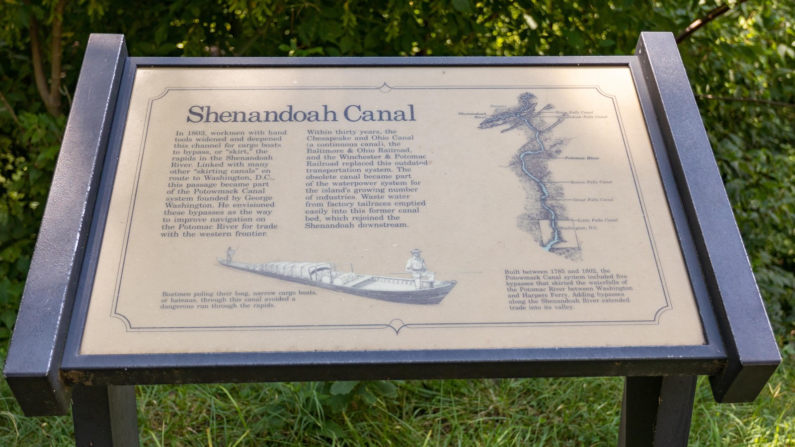
Information Panel: Shenandoah Canal
NPS / Claire Hassler
Quick Facts
Amenities
1 listed
Historical/Interpretive Information/Exhibits
In 1806, workmen with hand tools widened and deepened this channel for cargo boats to bypass, or "skirt," the rapids in the Shenandoah River. Linked with many other "skirting canals" en route to Washington, D.C., this passage became part of the Potowmack Canal system founded by George Washington. He envisioned these bypasses as the way to improve navigation on the Potomac River for trade with the western frontier.
Within thirty years, the Chesapeake and Ohio Canal (a continuous canal), the Baltimore & Ohio Railroad, and the Winchester & Potomac Railroad replaced this outdated transportation system. The obsolete canal became part of the waterpower system for the island's growing number of industries. Waste water from mill and foundry tailraces emptied easily into this former canal bed, which rejoined the Shenandoah downstream.
Art Caption: Boatman pulling their long narrow cargo boats, or bateaus, through this canal avoided a dangerous run through the rapids.
Map Caption: Built between 1785 and 1802, the Potowmack Canal system included five bypasses that skirted the waterfalls of the Potomac River between Washington and Harpers Ferry. Adding bypasses along the Shenandoah River extended trade into its valley.