Last updated: May 16, 2025
Place
Assan (Asan) Beach
National Archives 127-N-63472
Quick Facts
Location:
FPF5+8WP, Maina, Guam
Significance:
Northern landing site during the Battle of Guam
Today, Assan's most distinguishable landmark is a large grassy park that sits between the main village and the ocean. Known by many as Assan Beach Park, the Asan Beach Unit of the War in the Pacific National Historical Park is a large expanse of grass, with coconut trees, pavilions, a popular walking path, the Liberator's Memorial and historical artifacts, but in 1944 during the Battle of Guam, this was a scene of fierce fighting and carnage.[1]
During the occupation of Guam by the Imperial Japanese Army, the indigenous CHamoru of the coastal village of Assan remember life as relatively calm and quiet as long as they obeyed the Imperial Japanese. Women often worked the fields, planting crops and harvesting.
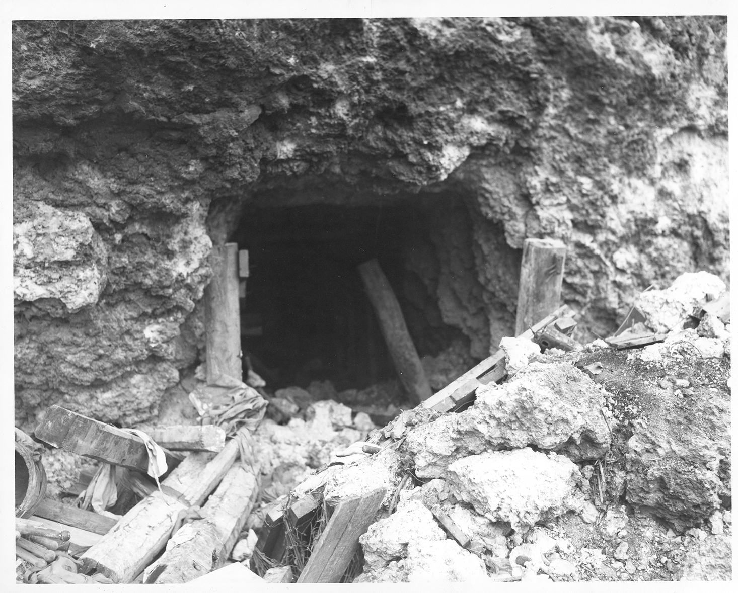
Japanese occupiers forced the CHamoru to build defenses throughout the island. At Assan village, CHamoru and American prisoners-of-war piled rocks along the beach and clogged the reef with heavy wire cubes filled with cement and coral. The forced laborers built tank traps made of vertical tree trunks buried under the sand, as well as the pillboxes and bunkers that can still be seen today. Caves in the cliffs above Assan were turned into machine gun positions. Even children were forced to join the war effort. When they were in school, children were required to move materials for the laborers.[2]
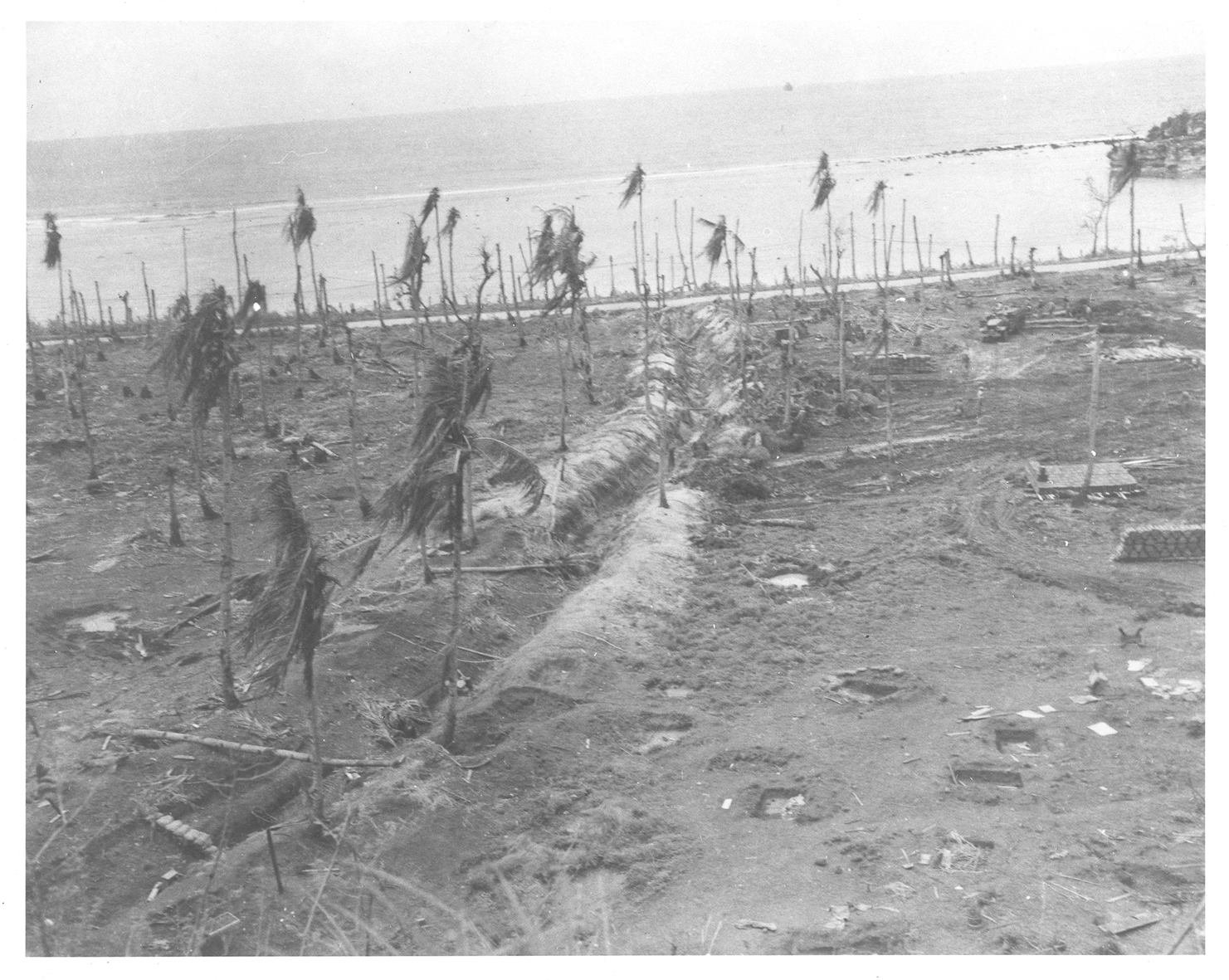
Aware that the Japanese were preparing for an invasion of Guam, the American forces did their best to level the playing field. For two weeks leading up to the invasion, a formidable force of cruisers, battleships, destroyers, escort carriers and other vessels bombed the island. Battleships hurled 836 sixteen-inch rounds, and 5,422 fourteen-inch shells. Cruisers fired 3,862 eight-inch and 2,430 six-inch rounds. Destroyers fired 16,214 five-inch shells. In addition, carrier air strikes added to the assault.[3] The scars of this bombardment, which lasted from July 8 to July 21, 1944, can still be seen around Guam where these weapons blasted into cliffsides, forever changing the island's landscape.
While the bombardment battered the coast, the American Underwater Demolition Teams (UDTs) attacked the defenses protecting the landing beaches. During the week leading up to the invasion, the UDTs blew gaps in the rugged coral reefs surrounding the island, creating a route to shore for landing vehicles, and destroyed most of the mines and obstacles the Imperial Japanese Army had forced the CHamoru to construct. At Assan, they also left a playful message for the Marines. Nailed to a tree on the beach was a large sign reading "Welcome Marines! USO that way!"[4]
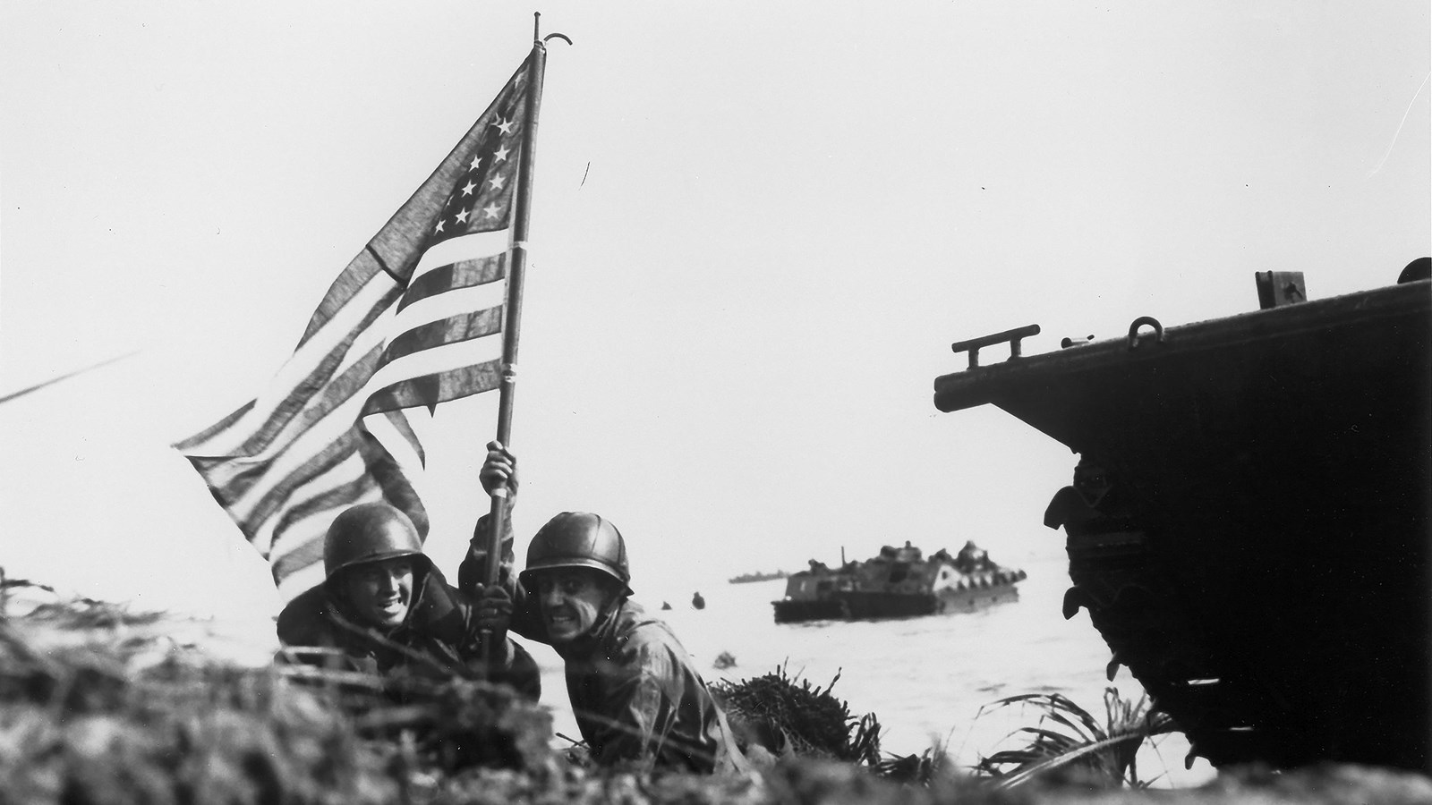
The weeks of preparation paid off on the morning of July 21, 1944, W Day for Guam. While a simultaneous attack took place five miles south at Hågat Beach, the Third Marine Division landed on the 2,500-yard beach stretching between Adelup Point and Assan Point, which the Marines called a "pair of devil horns." Between the two horns stretched a line of cliffs. To secure their beachhead, the Marines would need to capture the high ground.[5]
Under the cover of heavy artillery fire from gunboats and aerial strikes by Navy fighters, the Marines were transferred to shore in waves of armored Landing Vehicle Tracked (LVT)s and DUKWs. The cover fire allowed the transports to safety get close to shore, but when it lifted, the Japanese troops quickly returned to their weapon stations overlooking the beach. As the first wave of Marines splashed ashore, the Imperial Japanese Army's defense began in earnest. They turned their artillery, mortars and machine guns on the beaches and the reef.[6]
The Marines landed on the beach in three sections, then charged ahead to take the cliffs before the Japanese could fully recover from the shelling. The fiercest fighting took place at Chorito Cliff and Bundschu Ridge, the high ground overlooking the western edge of the beach. Sgt. Cyril O'Brien, a combat correspondent with the 3rd Marine Regiment, later wrote, "Nearly half my old company lies dead on the barren slopes of Chonito Cliff. ... They attacked up a 60-degree slope, protected only by sword grass, and were met by a storm of grenades and heavy rifle, machine-gun and mortar fire." Marines lay piled at the bottom of the ridges. Those who survived were forced to retreat to the beaches over and over before finally taking the ridge. [7]
Despite heavy Japanese resistance, the Americans emerged victorious. By the evening of W Day, they had taken the crucial high ground of Chorito Cliffs and Asan Ridge, but the victory was not without a cost: 105 men were killed in the fighting, 536 were wounded and 56 were missing.[8] War in the Pacific National Historical Park honors their sacrifice annually at their Memorial Day celebration.
Listen to the park’s first superintendent, Rafael Reyes, tells his story of being forced to build defenses at Assan.
View historic photos of Assan Beach during the Battle of Guam.
[1] Leo Babauta, “Asan-Maina (Assan-Ma’ina),” Guampedia, October 1, 2009.
[2]Vicente Blaz, “CHamorus Forced into War Effort,” Guampedia, June 9, 2019; Alfred Peredo Flores, Tip of the Spear: Land, Labor, and US Settler Militarism in Guåhan, 1944-1962, The United States in the World (Ithaca: Cornell University Press, 2023); Harry A. Gailey, The Liberation of Guam, 21 July-10 August 1944 (Novato, CA : Presidio, 1988), 87; Chris Dimla Lizama, “War Survivor: Lillian Tenorio Dimla,” Guampedia, June 18, 2019; Henry I. Shaw, Bernard C. Nalty, and Edwin T. Turnbladh, Central Pacific Drive, vol. III, History of U.S. Marine Corps Operations in World War II (Headquarters: Historical Branch, G-3 Division, U.S. Marine Corps, 1966), 446–47, 451.
[3] Shaw, et al, Central Pacific Drive, 448.
[4] John C. McManus, Island Infernos: The US Army’s Pacific War Odyssey, 1944 (New York: Caliber, 2021), 406; Shaw, et al, Central Pacific Drive, 441.
[5] Shaw, et al, Central Pacific Drive, 451–63.
[6] Gailey, The Liberation of Guam, 89–91; Cyril J. O'Brien, Liberation: Marines in the Recapture of Guam, Marines in World War II Commemorative Series, 1994; Shaw, et al, Central Pacific Drive, 460–63.
[7] Gailey, The Liberation of Guam, 95–96; Peggy Nelson, Lisa Duwall, and Laila Tamimi, “Asan and Agat Invasion Beaches: Cultural Landscape Inventory, War in the Pacific National Historical Park, National Park Service” (National Park Service, November 26, 2003), 51–53; O'Brien, Liberation.
[8] Shaw, et al, Central Pacific Drive, 471.
This article was made possible through generous support from the Mellon Foundation in partnership with the National Park Foundation and American Conservation Experience. Learn more about the Mellon Humanities Postdoctoral Fellowship.