Last updated: July 13, 2022
Place
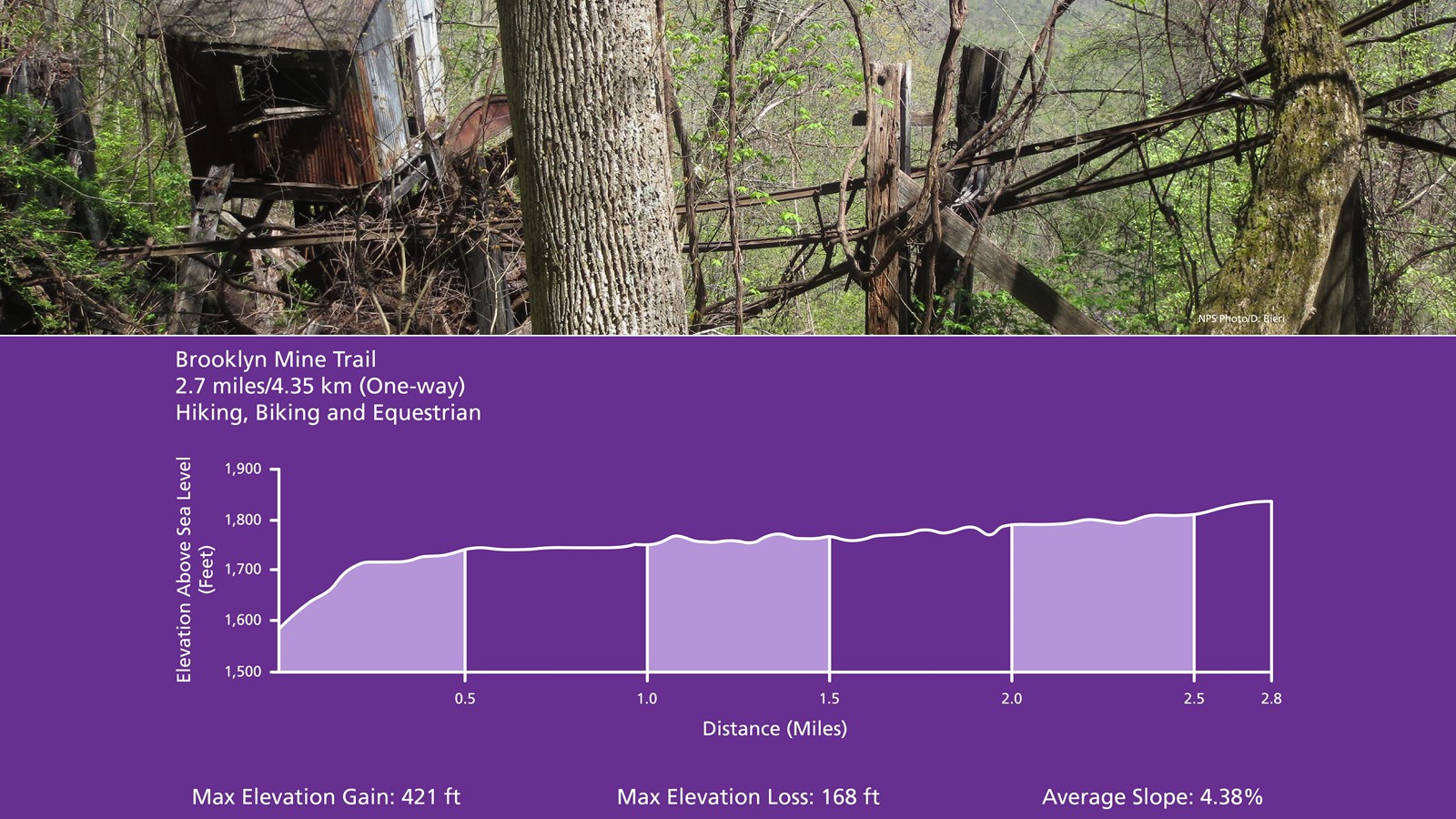
Brooklyn Mine Trail
NPS/Dave Bieri
Quick Facts
Amenities
2 listed
Parking - Auto, Trailhead
Labeled (1) on the Cunard, Thurmond and Stone Cliff Area Trails map
Length
2.7 miles/4.35 km (One-way)
Difficulty
Moderate
Trail type
Hiking, biking and equestrian
Total Elevation Gain
421 ft
Total Elevation Loss
168 ft
Average Slope
4.38%
Trail Description
This 2.7 mile hiking and equestrian Trail follows an old road through the forest to the Brooklyn coal mine site. Scenic views of the river through the trees can be found along the trail.
To reach the trailhead
From Route 19, follow Route 16 south through the town of Fayetteville. Take a left on Gateway Road (sign indicates Kaymoor and Cunard). Follow Gatewood Road for 4.6 miles and turn left at the sign for Cunard. Go 1.8 miles and turn left at both of the signs indicating Cunard River Access Road. The parking area is just past the trailhead, located 0.5 miles further on the right.