Last updated: November 1, 2024
Place
Camp Creek Overlook
NPS Photo
Quick Facts
Location:
Located between Mileposts 315-316
Significance:
Camp Creek Overlook provides close access to a tributary of Linville River where fishing opportunities are available
Amenities
2 listed
Parking - Auto, Trailhead
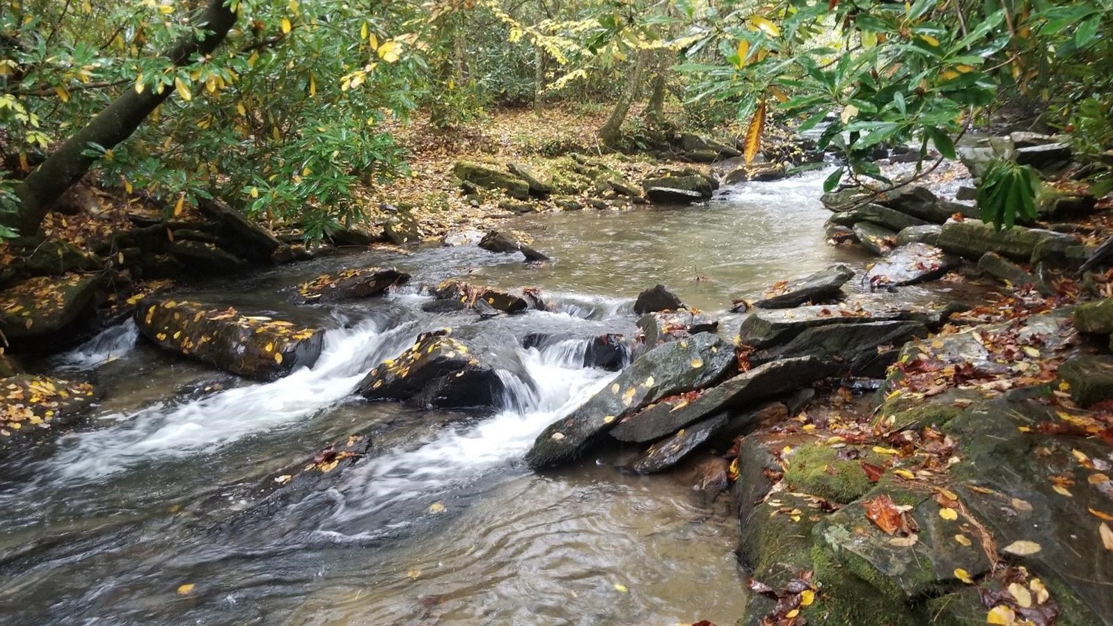
Camp Creek Overlook is located around a mile north of the Linville Falls Recreation Area. It derives its name from the Camp brothers, who logged parts of this area in the early 1900s.
The small paved overlook does not seem particularly remarkable at first. It is surrounded by a thick forest consisting of a variety of large trees and shrubs. Galax lines much of the slope next to the curb. This vegetation is broken up only by a narrow dirt trail that lies to the right of the overlook sign. This trail descends steeply into the forest for just under 400 feet through rhododendron thickets and ultimately ends at Camp Creek. A couple of openings in the thickets provide clear access to the creek. The creek originates near Camp Creek Mountain a short distance northeast of the overlook. Below the overlook, it runs steadily from east to west flowing into the Linville River. Sections of the creek are broken up by large rocks with water rushing and churning around them. This makes for a beautiful sight as the creek flows under the shading branches that hang out over the banks.
Shortly beyond the creek, the dense woods become part of the Pisgah National Forest that surrounds much of the parkway in this area. Fishing is allowed in these waters. Please consult the Fishing page to learn more about the fishing regulations on the parkway.
Check the conditions of the area before you visit.