Last updated: April 23, 2025
Place
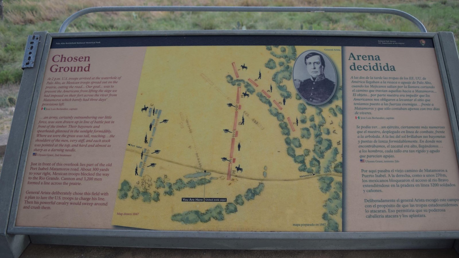
Chosen Ground Wayside
NPS Photo
Quick Facts
Location:
Brownsville, TX
Quote Text
At 2 p.m. U.S. troops arrived at the waterhole of Palo Alto, as Mexican troops spread out on the prairie, cutting the road... Our goal... was to prevent the Americans from lifting the siege we had imposed on their fort across the river from Matamoros which barely had three days' provisions left. ~ José Luis Berlandier, captain
...an army, certainly outnumbering our little force, was seen drawn up in line of battle just in front of the timber. Their bayonets and spearheads glistened in the sunlight formidibly [sic ]. Where we were the grass was tall, reaching...the shoulders of the men, very stiff, and each stock was pointed at the top, and hard and almost as sharp as a darning needle. ~ Ulysses Grant, 2nd lieutenant
Main Text
Just in front of this overlook lies part of the old Port Isabel-Matamoros road. About 300 yards to your right, Mexican troops blocked the way to the Rio Grande. Cannon and 3,200 men formed a line across the prairie.
General Arista deliberately chose this field with a plan to lure the U.S. troops to charge his line. Then his powerful cavalry would sweep around and crush them.
Image Descriptions
Center
Historical battle map showing initial and secondary positions of the U.S. and Mexican battle lines.