Last updated: June 5, 2024
Place
Colman Park
Olmsted Archives
Quick Facts
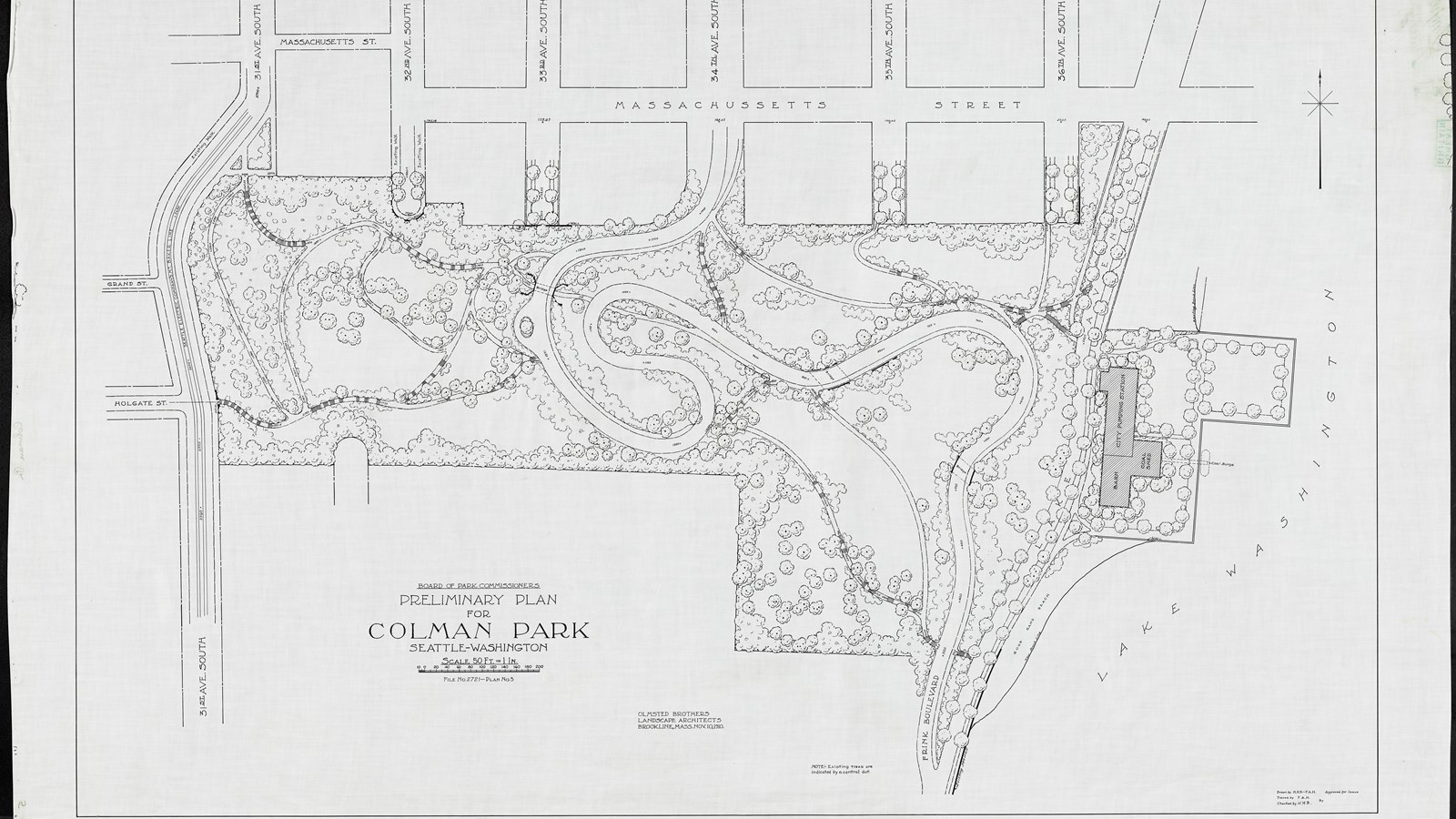
Colman Park is located within a steeply sloped area that John Charles Olmsted referred to as the Rainier Heights Landslide Section in his 1903 Seattle Parks Report. In that report, John Charles proposed acquiring the entire length of steep slope for park purposes, warning against using the land for subdivision development because “Houses will probably continue to be moved gradually on to adjoining land owned by someone else, and there will be no end to the trouble, expense and inconvenience due to the continuation of the slide if it is allowed to become occupied by houses… On the other hand, the movement of the land would be of small consequence if the ground is turned into a public park.”
Additionally, Olmsted proposed a parkway that would run along the top of Colman Park’s slope, providing views to Lake Washington and the mountains further in the distance. Due to the ambitiousness of the plan, the parkway was never realized. However, some parcels within the area that would have been the parkway were either donated or purchased for parkland for Seattle.
Within Colman Park, four bridges allow pedestrians to move, removed from vehicular traffic. Located at the North edge of the Mount Baker neighborhood, the forested hillside park features paths, community gardens, forests and lawns. Colman Park epitomizes John Charles’ goal: “to secure and preserve for the use of the people as much as possible of these advantages of water and mountain views and of woodlands.”
Source: "Colman Park," Olmsted Online
For more information and primary resources, please visit:
Olmsted Research Guide Online
Olmsted Archives on Flickr