Last updated: October 19, 2020
Place
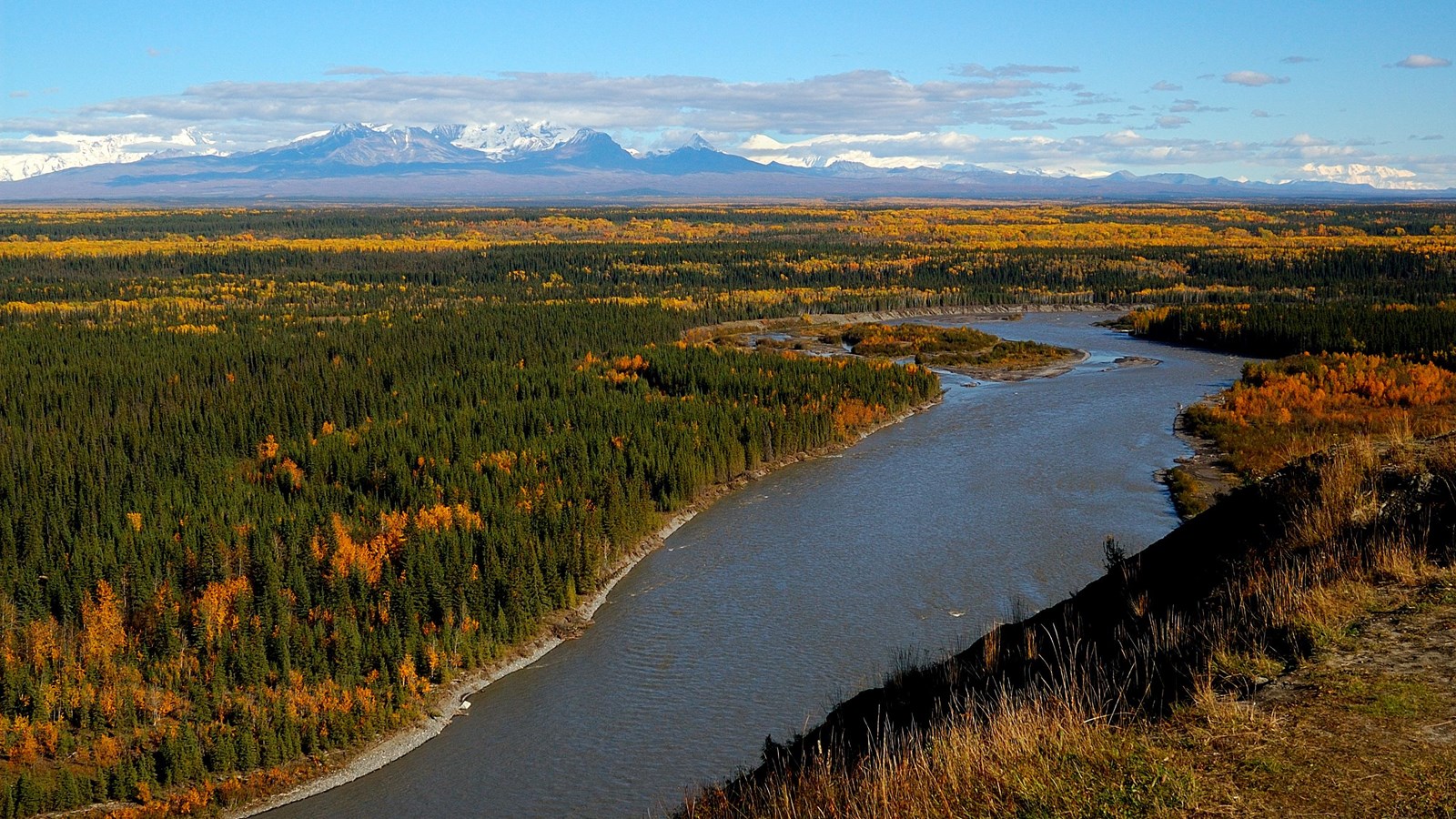
Copper River in Wrangell-St Elias
NPS
Quick Facts
Location:
Wrangell-St. Elias National Park & Preserve
Significance:
Scenic Wild River
Designation:
National Park and Preserve
Amenities
2 listed
Historical/Interpretive Information/Exhibits, Scenic View/Photo Spot
The Copper River is the largest river in the park. At 290 miles long, the Copper River begins at the Copper Glacier on the northeast side of Mount Wrangell, in the Wrangell Mountains. It first flows north, then west and then south where it forms the park’s western boundary. As it flows further southeast through the Chugach National Forest, it eventually empties into the ocean in the Gulf of Alaska near Cordova.
As an enormous Alaskan watershed, it is known for its extensive delta ecosystem. The Copper is the tenth largest river in the United States, as ranked by average discharge volume at its ocean mouth, USGS publication.
The river's famous salmon runs arise from the use of the river watershed by over 2 million salmon each year for spawning. The river's commercial salmon season is very brief, beginning in May for chinook salmon and sockeye salmon for periods lasting days or hours at a time. Sport fishing by contrast is open all year long, but peak season on the Copper River lasts from August to September when the coho salmon runs. Subsistence fishing (cultural and traditional uses of the land and water) is predominately done with dipnet or fishwheel, with special use permits for local rural residents.
Glacial rivers carry an extremely high level of silt, typically making it impossible to see the river bottom. Spring run-off, heavy rain, and hot summer temperatures can cause quick, dramatic change in water levels. Year round, The Copper River is extremely cold and hypothermia is a danger even after a brief submersion, regardless of air temperature. Always wear a drysuit and a personal floatation device (pfd) while floating or boating.
https://www.nps.gov/wrst/planyourvisit/river-floating-and-boating.htm
It's cultural and traditional name is Ahtna River, in Ahtna Athabascan - ‘Atna’tuu, "river of the Ahtnas", and in coastal Tlingit - Eeḵhéeni, "river of copper". The name of the river comes from the abundant copper deposits along the upper river that were used by Alaska Native communities and then later by settlers from the Russian Empire and explorers from the United States.
Since the river is 290 miles in length, the Lat/Long. is represented at Copper Center, Alaska:
Latitude: 61.955894470214844 Longitude: -145.298095703125