Last updated: June 29, 2023
Place
Crown Point National Natural Landmark
NPS Justin Radford
Quick Facts
Location:
40700 Crown Point Hwy, Corbett, OR 97019
Designation:
National Natural Landmark
MANAGED BY:
Amenities
6 listed
Historical/Interpretive Information/Exhibits, Information, Parking - Auto, Restroom - Seasonal, Scenic View/Photo Spot, Water - Drinking/Potable
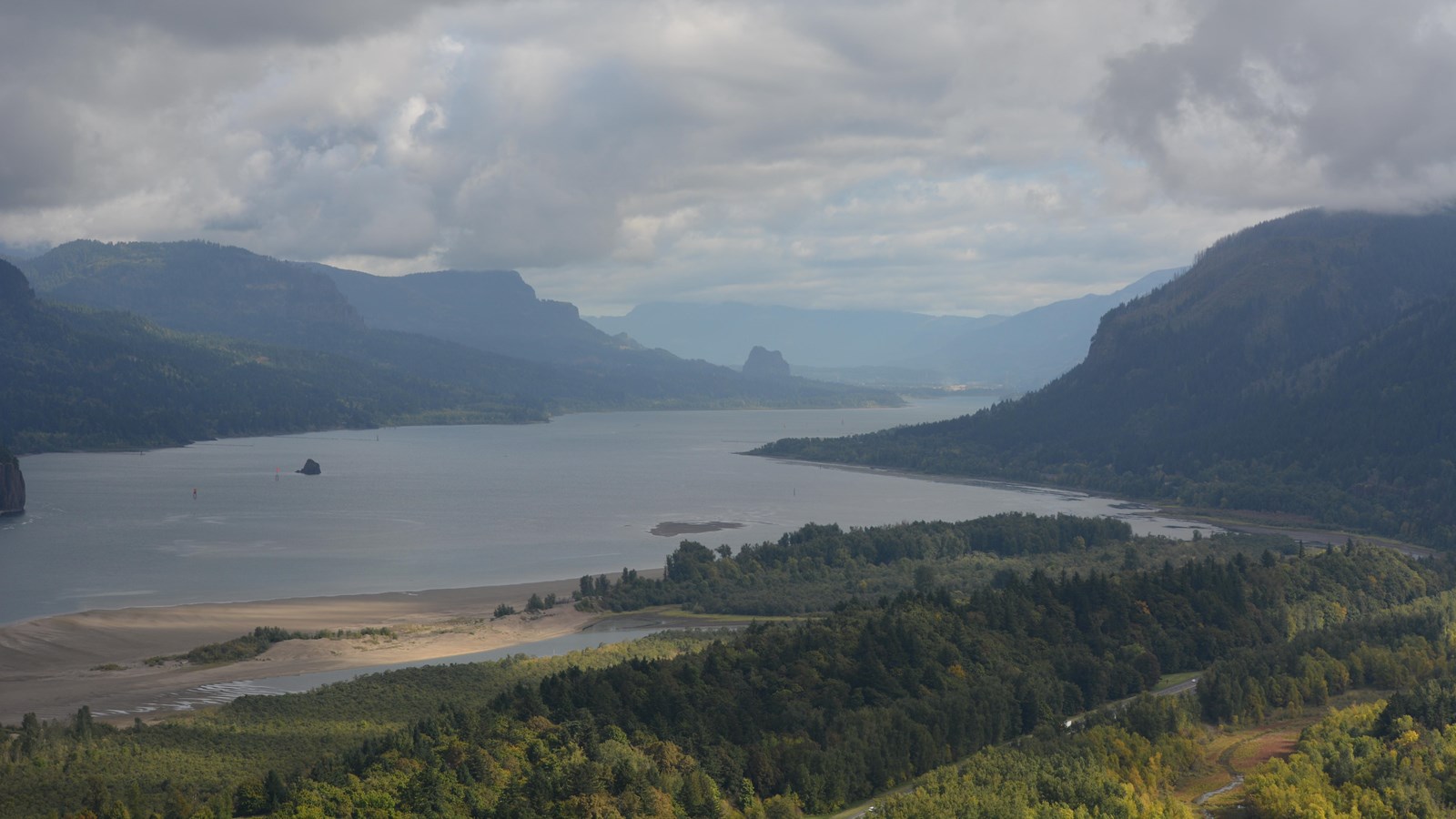
The Crown Point section of the Columbia Gorge illustrates a downcut stream valley formation and the raise of the rise of the Cascade Range. The Columbia River Gorge at Crown Point passes from the steeper, more rugged terrain of the western slopes of the Cascade Range to rolling cultivated plains. Here the Miocene lavas are overlain with conglomerates and sandstones. The Crown Point promontory provides a strategic vantage point for observing this classic illustration of riverine processes.
This viewpoint along Highway 30 was the site of the 1916 dedication of the Columbia River Highway, the innovative European-style road that traced a winding path through the perilous Columbia River Gorge, linking Portland and The Dalles.
Vista House opened in 1918 as a glamorous rest stop and observatory for those traveling the new highway. This “comfort station” was a rest stop like no other, featuring marble floors, stained glass windows — and, of course, a stunning view. In the words of The Oregonian, it was “the finishing achievement for the greatest highway in America.”
Architect Edgar M. Lazarus designed the building to be functional, beautiful and commemorative: the rest stop served as a memorial to the settlers who had traveled the final stretch of the Oregon Trail along the Columbia River. Inside, stone panels are carved with the names of settler families. Listed on the National Register of Historic Places in 1974, the building fulfills Lazarus’s vision as a “temple to the natural beauty of the Gorge.”
The octagonal building houses a museum, gift shop and interpretive display of historic and geologic points of interest in the Gorge. Additional information about the site's history can be found in our Vista House brochure.
The landmark is open daily, weather permitting. It closes when winds reach 50mph or more. Hours and weather closures are posted at vistahouse.com, or by calling 503-344-1368. Check Vista House's weather station here before you go.
Parking areas are open 6 a.m. to 9 p.m.
Please note: the Historic Highway has instituted a reservation system. To travel the Waterfall Corridor timed Use Permits are needed from May 24th through September 5th.
Crown Point also marks the beginning of the "Waterfall Corridor" that features eight waterfalls along the historic highway, including Multnomah Falls.
This is an excellent place to invison how 600 cubic miles of water might have rushed down the Gorge during the great Missoula Floods an the end of the last ice age.