Last updated: January 19, 2021
Place
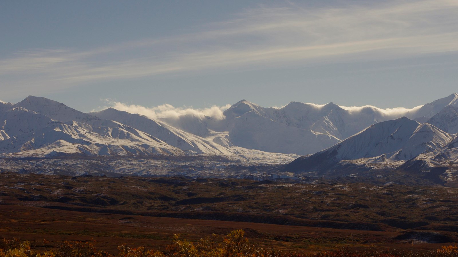
View of the Muldrow Glacier
NPS Photo
Quick Facts
Location:
Mile 69, Denali Park Road
Amenities
1 listed
Scenic View/Photo Spot
Look south of the Denali Park Road at Mile 69 for a view of the Muldrow Glacier, the longest glacier (34 miles [54 km] long) on the north side of the Alaska Range. The lower portion of the glacier is visible from the road for the next several miles.
Don’t look for shiny blue glacial ice, though, because here at the terminus of the glacier the ice is stagnant—unmoving—and covered in tundra. Yes, believe it or not that lumpy, hummocky, shrubby tundra less than a mile away to the south is underlain by ice. While perhaps not as romantically crevassed and frigid looking as an active glacier face, the vegetated terminus of the Muldrow is fascinating because it is evidence that the glacier surges.
All glaciers flow—that is one of their defining features. Glacial flow is mostly controlled by temperature, snow accumulation, and slope. However, a small minority of glaciers is also substantially affected by subglacial hydrology. Called surging glaciers, these ice rivers advance with sudden and rapid speed—sometimes as much as 100 times faster than average—after long periods of sluggish movement. The terminus can advance several miles in a year or two, leaving a bathtub ring at the top of the glacial valley where the ice has drained out. Surging glaciers do not experience a net gain in mass during surge events; rather the mass is transferred from up high to down low.
The Muldrow is one of four confirmed surging glaciers in Denali out of hundreds of glaciers. The upper 27 miles (42 km) currently flow slowly but constantly downhill as with any ‘living’ glacier. This movement carries away rocky debris and inhibits the growth of vegetation that might otherwise become established. However, the lower 7 miles (12 km) of Muldrow ice and debris are stagnant, having been deposited during glacial surges as long as 1,800 years ago and not having moved since. Younger moraines were deposited ~900 years ago and during surges in ~1905 and 1956–1957. Park geologists and university researchers speculate that the Muldrow may surge again at any time, and therefore monitor for signs of renewed surging.
The Muldrow Glacier takes a 90° turn as it flows down from the mountains, changing course from primarily east to north. The McKinley Strand of the Denali Fault strongly controls part of the path of the Muldrow, much like the Hines Creek Fault controls part of the path of Hines Creek. Along the east-flowing section, the Muldrow follows a weakness in the rocks caused by the fault and flows parallel to the mountain front along very steep topography. The sharp zag to the north in the last few miles happens where the glacier frees itself from the relative confines of the fault and flows away from the mountain range like most glaciers.