Last updated: November 27, 2020
Place
First Flag Unfurling Site
Quick Facts
Designation:
National Register of Historic Places
MANAGED BY:
Lewis and Clark NHT Visitor Centers and Museums
This map shows a range of features associated with the Lewis and Clark National Historic Trail, which commemorates the 1803-1806 Lewis and Clark Expedition. The trail spans a large portion of the North American continent, from the Ohio River in Pittsburgh, Pennsylvania, to the mouth of the Columbia River in Oregon and Washington. The trail is comprised of the historic route of the Lewis and Clark Expedition, an auto tour route, high potential historic sites (shown in black), visitor centers (shown in orange), and pivotal places (shown in green). These features can be selected on the map to reveal additional information. Also shown is a base map displaying state boundaries, cities, rivers, and highways. The map conveys how a significant area of the North American continent was traversed by the Lewis and Clark Expedition and indicates the many places where visitors can learn about their journey and experience the landscape through which they traveled.
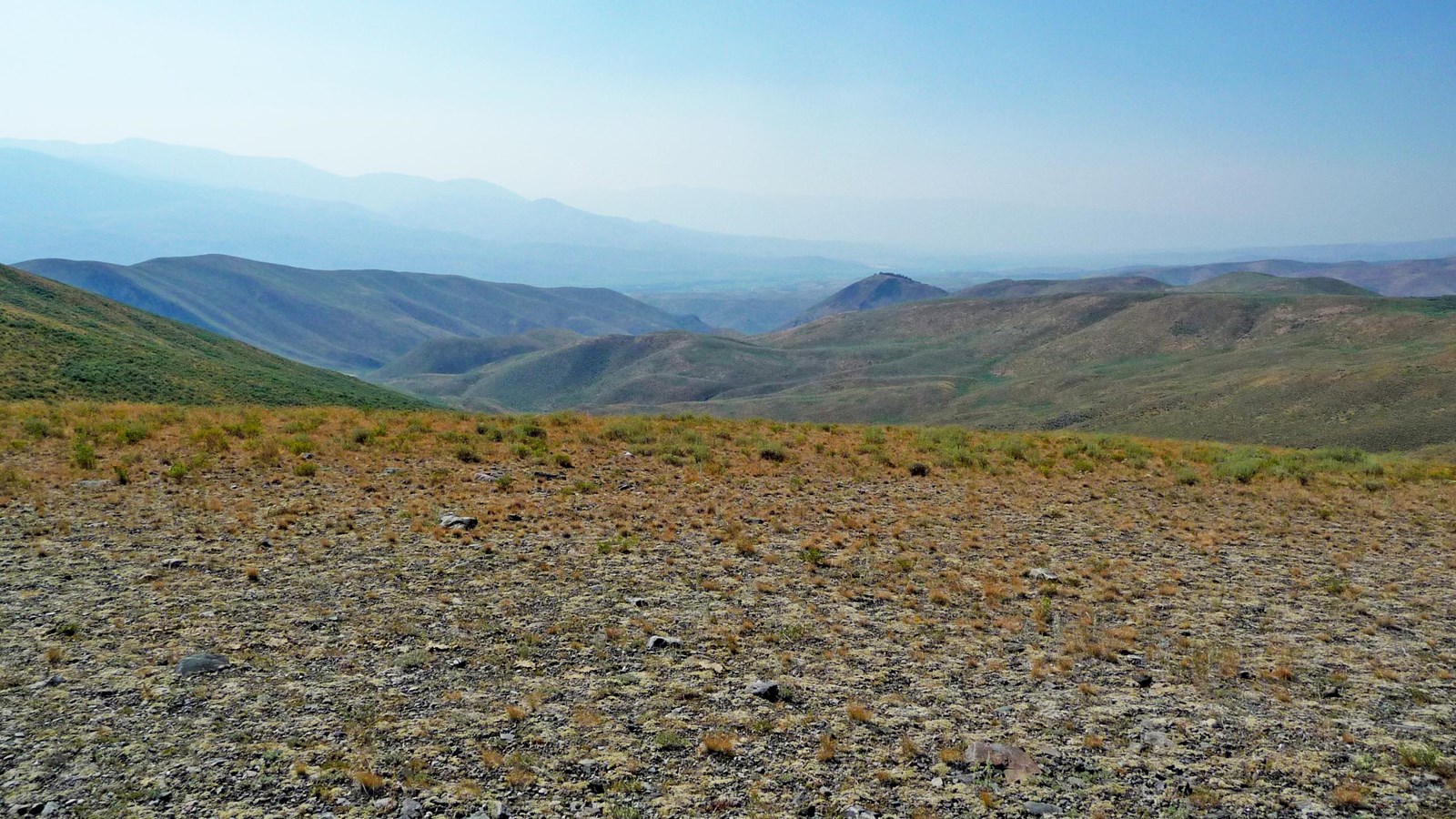
On August 13, 1805, Lewis finally made contact with the Shoshones, encountering a group of “two women, a man and some dogs.” Signaling his peaceful intentions, Lewis set aside his pack and rifle, and took a flag which he “unfurled and avanced singly towards them.” Although the small group initially fled, Lewis’ efforts eventually paid off, and he received a warm reception from the Shoshone chief Cameahwait at his camp. Convincing the wary Shoshone to return across the continental divide with him and then assist the expedition in portaging over Lemhi Pass proved to be a tremendous test of Lewis’ skillful diplomacy. However, it was Sacagawea’s joyful reunion with her brother Cameahwait that cemented the trust and goodwill between the two groups. Subsequently, Lewis and Clark were able to barter for 29 or 30 horses to transport all of their supplies through the mountains. They also secured the services of a guide, whom they nicknamed “Old Toby.” The Corps of Discovery departed Cameahwait’s Shoshone camp on August 30.
The First Flag Unfurling Site is a five-acre National Register-listed property located on BLM land adjacent to the Salmon-Challis National Forest. A historical marker and interpretive wayside exhibit are located next to a pull-off on NF-185, also known as Warm Springs Road. Despite the name and designation, there is no supporting evidence that this was the actual site Lewis unfurled the flag. However, it provides a good overview of the terrain and general area occupied by the Shoshone and traversed by the expedition.