Last updated: November 11, 2024
Place
Grand View Point: Grand View Point Overlook
J. Carver
Quick Facts
Location:
Island in the Sky
Significance:
Wayside Panel
Amenities
1 listed
Historical/Interpretive Information/Exhibits
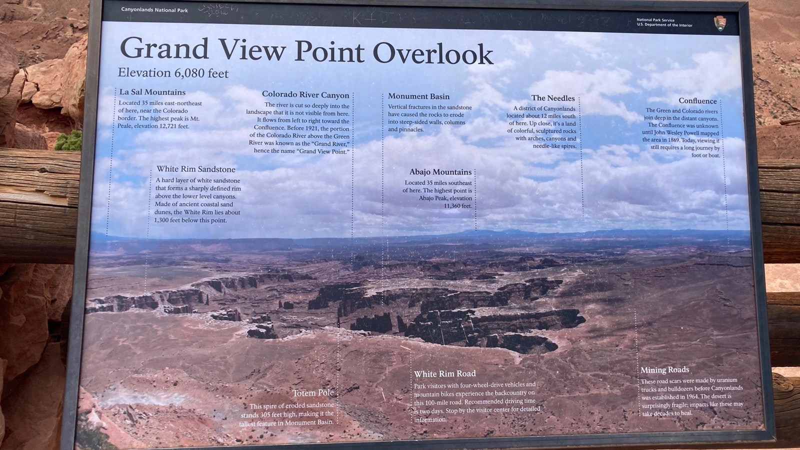
Elevation 6,080 feet
Left to Right: La Sal Mountains: Located 35 miles east-northeast of here, near the Colorado border. The highest peak is Mt. Peale, elevation 12,721 feet.
White Rim Sandstone: A hard layer of white sandstone that forms a sharply defined rim above the lower level canyons. Made of ancient coastal sand dunes, the White Rim lies about 1,300 feet below this point.
Totem Pole: This spire of eroded sandstone stands 305 feet high, making it the tallest feature in Monument Basin.
Colorado River Canyon: The river is cut so deeply into the landscape that it is not visible from here. It flows from left to right towards the Confluence. Before 1921 the portion of the Colorado River above the Green River was known as the "Grand River" hence the name "Grand View Point".
Monument Basin: Vertical fractures in the sandstone have caused the rocks to erode into steep-sided walls, columns and pinnacles.
White Rim Road: Park visitors with four-wheel-drive vehicles and mountain bikes experience the backcountry on this 100-mile road. Recommended driving time is two days. Stop by the visitor center for detailed information.
Abajo Mountains: Located 35 miles southeast of here. The highest point is Abajo Peak, elevation 11,360 feet.
The Needles: A district of Canyonlands located about 12 miles south of here. Up close, it's a land of colorful, sculptured rocks with arches, canyons and needle-like spires.
Mining Roads: These road scars were made by uranium trucks and bulldozers before Canyonlands was established in 1964. The desert is surprisingly fragile; impacts like these may take decades to heal.
Confluence: The Green and Colorado rivers join deep in the distant canyons. The Confluence was unknown until John Wesley Powell mapped the area in 1896. Today, viewing it still required a long journey by foot or boat.