Last updated: November 27, 2023
Place
Hiring of Charbonneau and Sacagawea
NPS (LECL photo)
Quick Facts
Location:
838 28th Ave SW, Washburn, ND 58577
Significance:
Location of the reconstructed Fort Mandan where the Lewis and Clark Expedition spent the winter of 1804–1805. Sacagawea and her husband, Toussaint Charbonneau, joined the expedition here.
Designation:
Lewis and Clark National Historical Trail
MANAGED BY:
Amenities
10 listed
Food/Drink - Snacks, Gifts/Souvenirs/Books, Historical/Interpretive Information/Exhibits, Information, Parking - Auto, Picnic Shelter/Pavilion, Picnic Table, Restroom, Ticket Sales, Trailhead
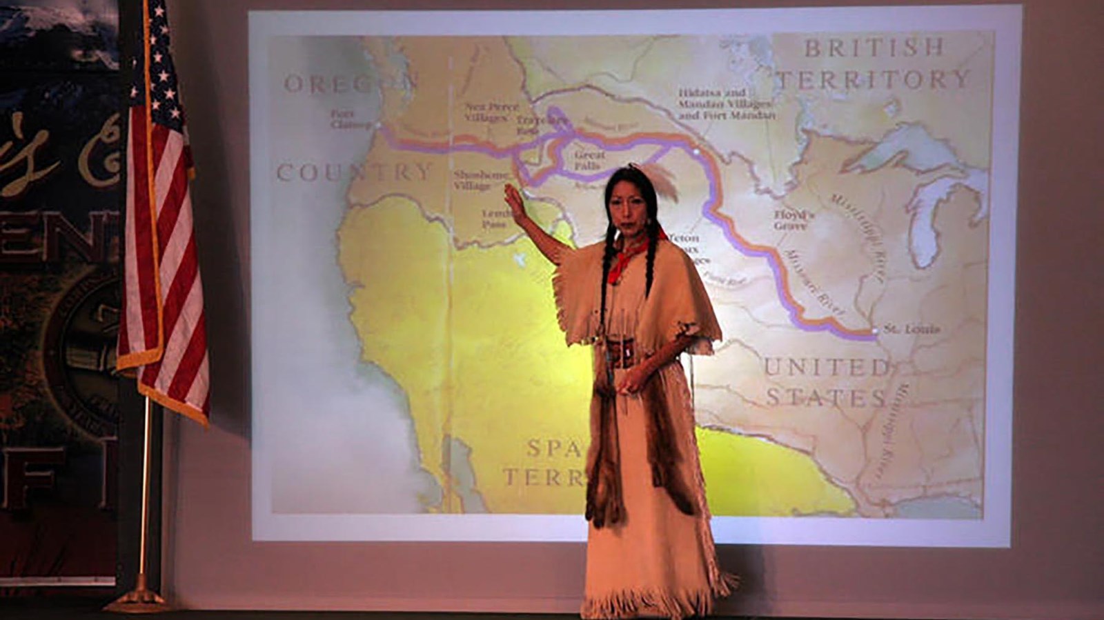
Mandan and Hidatsa families spent the cold winters of the Great Plains in large villages.
In the early 1800s, the largest Mandan and Hidatsa villages were located along the Missouri River near the Knife River confluence. In the late summer and fall, people from far up- and downriver flocked to the area to trade. Meriwether Lewis and William Clark had heard of these prominent trading towns and hoped to spend the winter near them.
In early November 1804, Lewis, Clark, and their crew arrived at the Mandan and Hidatsa villages. While the crew began to “Cut Down trees and raise our houses,” a French-Canadian trader came to introduce himself. His name was named Toussaint Charbonneau. He had lived in these villages for years, and he had two wives. One of these women was named Sacagawea.
Charbonneau offered Lewis and Clark his own skills as an interpreter (he spoke French and some Hidatsa), as well as Sacagawea’s (she spoke Hidatsa and Shoshone). Lewis and Clark were aware of the importance of good interpreters. They also knew, from what Mandan people had told them, that would need to trade for horses with the Shoshone to cross the Rocky Mountains. They agreed to hire Charbonneau and Sacagawea for the duration of the journey.
At age forty-six, Charbonneau became the oldest member of the permanent party, while Sacagawea, age sixteen, became the youngest.
As interpreters, Charbonneau and Sacagawea acted as critical links in a translation chain. Charbonneau did not speak English. But he could speak in French with George Drouillard, as well as with the French and Métis boatmen. Sacagawea did not speak French or English, but she could speak Hidatsa with Charbonneau. A chain formed in which, during meetings with Shoshone people, Sacagawea would translate from Shoshone to Hidatsa. Charbonneau then translated from Hidatsa to French for Drouillard. He would then translate to English, so Lewis and Clark could understand.
About this article: This article is part of series called “Pivotal Places: Stories from the Lewis and Clark National Historic Trail.”
Lewis and Clark NHT Visitor Centers and Museums
This map shows a range of features associated with the Lewis and Clark National Historic Trail, which commemorates the 1803-1806 Lewis and Clark Expedition. The trail spans a large portion of the North American continent, from the Ohio River in Pittsburgh, Pennsylvania, to the mouth of the Columbia River in Oregon and Washington. The trail is comprised of the historic route of the Lewis and Clark Expedition, an auto tour route, high potential historic sites (shown in black), visitor centers (shown in orange), and pivotal places (shown in green). These features can be selected on the map to reveal additional information. Also shown is a base map displaying state boundaries, cities, rivers, and highways. The map conveys how a significant area of the North American continent was traversed by the Lewis and Clark Expedition and indicates the many places where visitors can learn about their journey and experience the landscape through which they traveled.