Last updated: April 10, 2026
Place
Hogsback Summit
NPS Photo
Quick Facts
Location:
Utah Highway 65, about 5.5 miles southwest of Henefer, Utah
Significance:
Hogsback Summit is where the Mormon Pioneer/California/Pony Express trail corridor crosses a low divide between the Weber River (present-day Henefer, Utah) and Dixie Hollow.
MANAGED BY:
Utah Department of Transportation
Amenities
1 listed
Historical/Interpretive Information/Exhibits
Hogsback Summit is where the Mormon Pioneer/California/Pony Express trail corridor crosses a low divide between the Weber River (present-day Henefer, Utah) and Dixie Hollow. The first wagons, belonging to the Donner-Reed Party, crossed this divide in 1846, followed in 1847 by Brigham Young's vanguard party of Mormon pioneers. Imagine those emigrants' despair upon reaching this spot and seeing the jagged, blue-gray peaks of the Wasatch Mountains on the horizon ahead. From here, both wagon companies had to grub a rough track over divides and mountains and down a series of willow-packed canyons and creek bottoms in order to reach the Valley of the Great Salt Lake. The effort cost the Donner-Reed party 13 days, one of a series of troubles that caused the group to be trapped by blizzards in the Sierra Nevada Mountains.
Site Information
Location (Utah Highway 65, about 5.5 miles southwest of Henefer, Utah)
Hastings Cutoff and Mormon Trail Wagon Ruts at Hogsback Summit (southwest of Henefer), marked by white fiberglass trail posts, are clearly visible along the right side of the road beyond the fence line at the Summit and Morgan County boundary. Just ahead at Hogsback Summit, the pioneers looked west and saw a discouraging jumble of mountains. An interpretive sign at the turnout tells the story.
Look for the swales on the right near the Morgan County sign at odometer reading 5.7 miles.
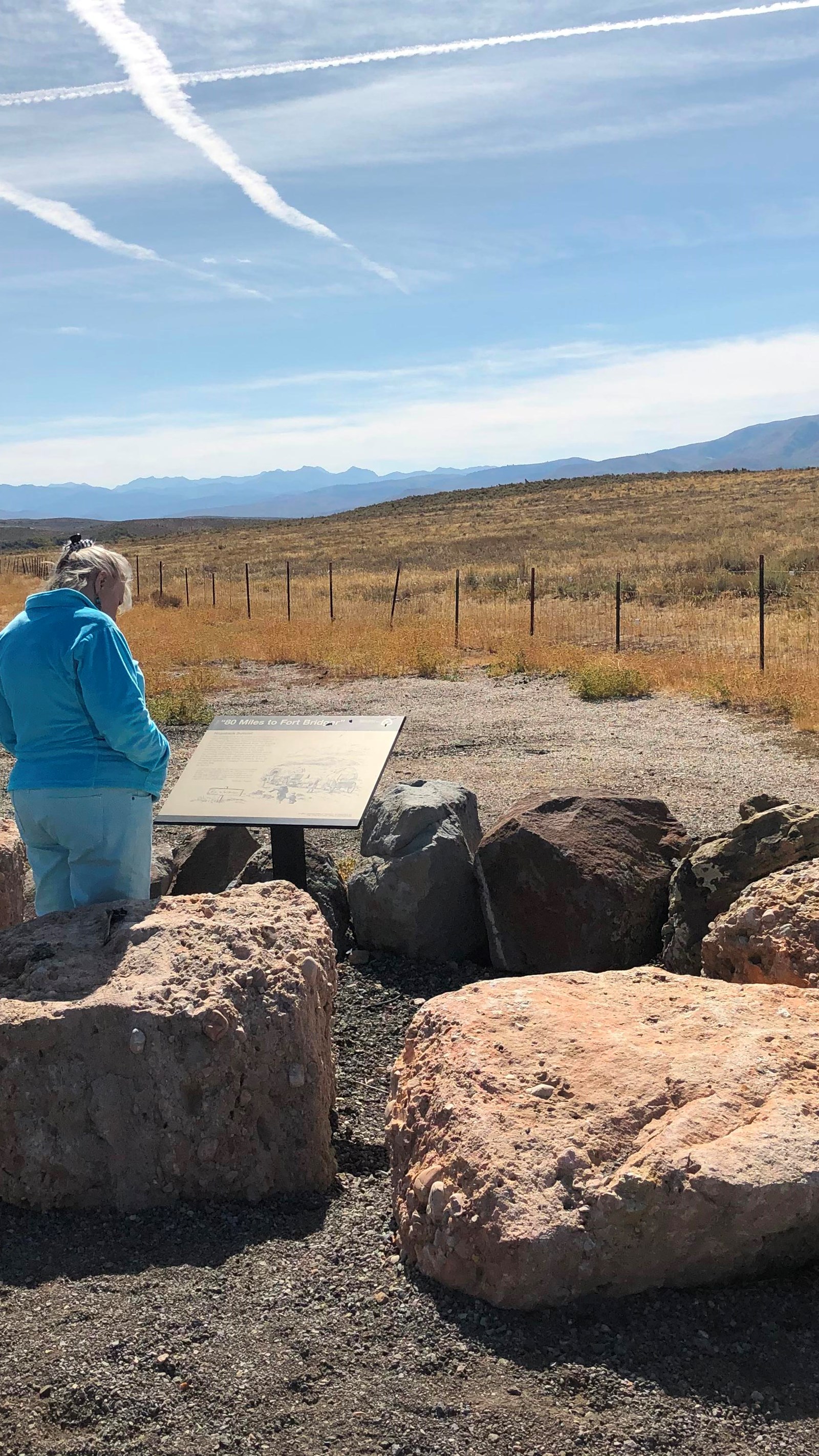
Exhibit
"40 Miles to Fort Bridger"
"The country west looks rough and mountainous," wrote William Clayton, describing this panorama of the Wasatch Mountains. Modern historians have dubbed this summit "Heartbreak Ridge" to describe the feelings of many early Mormon Pioneers who crested this ridge. After months on the trail, traveling over 1,200 weary miles, it was heart- wrenching to discover that the most difficult part of the journey still lay ahead. Some people must have broken down and wept. Others gritted their teeth with determination and moved southwest down off Hogsback Summit to challenge the mountains and canyons that lay ahead.
“...arrived [July 19] on the suummit of the dividing ridge and put a guide hard up, "80 miles to Fort Bridger"... The descent is not very steep but exceedingly dangerous to wagons being mostly on the side hill over large cobble stones, causing the wagons to slide very badly.” -William Clayton