Last updated: April 5, 2024
Place
Longmire Transportation Exhibit: Panel 5
NPS Photo
Quick Facts
Location:
Longmire
Amenities
1 listed
Historical/Interpretive Information/Exhibits
Season: Year-round
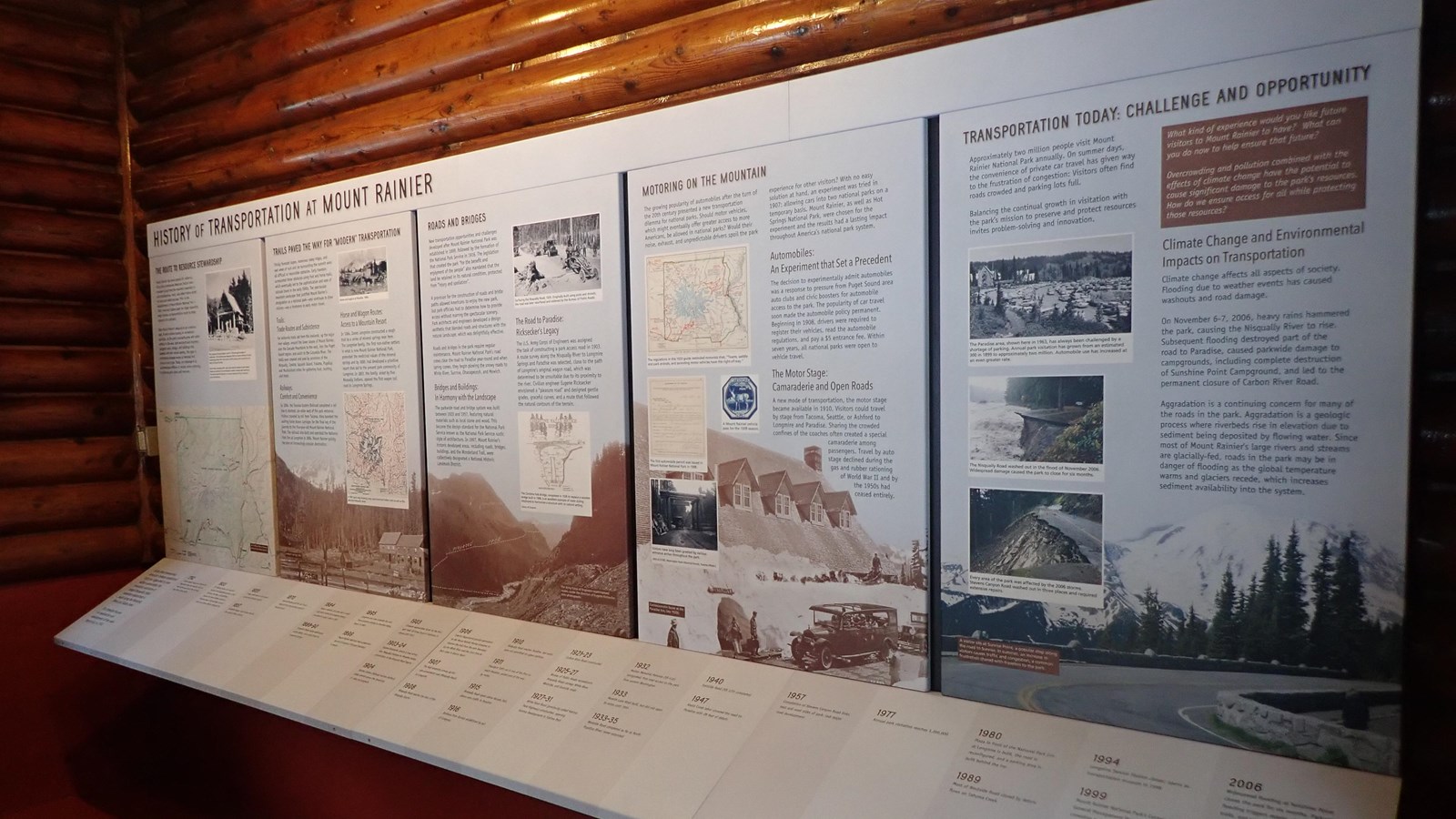
Longmire is located in the southwest corner of Mount Rainier National Park and is 6.5 miles (10.5 km) east of the Nisqually Entrance. The Transportation Exhibit is located inside the historic Longmire Service Station, which is next to the National Park Inn. The exhibit is open daily when the Longmire Museum is open. The exhibit panels are attached to the wall across from the door and consist of five panels with a timeline stretching across the bottom of the panels.
History of Transportation at Mount Rainier
Panel 5 Title: Transportation Today: Challenge and Opportunity
Panel 5 Main Text
Approximately two million people visit Mount Rainier National Park annually. On summer days, the convenience of private car travel has given way to the frustration of congestion: Visitors often find roads crowded and parking lots full. Balancing the continual growth in visitation with the park’s mission to preserve and protect resources invites problem-solving and innovation.
Climate Change and Environmental Impacts on Transportation - Climate change affects all aspects of society. Flooding due to weather events has caused washouts and road damage.
On November 6-7, 2006, heavy rains hammered the park, causing the Nisqually River to rise. Subsequent flooding destroyed part of the road to Paradise, caused parkwide damage to campgrounds, including complete destruction of Sunshine Point Campground, and led to the permanent closure of Carbon River Road.
Aggradation is a continuing concern for many of the roads in the park. Aggradation is a geologic process where riverbeds rise in elevation due to sediment being deposited by flowing water. Since most of Mount Rainier's large rivers and streams are glacially-fed, roads in the park may be in danger of flooding as the global temperature warms and glaciers recede, which increases sediment availability into the system.
Panel 5 Highlighted Text
What kind of experience would you like future visitors to Mount Rainier to have? What can you do now to ensure that future?Overcrowding and pollution combined with the effects of climate change have to potential to cause significant damage to the park’s resources. How do we ensure access for all while protecting those resources?
Panel 5 Description
The text fills the top two-thirds of the panel in two columns against a pale blue background. The highlighted text is in a brown box at the top of the right-side column. Towards the top of the left-side column is a black and white photo of a parking lot filled with cars, surrounded by hillsides covered in patches of meadow and subalpine fir trees. A wood building with a steeply angled roof stands next to the parking lot. A caption below the photo reads “The Paradise area, shown here in 1963, has always been challenged by a shortage of parking. Annual park visitation has grown from an estimated 300 in 1899 to approximately two million. Automobile use has increased at an even greater rate.” Below the black and white photo are two colored photos both showing road damage. The top photo shows a paved road that ends abruptly at a steep bank that is falling into a muddy, raging river. The bottom photo shows a paved road with one edge crumbling off down a steep rocky hillside. The top photo is captioned “The Nisqually Road washed out in the flood of November 2006. Widespread damage caused the park to close for six months.” The bottom photo is captioned “Every area of the park was affected by the 2006 storms. Stevens Canyon Road washed out in three places and required extensive repairs.” The bottom third of the panel is filled with a color photo that fades into the blue background of the rest of the panel at the top. The photo shows a curved road bordered by a low rock wall interspersed by rock crenellations that mimic the roughly triangle-shaped peak of Mount Rainier visible from the road. A woman sits on the rock wall next to the road. A caption reads “A visitor sits at Sunrise Point, a popular stop along the road to Sunrise. In summer, an increase in visitors causes traffic and congestion, a common frustration shared with travelers to the park.”
Panel 1: The Route to Resource Stewardship
Panel 2: Trails Paved the Way for “Modern” Transportation
Panel 3: Roads and Bridges
Panel 4: Motoring on the Mountain
Transportation Timeline