Last updated: April 14, 2021
Place
Lower Choctaw Boundary, Milepost 61.0
NPS Photo
Quick Facts
Location:
Milepost 61 on the Natchez Trace Parkway
Significance:
American Indian Site
Amenities
1 listed
Historical/Interpretive Information/Exhibits
The Natchez Trace Parkway transects the traditional homeland of the Choctaw Indians. Today there are two recognized tribes: The Choctaw Nation, who located in Oklahoma during the Indian Removal in the 1830s (Choctawnation.com), and The Mississippi Band of Choctaw Indians, who remained in the homeland and is headquartered in Choctaw, MS. (Choctaw.org)
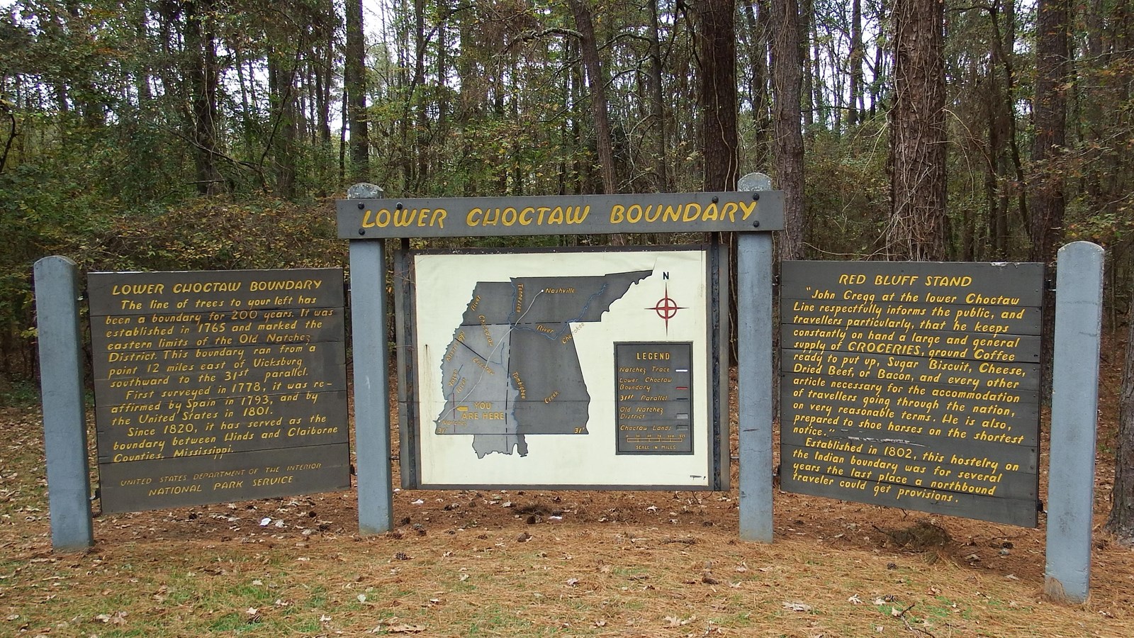
Lower Choctaw Boundary
The line of trees to your left has been a boundary for 200 years. It was established in 1765 and marked the eastern limits of the Old Natchez District. This boundary ran from a point 12 miles east of Vicksburg southward to the 31st parallel.First surveyed in 1778, it was re-affirmed by Spain in 1793, and by the United States in 1801.Since 1820, it has served as the boundary between Hinds and Claiborne Counties, Mississippi.
Red Bluff Stand
“John Gregg at the lower Choctaw Line respectfully informs he public, and travellers particularly, that he keeps constantly on hand a large and general supply of GROCERIES, ground Coffee ready to put up, Sugar Biscuit, Cheese, Dried Beef, or Bacon, and every other article necessary for the accommodation of travellers going through the nation on very reasonable terms. His is also, prepared to shoe horses on the shortest notice.”
Established in 1802, this hostelry o the Indian boundary was for several years the last place a northbound traveler could get provisions.