Last updated: December 5, 2023
Place
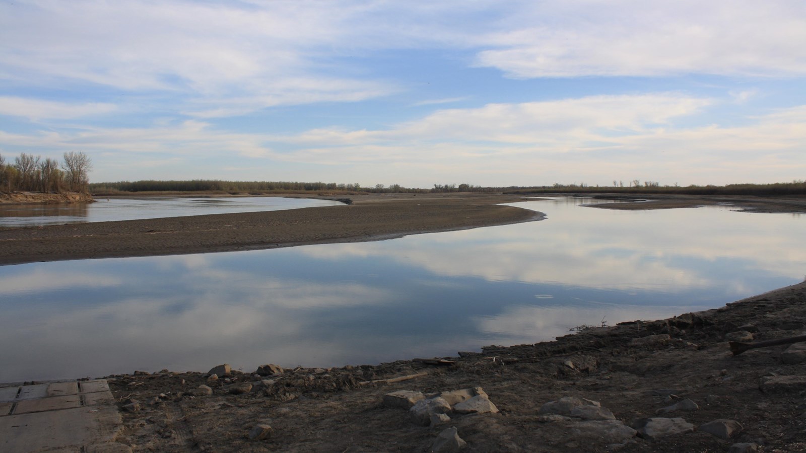
Missouri/Yellowstone Confluence
USFWS
Quick Facts
Location:
15349 39th Ln NW, Williston, ND 58801
Significance:
Meriwether Lewis and William Clark and their party stopped at this location on their way to the Pacific Ocean.
Designation:
Lewis and Clark National Historic Trail
Amenities
12 listed
Gifts/Souvenirs/Books, Historical/Interpretive Information/Exhibits, Information, Parking - Auto, Parking - Bus/RV, Picnic Table, Restroom, Restroom - Accessible, Scenic View/Photo Spot, Trailhead, Trash/Litter Receptacles, Wheelchair Accessible
Meriwether Lewis and William Clark knew about the Yellowstone River long before they reached it, because Mandan and Hidatsa people had told them about it.
Mandan leader Sheheke had sketched a map of the Yellowstone River for Lewis and Clark while the expedition wintered in Mandan territory.
Crow people call the river E-chee-dick-karsh-ah-shay (Elk River) due to seasonal elk migration routes that went by it. Hidatsa people referred to the river as the Yellow Stone (miʔciiʔriaashiish), named for the bluffs of yellow sandstone that frame the river in eastern Montana. French traders translated the Hidatsa name to French and called the river the Roche Jaune (“roche” means rock and “jaune” means yellow).
When Lewis and Clark finally reached the confluence, the party split up to determine which river was the Yellowstone and which was the Missouri. While they made observations based on the stars and the size of the river, Sacagawea told them which river she thought they should take—she had been here before.
The southern fork led to Shoshone communities, where Sacagawea had lived until she was twelve years old. Lewis and Clark were aiming for Shoshone territory. Sacagawea’s connections there were their best chance to procure horses to carry their boats, equipment, and supplies over the Rocky Mountains.
Reaching the Yellowstone was a familiar sight for Sacagawea and a cause for celebration for everyone. Lewis wrote that everyone was “in good health, and much pleased at having arrived at this long wished for spot, and in order to add in some measure to the general pleasure which seemed to pervade our little community, we ordered a dram [a serving of whiskey] to be issued to each person.” Pierre Cruzatte got out his fiddle and soon everyone was singing, dancing, and celebrating.
About this article: This article is part of a series called “Pivotal Places: Stories from the Lewis and Clark National Historic Trail.”
Lewis and Clark NHT Visitor Centers and Museums
This map shows a range of features associated with the Lewis and Clark National Historic Trail, which commemorates the 1803-1806 Lewis and Clark Expedition. The trail spans a large portion of the North American continent, from the Ohio River in Pittsburgh, Pennsylvania, to the mouth of the Columbia River in Oregon and Washington. The trail is comprised of the historic route of the Lewis and Clark Expedition, an auto tour route, high potential historic sites (shown in black), visitor centers (shown in orange), and pivotal places (shown in green). These features can be selected on the map to reveal additional information. Also shown is a base map displaying state boundaries, cities, rivers, and highways. The map conveys how a significant area of the North American continent was traversed by the Lewis and Clark Expedition and indicates the many places where visitors can learn about their journey and experience the landscape through which they traveled.