Last updated: March 31, 2025
Place
Monument Canyon Trail (Colorado National Monument)
NPS Photo / N Scarborough
Quick Facts
Location:
1) Upper TH on Rim Rock Drive, 2) Lower TH outside the Monument
Amenities
2 listed
Parking - Auto, Trailhead
Monument Canyon Trail (Colorado National Monument)
Map highlighting in red the Monument Canyon Trail and its generally backwards-S shape in Colorado National Monument, the lower trailhead beginning off Highway 340 and the upper trailhead from Rim Rock Drive.
- Location: Two access points:
- (1) from the Saddlehorn Visitor Center, turn left onto Rim Rock Drive and travel 3.8 miles (6.1 km) to the trailhead on the left. It is also the trailhead for Coke Ovens Trail.
- (2) from the west entrance of the monument, turn right onto Highway 340 (going east); after 2.1 miles (3.4 km) turn right just beyond mile marker #5 onto a dirt road that appears to be a driveway; go 0.1 mile (0.2 km) to the trailhead.
- Mileage: 6.0 one way (9.7 km)
- Difficulty Level: Moderate to steep
- Elevation: 6,140 to 4,700 feet (1871 to 1433 meters) from upper trailhead to lower trailhead.
- Average time: 4 hours
- Usage: Hiking only. Horseback riding permitted along the
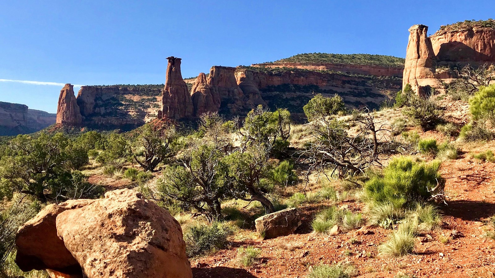
lower 5 miles. - Description (from upper access): Steep 600-foot descent from the plateau into Monument Canyon where you can walk beside many of the park's major rock formations: Independence Monument, Kissing Couple, and the Coke Ovens. Check out a photo gallery of this hike.