Last updated: October 30, 2023
Place
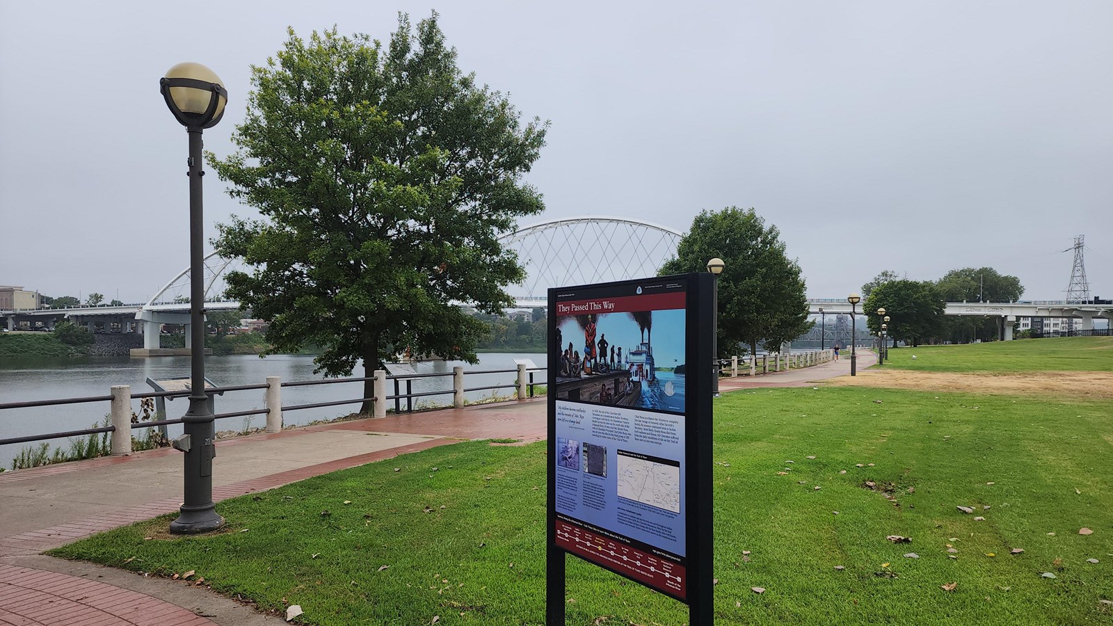
North Shore Riverwalk Park
Photo/USACE
Quick Facts
Location:
Intersection of Willow St. and Riverfront Park Drive, in North Little Rock, Arkansas.
Significance:
The Water Route as an Indian Removal path on the Arkansas River was important to many Native American tribes in the early 1800s. Some of the tribes include Chickasaw, Choctaw, Muscogee, Cherokee, and Seminole.
MANAGED BY:
"My children became motherless and the remains of Mrs. Ross were left in a strange land." - Cherokee Principal Chief John Ross
The exhibits and signs marking the trail commemorate the removal of many thousands of American Indians along the Arkansas River. Those that made it to Indian Territory (today's Oklahoma) had to adapt to a new, unfamiliar land.
At North Little Rock, both the land and water routes of the Trail of Tears intersect. Detachments of Choctaw, Muscogee, and Chickasaw, traveled the Memphis to Little Rock Road, and the Cherokee used the same road, referred to as the Bell Route of the Trail of Tears. Choctaw and Chickasaw were ferried across the river on their removal routes. Some removal groups traveled overland northwest from here to Fort Gibson in Indian Territory, parallelling the river for hundreds of miles. All five of the southeastern removed tribes (Cherokee, Choctaw, Chickasaw, Muscogee, and Seminole) on water removal routes traveled this stretch of the Arkansas River.
In 1838, 720 Cherokee on the Steamboat Smelter camped near here on the north bank of the river. In 1839, the wife of Cherokee Chief Joss Ross, Quatie, passed away while traveling on the Steamboat Victoria with the last group of Cherokee just before Little Rock. She was buried in town, and her grave site can be visited at Mount Holly Cemetery. Her headstone is in the Historic Arkansas Museum. All Cherokee suffered from the daily conditions of life on the Trail of Tears and no one was exempt. She represents the dangers of travel to all Indian people being removed by water, including sickness.
North Little Rock is 191 miles by water from Indian Territory, the end of the Trail of Tears Water Route.
Site Information
Location (Intersection of Willow St. and Riverfront Park Drive, in North Little Rock, Arkansas)
Amenities
Tables, Restrooms accessible if there is an event
Safety Considerations
More Site Information
Exhibit Audio Description Available
Trail of Tears National Historic Trail
Trail of Tears: Arkansas River Water Route Itinerary
You can visit multiple Water Route sites on the Arkansas River by following the Trail of Tears: Arkansas River Water Route Itinerary. Each site features one aspect or story about the Cherokee and Creek experience traveling the Trail of Tears by water, highlighting the challenges and complexities that arose daily on the Arkansas River.