Last updated: August 16, 2022
Place
Paradise Trails Orientation: Waterfall & Alta Vista Trail Junction
NPS Photo
Quick Facts
Location:
Paradise Area Trails
Amenities
2 listed
Historical/Interpretive Information/Exhibits, Information
Season: Summer
Paradise is open year-round, but this orientation guide is designed for the summer season when trails are snow-free. In spring and fall, there may be patches of snow covering sections of trail. Please stay on trails, even if it means crossing snow, to avoid trampling delicate meadow plants. Pets are not allowed on trails.
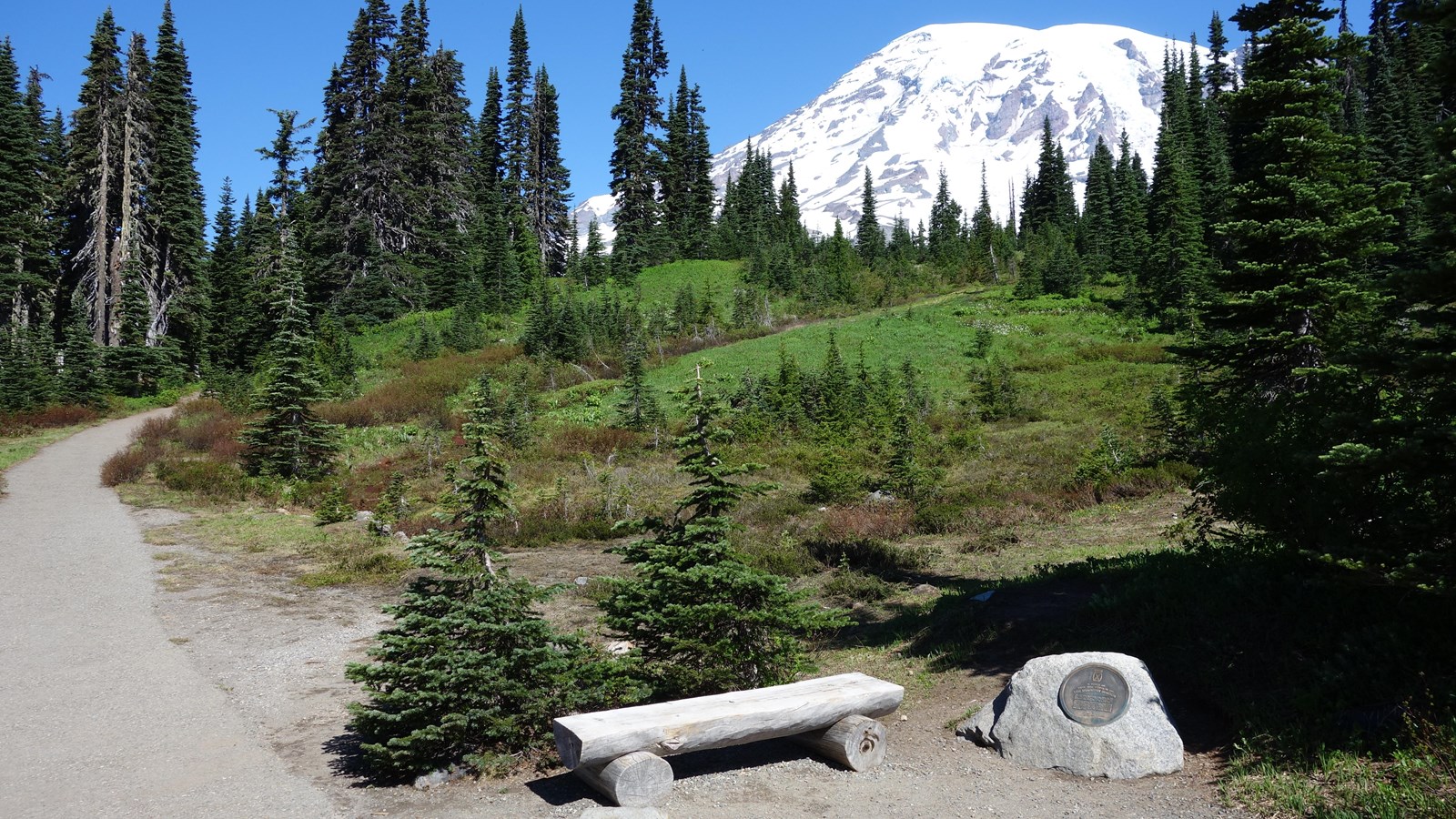
This location is the junction of Waterfall Trail and Alta Vista Trail, with north located midway between the two uphill branches of the trails looking roughly towards Mount Rainier. Also on the north side of the junction is a bench next to a small boulder with a bronze plaque inset into it memorializing the 10th Mountain Division, which trained on Mount Rainier in 1941-42 before serving in World War II.
-
Waterfall Trail is oriented roughly east-west at this intersection, with the downhill trail to the east and the uphill hill trail angling to the northwest.
- Alta Vista Trail goes to the south downhill and angles northeast if traveling uphill.
How Far Is It?
- Lower Parking Lot: 0.34 miles, average walking time 13 minutes, south on Alta Vista Trail (downhill). The Nisqually Vista Trailhead is located on the western end of the lower parking lot. There are no restrooms in the lower parking lot, but restrooms are available in the Paradise Picnic Area, downhill from the parking lot.
- Connecting to Skyline Trail: Both Alta Vista and Waterfall Trails cross the Skyline Trail nearby: 0.04 miles (211 ft), average walking time 1.5 minutes, northeast on Alta Vista Trail (uphill) or 0.5 miles (260 ft), average walking time 2 minutes, east on Waterfall Trail (downhill).
- Jackson Visitor Center and Upper Parking Lot: 0.19 miles, average walking time 7 minutes, by following the Waterfall Trail east to the Skyline Trail then taking the Skyline Trail downhill to the upper parking lot. An alternative and less direct route is to go south on Alta Vista Trail (downhill) then take Avalanche Lily Trail east to connect to the upper parking lot, 0.32 miles, average walking time 12 minutes. Restrooms, information, food, and gifts available at the visitor center.
- Connecting to Deadhorse Creek Trail: 0.18 miles, average walking time 7 minutes, northwest on Waterfall Trail (uphill). Deadhorse Creek Trail parallels and connects to the Skyline Trail higher up in the meadows or follow Deadhorse Creek Trail downhill to connect to the Nisqually Vista Trail.
- Myrtle Falls: 0.49 miles, average walking time 19 minutes, east on Waterfall Trail. Stay on the Waterfall Trail past the first intersection with the Skyline Trail until the Waterfall Trail terminates at the junction with the eastern branch of the Skyline Trail. Follow the Skyline Trail north to Myrtle Falls.
For additional information, download the Paradise Area Trails Map.