Last updated: October 7, 2022
Place
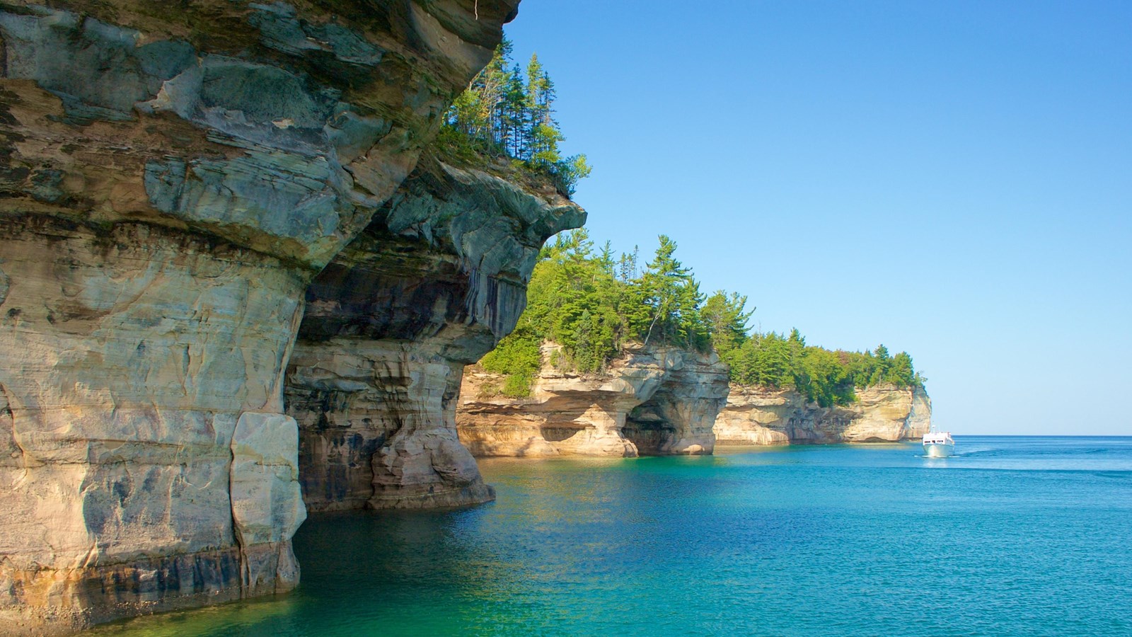
Pictured Rocks Cliffs
NPS Photo
Colorful and bold, the Pictured Rocks cliffs tower 50 to 200 feet above Lake Superior. These sandstone cliffs stretch for about 15 miles along the lake from Sand Point on the west to just after Spray Falls on the east. The most colorful portion of the cliffs begins east of Miners Beach.
The name "Pictured Rocks" comes from streaks of mineral stain that decorate the face of the weather-sculpted sandstone. Stunning colors occur when groundwater oozes out of cracks and trickles down the rock face. Iron (red and orange), copper (blue and green), manganese (brown and black), and limonite (white) are among the most common color-producing minerals.
The best view of the cliffs is from the water. A National Park Service authorized concessionaire operates a non-stop boat tour of the Pictured Rocks cliffs from mid-May through mid-October.
The 10-mile loop hiking trail in the Chapel Basin provides the best views from land. Miners Castle provides a view of the cliffs in the distance, looking eastward from the lower overlook. This stretch of cliffs can also be viewed from the west end of Miners Beach.
The North Country National Scenic Trail extends the length of the lakeshore, providing beautiful views along the trail for both backpackers and day hikers. For safety's sake - please stay away from the cliff edge!