Last updated: February 12, 2023
Place
Reclaiming the Land
NPS Photo
Quick Facts
Location:
North Valley Trail
Designation:
Interpretive Sign
Amenities
2 listed
Benches/Seating, Historical/Interpretive Information/Exhibits
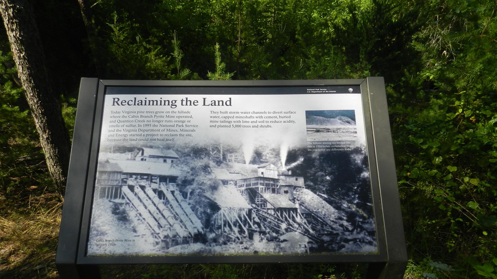
Standing on this viewing platform, look through the trees across the creek and you can see the hillside site where the old milling buildings were contrusted and operated by the Cabin Branch Mining Company from 1889-1920. Milling the pyrite ore and sorting it by quality and size was an essential part of the mining operation. After sorting by size, the ore would be spread out and hammered until it could pass through a 2 1/2 inch ring. Smaller pieces were ground between wheels and screens until fine. It was then sent down the hill via the vertical structures show on the sign image and put into railway cars.
When the mine closed down in 1920, the buildings were abandoned and many of the mine tailings were left exposed. Sulfur from the pyrite started to leach into the creek and raised the acidity of the water. While reclamation of the mine land was ongoing since the passage of the Clean Water Act in 1970, the largest reclamation project took place in 1995, capping mineshafts, burying mine tailings with lime, building storm-water channels to divert run-off, and planting trees and shrubs.
When the mine closed down in 1920, the buildings were abandoned and many of the mine tailings were left exposed. Sulfur from the pyrite started to leach into the creek and raised the acidity of the water. While reclamation of the mine land was ongoing since the passage of the Clean Water Act in 1970, the largest reclamation project took place in 1995, capping mineshafts, burying mine tailings with lime, building storm-water channels to divert run-off, and planting trees and shrubs.