Last updated: November 2, 2024
Place
Second Falls
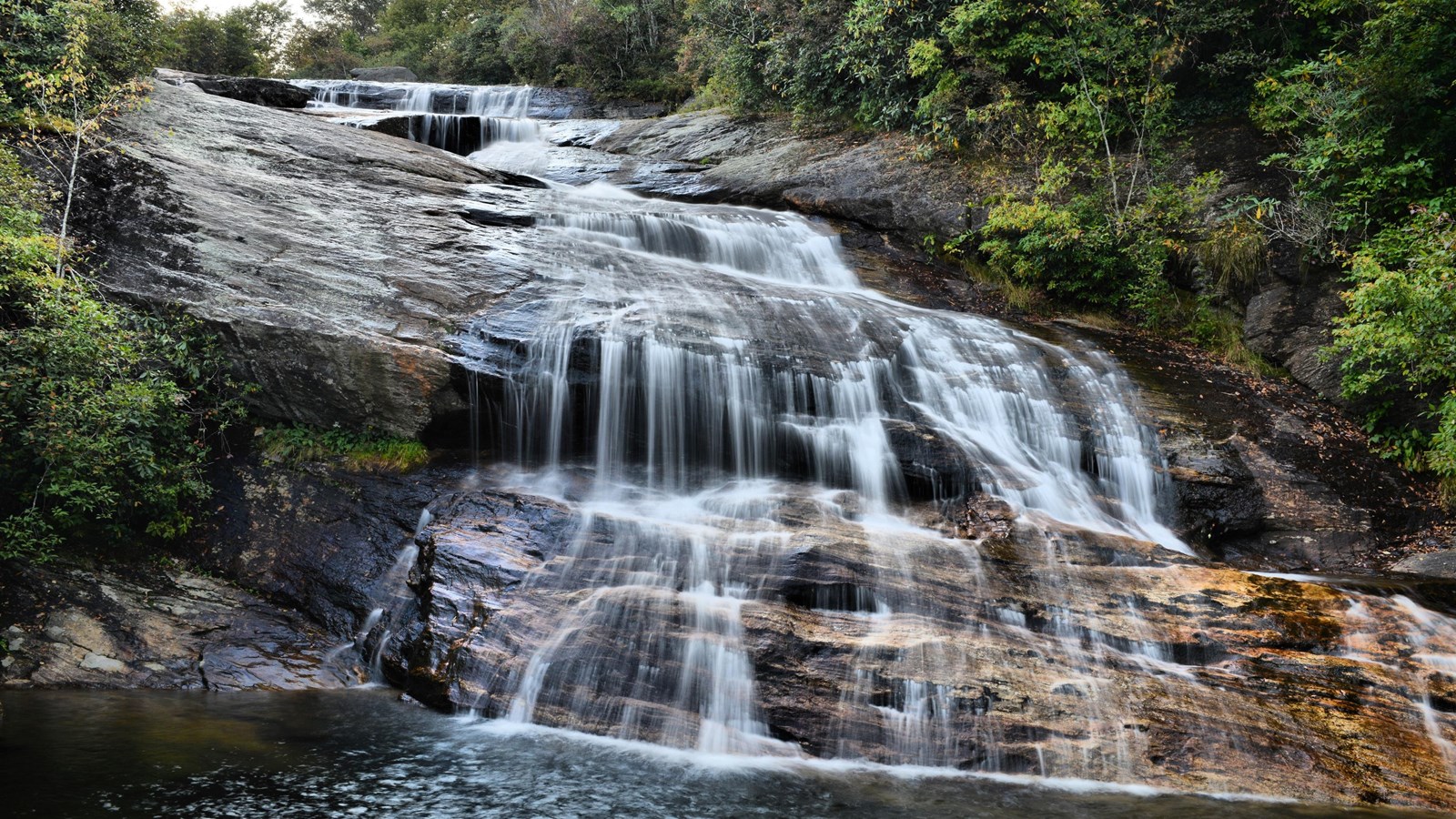
NPS Photo / A. Armstrong
Quick Facts
Location:
Milepost 418
MANAGED BY:
Amenities
5 listed
Information Kiosk/Bulletin Board, Parking - Auto, Scenic View/Photo Spot, Toilet - Vault/Composting, Trailhead
Be cautious while enjoying waterfalls around the Parkway. Do not climb on rocks near waterfalls and use extreme caution when walking along riverbanks. These rocks are slippery from mist and algae. The top of any waterfall is dangerous—never play in the stream above a waterfall.
Hike into a mile-high valley featuring spectacular waterfalls surrounded by rolling ridges. The Graveyard Fields Loop Trail is a very popular and reasonable hiking distance for families, including children, and includes waterfalls. The 1.3-mile loop trail is rated as easy overall, however the spur trails to the waterfalls are moderately steep. Trail access is from the Graveyard Fields Overlook at Milepost 418.8 of the Blue Ridge Parkway, but the area is managed by Pisgah National Forest. Finding a parking spot might require the willingness to park a significant distance away and walk on the road to the overlook. Signs on the roadsides clearly mark where motorists can and cannot park. Cars attempting to park in restricted areas have rolled over the edge down a steep embankment! If the parking lot is full, visit one of the other hiking areas available along the Blue Ridge Parkway.
The two waterfalls in the Graveyard Fields area are accessible from the trailhead near the vault toilets in the overlook. A trail map is available in the overlook parking lot. Familiarize yourself with the general loop trail prior to hiking. Taking a photo of the trail map is recommended. “Social trails” (or illegal trails) have been created over the years, which can make navigating confusing. Please do not compound this problem by going off the established trails.
Second (or Lower) Falls is only 1/3 of a mile from the trailhead. Follow the trail down to the Yellowstone Prong, the stream that feed both waterfalls. After crossing the stream, take a right on the spur trail that follows the stream as it flows down to the waterfall. A series of stair steps will take you to the base of the waterfall for safe viewing, photography, and cooling off in the mist of the falls. Return to the loop trail the same way you came.
To reach the Upper Falls, continue on the loop trail through the beautiful open meadow. Look for a spur trail to the right after about a half a mile of hiking. It is before you recross the Yellowstone Prong. This 0.8-mile spur trail to the Upper Falls crosses small creeks and is rocky towards the end. The Upper Falls is divided into two sections, each accessible by a short side trail. At the lower section, the river flows over an angled rock outcrop resembling a chute before pooling above several large boulders. The upper section is a classic tall waterfall where the water falls over a high cliff and flows over a rock face.
To return to your car, follow the Upper Falls Spur Trail back to the Graveyard Fields Loop Trail. Turn right on the loop trail where it will cross the Yellowstone Prong and ascend through a rhododendron thicket back to the other end of the parking lot.
Be aware that camping is not allowed in the Graveyard Fields area. During the season, the nearest National Park Service campground is located at Mount Pisgah. In the winter, the Blue Ridge Parkway may be closed in this area due to ice and snow.
Check the conditions of the area before you visit.