Last updated: November 10, 2024
Place
Shafer Canyon Overlook: Dropping into the Canyons
E.Butko
Quick Facts
Location:
Island in the Sky
Significance:
Wayside Panel
Amenities
1 listed
Historical/Interpretive Information/Exhibits
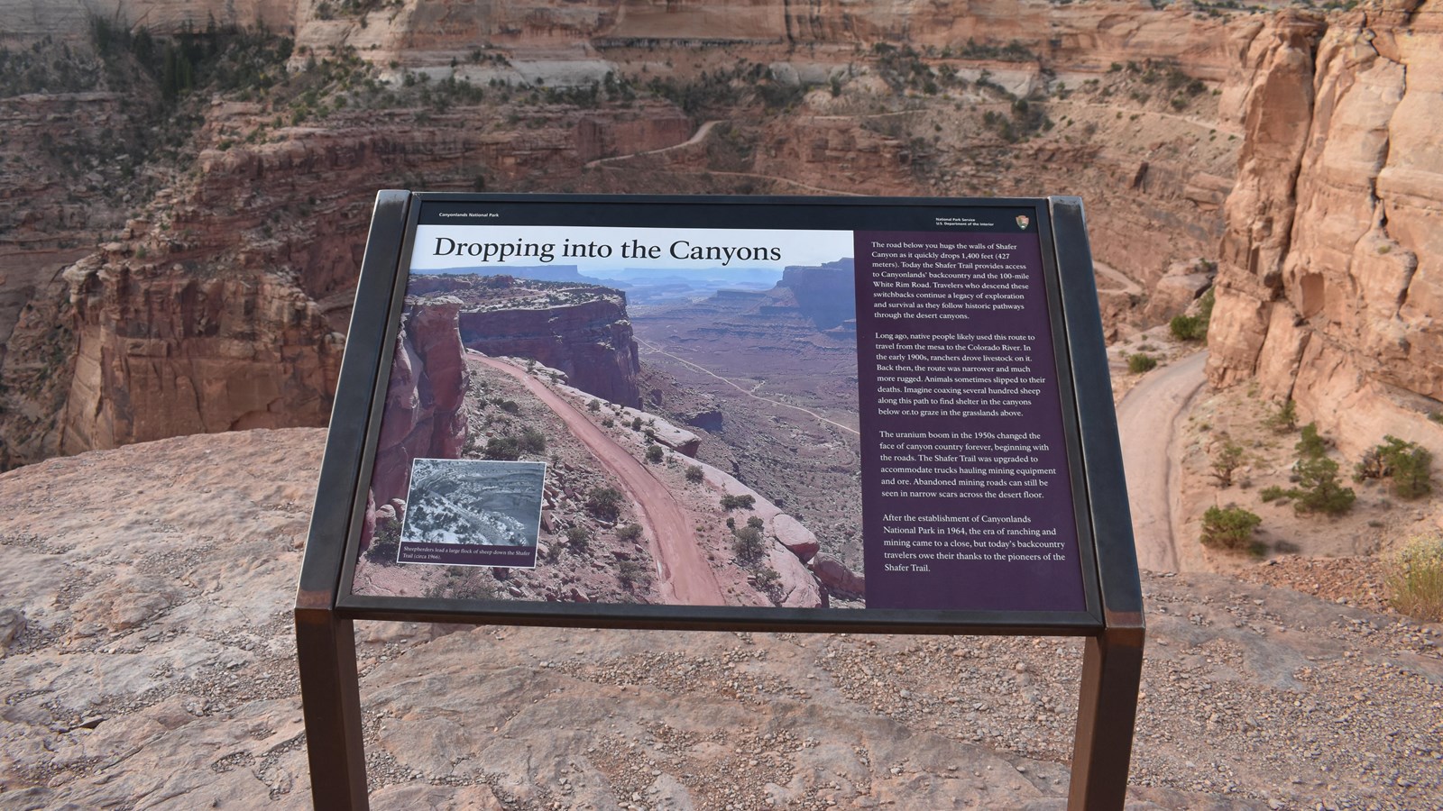
The road below you hugs the walls of Shafer Canyon as it quickly drops 1,400 feet (427 meters). Today the Shafer Trail provides access to Canyonlands' backcountry and the 100-mile White Rim Road. Travelers who descend these switchbacks continue a legacy of exploration and survival as they follow historic pathways through the desert canyon.
Long ago, native people likely used this route to travel from the mesa to the Colorado river. In the early 1900s, ranchers drove livestock on it. Back then, the route was narrower and much more rugged. Animals sometimes slipped to their deaths. Imagine coaxing several hundred sheep along this path to find shelter in the canyons below or to graze in the grasslands above.
The uranium boom in the 1950s changed the face of canyon country forever, beginning with the roads. The Shafer Trail was upgraded to accommodate trucks hauling mining equipment and ore. Abandoned mining roads can still be seen in narrow scars across the desert floor.
After the establishment of Canyonlands National Park in 1964, the era of ranching and mining came to a close, but today's backcountry travelers owe their thanks to the pioneers of the Shafer Trail.
Photo Inset Caption: Sheepherders lead a large flock of sheep down the Shafer Trail