Last updated: March 1, 2023
Place
The Missouri River
U.S. Department of Energy
Quick Facts
Location:
Toe Rd, Crofton, NE 68730
Significance:
Members of the Lewis and Clark expedition traveled up and down the Missouri River in 1804–1805 and 1806. Indigenous people living in villages along the river traded, offered hospitality, and provided guidance to them along the way.
Designation:
Dams built by the U.S. government in the twentieth century have radically changed the Missouri River.
MANAGED BY:
Amenities
18 listed
Beach/Water Access, Boat Ramp, Dock/Pier, Electrical Hookup - Boat/RV, Fire Pit, Grill, Pets Allowed, Picnic Shelter/Pavilion, Picnic Table, Playground, Sewer Hookups - Boat/RV, Showers, Tent Campsites, Toilet - Flush, Toilet - Vault/Composting, Trash/Litter Receptacles, Water - Drinking/Potable, Water - Hookup - Boat/RV
Time and human intervention have changed the Niobrara and Missouri Rivers. In 1804, Sergeant John Ordway described a landscape teeming with deer and large flocks of geese. He noted rich river bottoms “covered with different kinds of Timber.” For Ponca people who called the area home, the land and rivers provided physical and spiritual nourishment.
In the 200 years since Ordway wrote those words, the construction of settlements, farms, dams, and other infrastructure have altered the rivers and surrounding landscape.
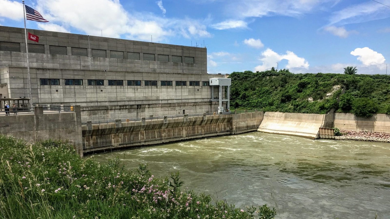
Today, farms and ranches cover the prairies above the river. Pollution from nearby towns and cities leaches into the river, affecting fish and other wildlife. Most significantly, the closest upstream dam, the Gavins Point Dam, slows the current of the Missouri and catches the mud it would naturally wash downstream.
Built in 1952, Gavins Point was one of many dams that the U.S. Army Corps of Engineers constructed on the Missouri River as part of the Missouri Basin Program (also commonly called the Pick-Sloan Plan). Congress voted to build these dams, claiming that they were needed for flood control, irrigation, and hydroelectricity generation.
Before the dams, spring and summer rains frequently caused flooding along the Missouri. For Ponca people, the floods provided fertile soil and needed moisture for their gardens in the bottomlands.
The dams mitigate floods, help to irrigate farms, and generate electricity. But what is lost when the river cannot flow freely?
About this article: This article is part of series called “Pivotal Places: Stories from the Lewis and Clark National Historic Trail.”
Lewis and Clark NHT Visitor Centers and Museums
This map shows a range of features associated with the Lewis and Clark National Historic Trail, which commemorates the 1803-1806 Lewis and Clark Expedition. The trail spans a large portion of the North American continent, from the Ohio River in Pittsburgh, Pennsylvania, to the mouth of the Columbia River in Oregon and Washington. The trail is comprised of the historic route of the Lewis and Clark Expedition, an auto tour route, high potential historic sites (shown in black), visitor centers (shown in orange), and pivotal places (shown in green). These features can be selected on the map to reveal additional information. Also shown is a base map displaying state boundaries, cities, rivers, and highways. The map conveys how a significant area of the North American continent was traversed by the Lewis and Clark Expedition and indicates the many places where visitors can learn about their journey and experience the landscape through which they traveled.