Last updated: October 10, 2024
Place
Upper Choctaw Boundary, Milepost 128.4
NPS Photo
Quick Facts
Location:
Natchez Trace Parkway, Milepost 128.4
Significance:
American Indian Site and Trailhead
Amenities
3 listed
Historical/Interpretive Information/Exhibits, Parking - Auto, Trailhead
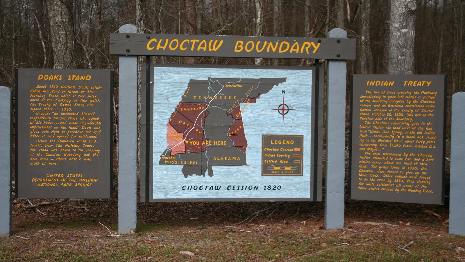
After 1800, treaties between the Choctaw and the US government whittled away tribal rights and lands.
Finally, in 1830, the Treaty of Dancing Rabbit Creek was negotiated at a council house near this spot. All the remaining Choctaw homeland--nearly 10.5 million acres--was taken.
From 1831 through 1834, thousands of Choctaw trekked over 500 miles to "Indian Territory." The US War Department had promised in 1830 to "be kind and brotherly to them...to furnish them with ample corn and beef, or pork for themselves and their families."
Instead, the Choctaw had inadequate clothing and supplies. Heavy rain, blizzard-like snowfall, and a shortage of wagons turned the forced removal deadly.
Hikers can access the Yockanookany section of the Natchez Trace National Scenic Trail from the short self-guided interpretive walk at the location.
See Alerts & Condition for addtional information.
See Hiking the Yockanookany Section of the Natchez Trace National Scenic Trail for additional information.
-
The Choctaw Spirit, Upper Choctaw Boundary, Milepost 128
Speaker: Ian Thompson, Director of the Choctaw Nation of Oklahoma Historic Preservation Department.
- Credit / Author:
- NPS
- Date created:
- 06/17/2016