Last updated: May 30, 2023
Place
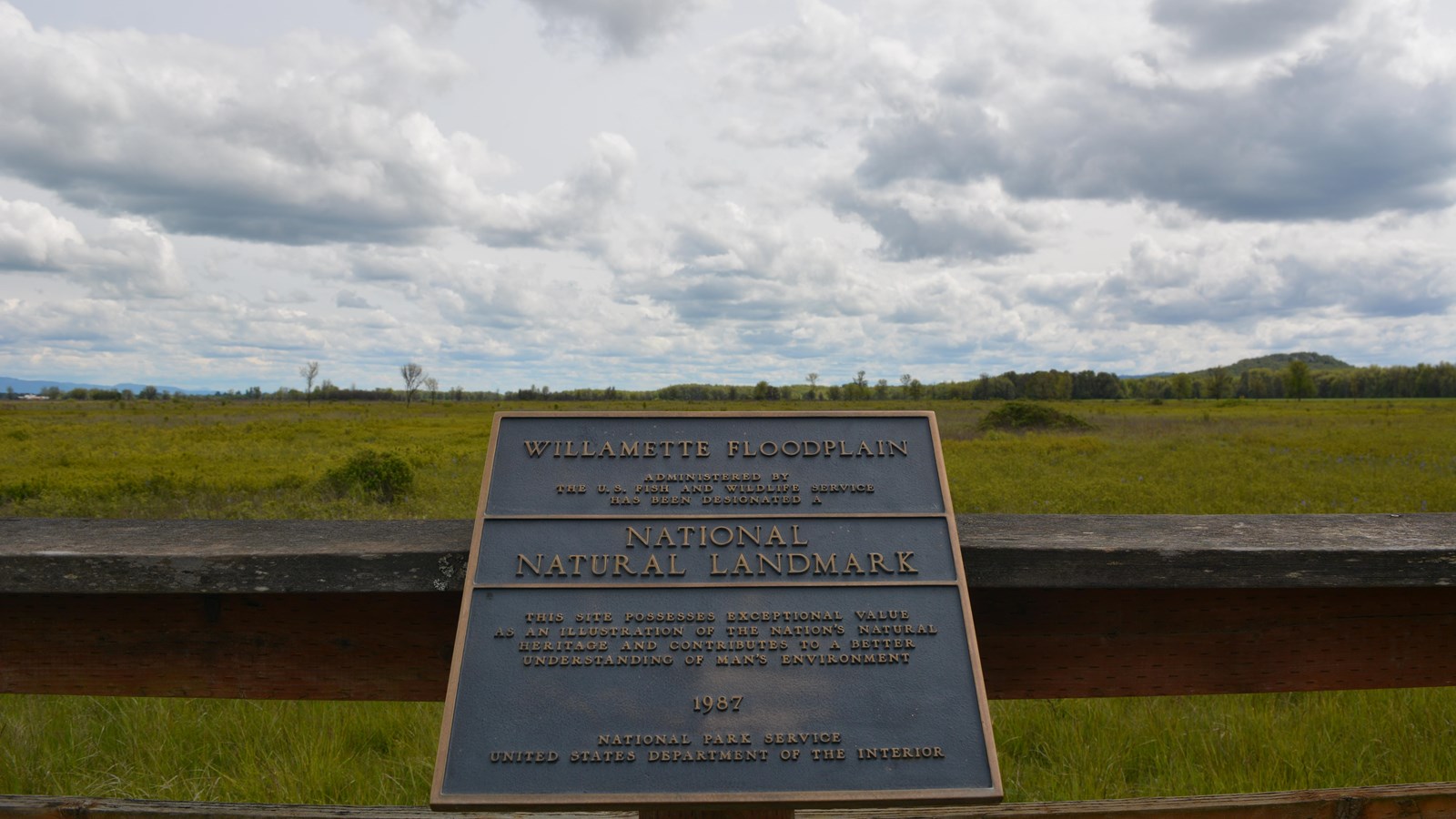
Willamette Floodplain National Natural Landmark
NPS
Quick Facts
Location:
William L. Finley National Wildlife Refuge can be found off of Highway 99W 10 miles south of Corvallis, Oregon. You can also reach the Refuge via Bellfountain Rd. along the west of the Refuge. Be wary of Google Map directions coming from the south (i.e. Eugene). Sometimes these directions want to take you to a locked interior road along Bruce Rd. We are working with Google on this issue. The Snag Boat Bent Unit can be located off of Peoria Road, 1 mile south of Peoria.
Designation:
National Natural Landmark
Amenities
5 listed
Information, Parking - Auto, Restroom, Scenic View/Photo Spot, Trash/Litter Receptacles
The Willamette Floodplain represents the mix of bottomland grasslands once common throughout the interior valleys of western Oregon and Washington. It is a large remnant example of largely unplowed native grassland and ash woodland. The bottomland grasslands include the largest remnants in the North Pacific Border Region. These grasslands include both the full range of bottomland communities and the large diversity of endemic species primarily restricted to these habitats. The grassland communities include a fairly complex matrix of tufted-hairgrass bottomland prairie (Deschampsia caespitosa valley prairie), sedge-meadow barley bottomland grassland (Carex unilateralis – Hordeum branchyantherum bottomland grassland), and hawthorn- rose bottomland shrubland (Crataegus douglasii – Rosa nutkana bottomland shrubland), all of which are well represented at the site in areas with pluvial clay or silty clay soils. In the better drained areas, where alluvial silt loams occur, a matrix of tufted-hairgrass valley prairie and red fescue valley prairie (Danthonia californica – Festuca rubra valley grassland) is found. In the very wet area along Muddy Creek are large and significant examples of Oregon ash bottomland forests (Fraxinus latifolia/Carex obnupta and Fraxinus latifolia/Symphoricarpos albus). All of these grassland and shrubland communities have become increasingly rare as most of the bottomland areas in the interior valleys have been converted to farmland and to pasture.
In the bottomland grassland are found five vascular plant species listed by the U.S. Fish and Wildlife Service as candidate threatened or endangered species. The site also has populations of some threatened and endangered animal species. The area has occurrences of two threatened animals of concern to the U.S. Fish and Wildlife Service. Muddy Creek has populations of the Oregon chub (Hybopsis crameri), a candidate species endemic to the Willamette and Umpqua River systems. The site has wintering populations of Lewis’ woodpecker (Melanerpes lewis) and breeding western pond turtles (Clemmys marmorata), both of which are considered threatened in Oregon but more common elsewhere.
The site is located on essentially flat topography typical of the floor of the Willamette Valley. It is on the Calapooyia geomorphic surface, characterized by the absence of appreciable local relief. Elevation ranges from about 270 to 290 feet (82 to 88 meters). Gentle swales and ridges, which are most easily distinguished on aerial photographs, provide the only variation. Muddy Creek, a small, turbid, meandering, valley-bottom stream with associated ash forests, flows along the eastern edge of the area.