An official website of the United States government
Here's how you know
Official websites use .gov A
.gov website belongs to an official government
organization in the United States.
Secure .gov websites use HTTPS A
lock (
) or https:// means you've safely connected to
the .gov website. Share sensitive information only on official,
secure websites.
Sunset Crater Volcano rises over part of the Bonito Lava Flow created during its eruption.
NPS
Volcanoes and Lava Flows
A thousand years ago, around the year 1085 CE, this landscape would have been unrecognizable, in the midst of a violent volcanic eruption that radically changed the lives of the people who lived here. The ground shook with earthquakes for days or weeks before the eruption began, prompting mass evacuations of the pithouses and fields that now lie buried by lava. Then the ground split open along a great fissure nearly 6 miles (11 km) long, and lava erupted out of it to heights of 850 feet (260 meters) or more.
This type of “curtain of fire” eruption is relatively common among the Hawaiian volcanoes, and the eruption that occurred here at Sunset Crater in 1085 would have been quite familiar to Native Hawaiians. It may have been familiar to the people living here, too – while eruptions in this part of northern Arizona are less frequent than eruptions in Hawai‘i, volcanic activity here has been ongoing for hundreds of thousands of years.
As the lava fountain progressed, activity concentrated in several areas along the fissure. As the lava flung out of the fissure cooled, it fell back to earth as tiny rocks called cinders. Other, bigger pieces of lava are called lava bombs. These cinders and lava bombs began to pile up around the main vent of the eruption, creating the cinder cone we see today.
Even more lava poured out across the landscape, creating the Bonito and Kana’a lava flows. As the surface of the lava flow cooled, hot lava continued to flow underneath and occasionally break through the cooler surface, creating the jagged landscape seen on the lava flows today. These slow-moving flows filled in two small valleys to a depth of 100’ (30m) or more. If a lava flow of that depth covered Flagstaff today, the whole town would be buried except for the top of Sechrist Hall on the university campus.
The eruption and formation of Sunset Crater Volcano incinerated the surrounding landscape, covering almost 900 square miles (2300 square km) with lava and ash. The volcano has several names given to it by Indigenous people, including Palatsmo (Red Hill, Hopi), Ha Gudni Káá (Where It Burned, Dilzhe’e Apache), and Dził Bilátah Łitsoí (Yellow-Tipped Mountain, Diné).
The lava fountain and ash cloud produced by the eruption were likely visible throughout much of the region. The ash cloud is estimated to have been around 5 miles (8km) tall, and could have been seen from high points in the landscape from Tucson to Durango to Las Vegas. People would quickly have realized that something highly unusual was happening!
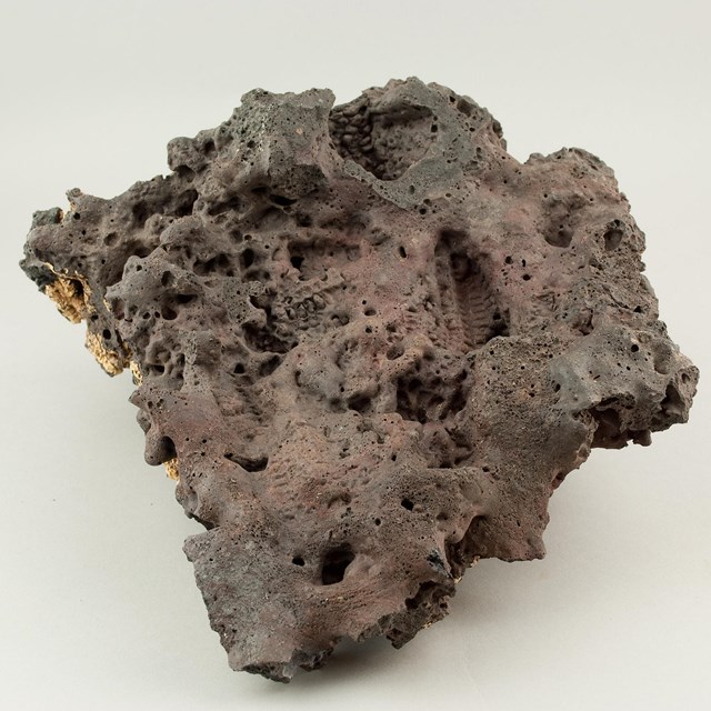
A giant fissure opened in the ground as Sunset Crater Volcano began to erupt. Part of that fissure is visible in the Bonito Lava Flow today.
NPS
The Lava Flows Today
For decades after the eruption, little to nothing grew on the lava flows. In the dry, cold climates of northern Arizona, rock weathers slowly and soil formation occurs over many centuries. Lichens and mosses are typically the first plants to become established on new rocks, because they don’t require any soil. Over time, as those first pioneer plants grow and die and decompose, soils begin to form and other plants begin to grow. On the lava flow today, you can see ponderosa pines, juniper, rabbitbrush, and a few other hardy plants twining their roots through the cinders for sparse water and nutrients.
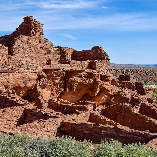
The fertile soils that once filled the valley below O’Leary Peak are gone, buried below a lava flow as thick as a ten-story building. Farther from the lava flow, however, a thin layer of cinders and ash covered the sandstone and limestone hills of the Painted Desert, making it possible to grow food there. Many of the people whose homes were buried by the eruption relocated to what is today Wupatki National Monument, where they worked to rebuild their lives and develop a new way of living in a new place.
Lidar map of the Flagstaff area showing the boundary of Sunset Crater Volcano National Monument
NPS
The San Francisco Volcanic Field
Sunset Crater Volcano is one of around 600 cinder cones in the Flagstaff area. This is a region of intense volcanism that began around 3 million years ago with the formation of a lava dome called Bill Williams Mountain. The San Francisco Peaks began forming soon after that, and over 2 million years they grew into an immense mountain that was probably 16,000 feet (5300 meters) tall - at one time, it was the tallest mountain in the continental US, and the 10th tallest in North America!
Ancestral height of the San Francisco Mountains
NPS
San Francisco Mountain lost its top around 550,000 years ago. It's not clear whether it had a major eruption, similar to the 1980 eruption of Mount St Helens, or whether it collapsed in an event called a "gravitational collapse." There is good evidence for both theories, and holes in both theories as well.
The San Francisco Volcanic Field is massive, covering thousands of square miles. It is likely to be the result of a process called crustal delamination. This is a geologic process by which the underside of the earth's crust is separated from the upper crust, as a result of plate movement, metamorphosis of rocks, or instabilities in mantle currents below. This detachment allows hot magma to contact the cooler crust, melting it and forcing molten rocks upwards through the crust to the surface.
Volcanic activity over the past 3 million years has produced hundreds of cinder cones, dozens of lava domes and lava flows, and the stratovolcano of the Peaks themselves, which still stands nearly 5000 feet (8000 meters) over the surrounding landscape and is home to the highest peak in Arizona. Volcanism is a part of life in this part of the world, and the field is still geologically active. In the long term, there's no doubt more eruptions will occur here and more cinder cones will form, and we - or our descendants - will adapt and learn to live with them, just like our predecessors and ancestors did.
Below the lava flows are ancient sedimentary rocks. The oldest rock layers exposed in the area, the Kaibab and Moenkopi formations, are found at Wupatki National Monument. As dry as the sun-baked desert looks today, a closer look at the rocks reveals water-formed ripples, mud cracks, river gravels, and the imprints of thousands of shells from clams, mollusks and other marine life.
Kaibab Formation
The 240 million-year-old Kaibab Formation is made of limestone, a rock type formed on the sea floor. Prior to the uplift of the Colorado Plateau, this region was near sea level and was periodically covered by large inland seas. Like all oceans, the sea covering this area was teeming with billions of microscopic organisms, whose skeletal remains gently floated to the ocean floor after the creatures died. Over millions of years, the tiny skeletons amassed and, mixed with sand and clay, formed a layer of briny ooze hundreds of feet thick. Through time, this ooze compacted and hardened to form limestone.
Moenkopi Formation
Well-preserved ripple patterns, abundant mud cracks and fossilized burrow traces are seen in the layered sandstone and shale of this formation. This deep red, 200 million-year-old rock layer records a period of meandering rivers, tidal flats and other near shore deposits laid down on top of the Kaibab after the seas had retreated westward. A new type of animal was flourishing; dinosaurs, thriving on the moist climate's lush vegetation, were roaming the land. River Gravel Deposits As the Little Colorado River cut down through the sedimentary layers over the last two million years, it left behind gravel deposits that document its ancestral meandering. These deposits form flat-topped caps of grayish gravel over many of the red Moenkopi hills.