Last updated: December 7, 2024
Thing to Do
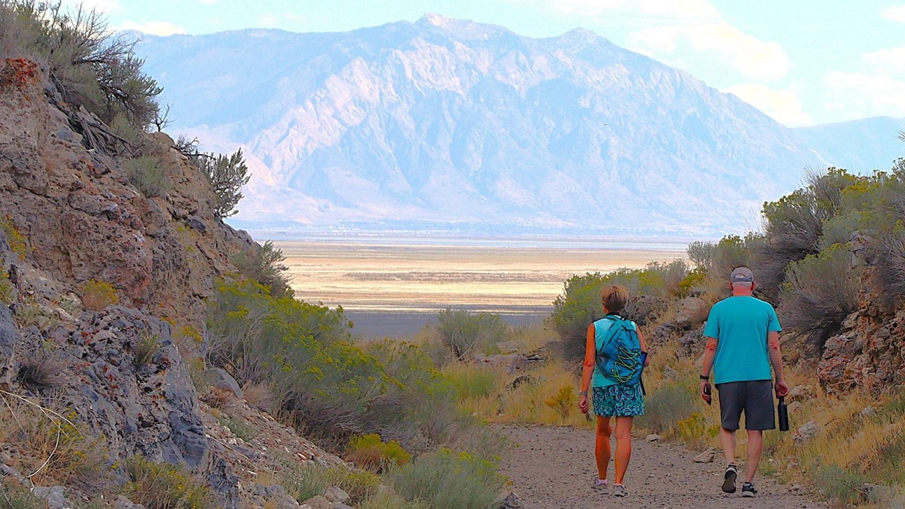
Hike the Big Fill Loop Trail
NPS
The Big Fill Loop Trail is a one mile and a half round-trip walking trail. Visitors walk on original Central Pacific grade and return on the Union Pacific grade. The trail showcases the Central Pacific's Big Fill and the abutments that once supported the Union Pacific's Big Trestle. Walk through cuts, over fills, and see drill marks where workers blasted rock away. Keep in mind, all of this was accomplished by simple tools, sweat, and an amazing amount of endurance.
Things you should know before you go...
- The Big Fill Trail follows the old railroad grades, the sloped earthen beds on which track and ties were laid. You'll begin the trail on the Central Pacific's grade and return on the Union Pacific's grade.
- The Big Fill Trail is a 1 1/2 mile loop that will take you about an hour to an hour and a half to walk.
- Take plenty of water. Summer temperatures regularly reach into the 90s and can exceed 100 degrees (F). There is no shade along the trail.
- Wear appropriate clothing for the weather and don't forget your sunscreen.
- Watch your step as you walk. Uneven surfaces are common along the trail.
- Stay on the marked trail. Leaving the trail damages sensitive vegetation, creates new trails, leads to erosion of historic and natural resources, and encroaches upon wildlife habitat.
- Be thoughtful of nature. It is unlawful to disturb or harm any wildlife in the park.
- If severe weather threatens, seek shelter or get back to your vehicle immediately.
- It is unlawful to remove anything from a National Park Service site. If you find something interesting along the trail, leave it in its place for someone else to enjoy. If you find an artifact or notice any damage to the trail, notify a ranger as soon as possible.
An Epic Story
Construction features along the Big Fill Trail demonstrate the engineering skill and sheer determination of railroad workers who labored here. Not since tunneling through the Sierra Nevada did the Central Pacific confront such a rugged landscape. This portion of the railroad also represents the most grueling construction the Union Pacific undertook from Omaha to Promontory.
As you walk the trail, remember that all construction was completed entirely by hand. What will take you 1 to 1.5 hours to walk, took the railroad companies about three months to build - just for this small section of railroad! Also remember that the construction features you will see along the way are only part of the epic story of the transcontinental railroad. At 1,776 miles long, the railroad stretched from Omaha, Nebraska to Sacramento, California. It remains one of the most remarkable engineering feats in American history.
(The numbers below correspond with points of interest markers along the trail. Companion booklets are available for purchase in the park store, located in our Visitor Center.)
1. Steep Grade and the Orange Special Wreck.
Directly across from where you step onto the railroad grade is a plaque commemorating the "Orange Special" wreck. This wreck was caused in part by the steep 1.6% grade that continues to your right along the paved road. On the transcontinental route, only a short section of track near the summit of the Sierra Nevada was steeper than the grade here. All freight trains and many long passenger trains required at least one helper, or hog, locomotive to assist them up and down Promontory's east slope.
The Pacific Railroad Act of 1862 mandated that the transcontinental railroad grade's steepness could not exceed 2%. This was so that locomotives could ascend the grade while pulling heavy loads and also to keep trains from derailing while descending the grade. It is for these reasons that the grade does not follow what would appear to be the most direct route, but incorporates many curves and turns along its path to Promontory.
2. Parallel Construction
By 1864, changes to the Pacific Railroad Act allowed grading crews to work up to 300 miles ahead of track laying crews. These changes also allowed both railroad companies to receive a portion of their government subsidies once track was laid and inspected.
Because a meeting point had not been mandated to the companies, they had no incentive to cease construction as their work crews drew closer to one another. Consequently, they built grade past each other for 250 miles. When a meeting point was finally agreed upon, both companies discontinued grading beyond Promontory Summit. Because of this, you will see both complete grade and partially constructed grade throughout the park.
You are now walking on what was the Central Pacific's grade. Below you is the Union Pacific's grade. Much like laying the bed of an asphalt road, building the grade took the most time in construction the transcontinental railroad.
3. Cuts and Fills
Rock cuts and fills had to be constructed along the route to bring it within the required grade of 2% or less. When possible, material from the cuts was used to create fill. To make the cuts, a two-man team called "double-jackers" drilled holes in solid rock using a long, narrow drill bit, which was repeatedly struck with a heavy sledge hammer or double jack. After the hole was drilled, a worker called a "powder monkey" would fill it with black powder, carefully tamp and fuse the powder, and set off the charge. A successful blast would reduce the rock to a size that could be shoveled into mule-drawn dump carts and taken to an area that needed to be filled.
4. Spoils Pile
Below you is a spoils pile. When debris from construction of rock cuts wasn't needed, the rock was dumped into mounds called spoils piles. Most of these piles were size-graded. That is, each spoils pile featured a different size of rock. Notice too, the top of this spoils pile is perfectly flat. In this case, flattening of the top surface may have been done to create a work area along the grade.
5. Towns and Camps
The harsh terrain surrounding you was also home to thousands of railroad workers during the final days of the railroad's construction. Central Pacific's camps were located to the west, and several Union Pacific camps were scattered in the valley below you.
Although many Union Pacific camps maintained reputations as "hell-on-wheels" towns, only Deadfall held this distinction in the Promontory area. Because most of the Union Pacific camps near Promontory were composed of Mormon workers, they were relatively peaceful places.
6. The Big Fill and the Big Trestle
As late December 1868, Central Pacific surveyors planned a route that would require blasting an 800-foot tunnel through the east face of the Promontory Mountains. During an inspection of the site, Central Pacific President Leland Stanford overruled the idea as too costly and time consuming. Surveyors picked a new route that avoided tunneling but posed a new problem: how to cross Spring Creek Ravine.
In February 1869, the Mormon construction firm of Benson, Farr, and West, began work on the Central Pacific's Big Fill to span the ravine. Imagine placing the first small, mule-drawn dump cart load of fill at the bottom of the ravine below you. The work that followed took over two months of intense effort by 250 dumpcart teams and more than 500 workers. Load after load of fill, totaling more than 101,000 cubic yards, was required to conquer the 500 foot chasm. The Big Fill remains one of the more impressive construction efforts in the history of American railroading.
To span Spring Creek Ravine, the Union Pacific constructed the Big Trestle, which was located 150 feet east of the Big Fill. Because it was meant to be a temporary structure, construction of the Big Trestle took only 36 days, as compared to the Central Pacific's Big Fill, which took more than two months.
The trestle was 85 feet high and 400 feet long, and as one reporter put it, there were no words that "... would convey and idea of the flimsy character of that structure." Another reporter suggested that it "...will shake the nerves of the stoutest hearts of railroad travelers when they see what a few feet of round timbers and seven inch spikes are expected to uphold - a train in motion."
About eight months after completion of the transcontinental railroad, however, the Central Pacific gained control of the route from Promontory Summit to Ogden, Utah and trains began using the Big Fill rather than the Big Trestle. Ogden then replaced Promontory Station as the terminus for both railroads, and track was removed from the trestle. Today, only photographs, abutments, and footings remain to remind us of the Big Trestle.
7. Borrow Pits
The depression in the hillside before you is called a borrow pit. When a fill required more material than was available from the cuts, borrow pits, like this one, were dug from the adjacent hillsides.
Return to stop 6 and follow the trail to stop 8. If you would like, you may continue to talk across the big Fill before turning back to stop 6.
8. The False Cut
Approaches to both the Big Fill and the Big Trestle required blasting massive rock cuts. Notice the center cut here is not complete. Apparently, construction began in the wrong place. Thus, the cut has come to be called the "False Cut." Workers corrected the error by construction the cut to your left, Carmichael's Cut.
9. The Big Trestle Abutments
The area on which you are standing is one of the abutments of the Big Trestle. Take a moment to imagine what the Big Trestle looked like spanning the ravine in front of you, as compared to the Big Fill on your left. If you were traveling by rail to Promontory, which would you prefer?
10. Drill Marks & Carmichael's Cut
You are now walking through Carmichael's Cut, which was part of the Union Pacific's grade and has a multitude of drill marks through it. As you continue on through the cut, see how many drill marks you can find. The entire cut procedure was done in a stair-step fashion, meaning that several crews worked at different levels and on both sides of the cut at the same time. This type of construction allowed cuts to be created faster and more efficiently.
Now step to the end of Carmichael's Cut and take a look at the opposite side of the False Cut.
11. False Cut and Stair-Step Construction
This side of the False Cut is a good example of stair-step construction and how railroad workers blasted their way through the rock to create a finished cut such as Carmichael's Cut.
12. The Telegraph
During construction of the transcontinental railroad, a telegraph line was also built alongside the railroad grade. The telegraph made communication between various points along the railroad immediate, which greatly facilitated obtaining supplies and materials and enabled station masters to effectively manage traffic on their parts of the transcontinental route. Most importantly, the telegraph enabled instant communication across the nation, further linking east and west.
13. Rock Shelter
Small rock shelters are scattered throughout the Promontory Mountains. This particular rock shelter may have been used as a cache for construction materials or as a shelter during blasting.
14. Deterioration of the Union Pacific Grade
In late 1869, the Central Pacific assumed responsibility for the segment of railroad between Promontory and Ogden. The Union Pacific abandoned its grade, including the Big Trestle, and the grade built through this area by Central Pacific became the main line for the next 36 years. Because it was no longer used, the Union Pacific grade deteriorated and is now much smaller than its counterpart.
Deterioration of the grade is difficult to see in the photo below. During your walk, however, take time to notice the difference between the two grades.
A New Era
The Promontory Mountains, which once served as a looming reminder of the harsh terrain, now stand watch over the achievements of those who labored here. These same achievements remain preserved at Golden Spike National Historical Park as a tribute to the perserverance and talents of all who worked to complete an engineering marvel and open a new chapter in our nation's histroy - the era of the railroad!
This new era brought sweeping changes to American and united the country as never before. Geographically, economically, and politically, the nation was tied together by a band of iron rails on which a new generation of Americans raced to lay claim to a future full of promise.
We hope that you have enjoyed your walk along the Big Fill Trail. For more information about the transcontinental railroad, talk to a ranger, visit our website at www.nps.gov/gosp, or visit the bookstore in our visitor center.
Thank you for visiting Golden Spike National Historical Park!
Details
Activity
Self-Guided Tours - Walking
Pets Allowed
Yes
Activity Fee
No
Entrance fees may apply, see Fees & Passes information.
Location
Big Fill Loop Trailhead
The Big Fill trailhead is approximately four miles from the Visitor Center. Traveling east from the Visitor Center, stay on the paved road and make first right onto Golden Spike Drive. Travel approximately two miles and turn left at the stone entrance columns and Big Fill trail Sign and proceed into the gravel parking lot.
Reservations
No
Accessibility Information
Trail is 3-6' wide, less than a 2% grade, gravel.