Last updated: February 7, 2021
Thing to Do
Bike Big Bend
NPS
Big Bend by Bike
Lightly traveled roads and varied terrain make Big Bend a premier bicycling location. Over 100 miles of paved roads and 160 miles of backcountry dirt roads provide challenges for riders of all types and abilities. Bicyclists must be extremely cautious and well-prepared, but bicycling allows outstanding panoramic views unobstructed by a windshield. It also allows the bicyclist to see and hear some of the smaller wonders of Big Bend from a more intimate viewpoint.
Safety
Bicyclists must share the roads with vehicles and obey all traffic laws. Paved roads within the park are narrow and often have no shoulders. Bicyclists should take proper measures to stay safe, such as riding single-file, wearing bright and/or reflective clothing, and being aware of their surroundings.
Traffic is sparse in summer and highest during March and early April and on holiday weekends throughout the year. Use extreme caution.
Recommended Biking Routes:
Many of the rides in Big Bend National Park are easier with a shuttle. A few suggestions follow. Check with a ranger for more information.
If you have a shuttle available:
Panther Junction to Rio Grande Village
Difficulty: Easy; Distance: 20 miles, paved; Time 1.5-2.5 hours
Although there are some hills, the ride is mostly downhill as the elevation drops 1,900 ft. over the course of the ride. Be wary of large motorhomes and trailers travelling this road, especially during fall, winter, and spring. For a variation, ride to the Hot Springs Historic District on the 2-mile unpaved spur road 16 miles from Panther Junction. Your shuttle can meet you at either Rio Grande Village or the Hot Springs. The ride has outstanding views of the Sierras del Carmen and the Rio Grande in the distance.
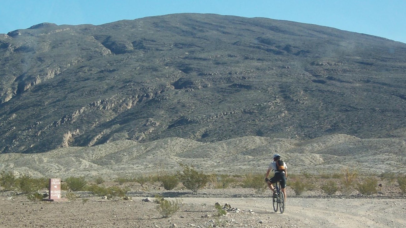
Panther Junction to Rio Grande Village via the Glenn Springs Road
Difficulty: Moderate; Distance 10 miles paved, 25 miles unpaved; Time: 4-6 hours
Ride six miles toward Rio Grande Village on the paved road, then turn onto Glenn Springs Road. Follow it for 15 miles as it skirts the Chisos Mountains and leads to a desert spring before joining the River Road. Turn left and follow the River Road for 9.6 miles to its junction with the paved road. Turn right and ride on the paved road for 4 miles to Rio Grande Village.
Panther Junction to Castolon via the Ross Maxwell Scenic Drive
Difficulty: Strenuous; Distance: 35 miles, paved; Time: 3-6 hours
This ride travels through some of the most scenic terrain in the park. It skirts the Chisos Mountains and passes interesting geologic features and historic sites. Although the loss of elevation between Panther Junction and Castolon is 1,580ft., the terrain is challenging with many steep hills.
Old Ore Road
Difficulty: Strenuous; Distance: 26 miles, unpaved; Time: 4-6 hours
This ride is best taken from north to south for an easier ride and great views of the Chisos Mountains. The road is rough and rocky and the terrain is challenging. Park on the edge of the Dagger Flat Auto Trail at the north end of the Old Ore Road.
Old Maverick Road
Difficulty: Easy; Distance: 13 miles, unpaved: Time: 1.5-2 hours one-way
Start from the parking lot near the Maverick Entrance Station. This route is easiest north to south. There are many good views along the route, which ends at Santa Elena Canyon. Seasoned riders can return to Maverick for a strenuous 26-mile trip.
If you do not have a shuttle available:
Panther Junction to the Chisos Basin
Difficulty: Strenuous; Distance: 20 miles, paved; Time: 2-4 hours round-trip
Ride three miles of gradual uphill west of Panther Junction to the Chisos Basin Junction. Turn left and ride seven miles to the Chisos Basin. The road is very steep, with 15% grades. The elevation gain is 1,650 ft. Watch for traffic and be ready to pull off the road if necessary. This ride is an aerobic challenge even for those in excellent physical condition. The ride down is exhilarating. Watch for animals and obstacles on the road and make sure you don't break the 45mph speed limit!
Grapevine Hills Road
Difficulty: Moderate; Distance: 15 miles, unpaved; Time: 2-3 hours round-trip
Park at the junction of the paved road and the Grapevine Hills Road for this ride past interesting rock formations. For variety, hike the 2-mile round-trip Grapevine Hills Trail near the end of the road. Return the same way.
Paint Gap Road
Difficulty: Moderate; Distance: 15 miles, unpaved; Time: 2-3 hours round-trip
Park at the junction of the paved road and the Paint Gap Road. The road has a variety of surfaces including sand and rocks, and is especially rough near the end. Return the same way.
Dagger Flat Auto Trail
Difficulty: Easy; Distance: 18 miles, unpaved; Time: 2-3 hours round-trip
Park near the junction of the paved road and the Dagger Flat Auto Trail. This route is fairly flat with a gentle uphill on the way out. Watch for sand along the way--you can get bogged down. There are many interesting plants along the route. Return the same way.
Discover more information on biking in Big Bend at:
Bicycling - Big Bend National Park
Details
Activity
Biking
Pets Allowed
Yes with Restrictions
Pets are allowed where vehicles can go. Pets are not allowed on trails.
Read more about bringing your pet to Big Bend.
Pets - Big Bend National Park
Activity Fee
No
Entrance fees may apply, see Fees & Passes information.
Reservations
No
Season
Winter, Spring, Fall
Accessibility Information
Big Bend is remote. We are continually working to upgrade facilities for accessibility and to improve park access for all visitors. While not all facilities are fully accessible, park rangers are happy to assist any visitor with special needs.