Last updated: May 12, 2023
Thing to Do
Guadalupe Ridge Trail (GRT)
NPS / Andy Rankin
Please Note: Currently in Carlsbad Caverns National Park the Guadalupe Ridge Trail from the visitor center to the west park boundary) is closed due to flood damage. The Old Guano Trail is open. More Information>>
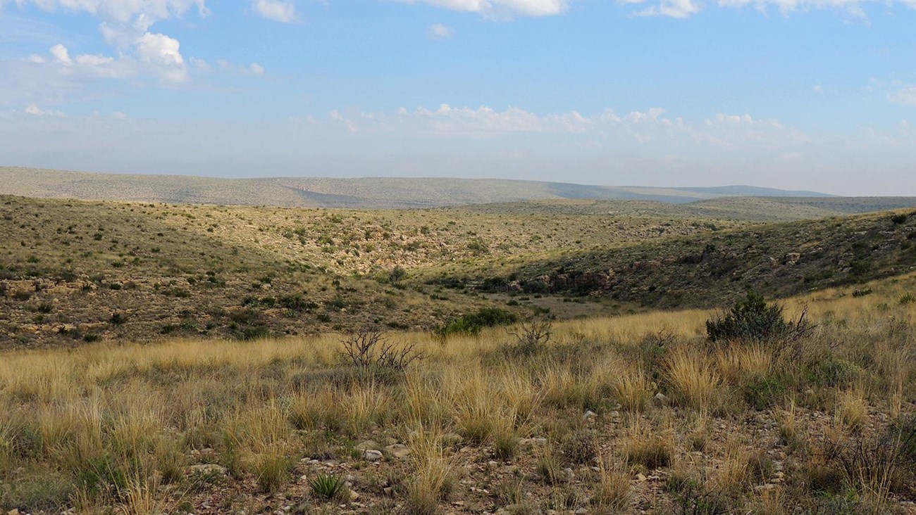
The 100 mile (161 km) Guadalupe Ridge Trail (GRT) starts in Guadalupe Mountains National Park, at the highest point in Texas—Guadalupe Peak (8751 ft/2667 m). Some sections of the trail in the Guadalupe Mountains climb and dip over a 60% solid rock grade and are very rugged terrain. The trail travels through Chihuahuan Desert, mixed coniferous forest, and riparian woodlands before exiting the national park to the Lincoln National Forest.
The national forest has mixed coniferous forest along with spectacular rocky canyons. An optional loop will take trekkers through Last Chance Canyon and Sitting Bull Falls, a desert oasis with a series of small waterfalls and pools.
The trail continues through Carlsbad Caverns National Park and Bureau of Land Management land with stunning views of the rugged and unforgiving Guadalupe Ridge. Hikers can stop at the Carlsbad Caverns National Park Visitor Center before dropping into White’s City, New Mexico and the end of the Guadalupe Ridge Trail.
Over 20 miles (32 km) of the GRT is within Carlsbad Caverns National Park.
Details
Duration
5-6 Days
5-8 days for the average hiker to thru-hike.
Trail Segment Distances:
Carlsbad Caverns (20 miles / 32 km)
Lincoln National Forest (18 miles / 29 km)
Optional Sitting Bull Falls Loop (30 miles / 48 km)
Guadalupe Mountains (39 miles / 63 km)
Activity
Backcountry Camping
This trail covers 100 miles (161 km) through Carlsbad Caverns National Park, Lincoln National Forest, Bureau of Land Management, and Guadalupe Mountains National Park. This trail takes you through the heart of the most exposed fossilized reef in the entire world! You will walk the ridge of the mountain range and hike through two different states, two National Parks and one National Forest. Ultimately the GRT is a 100+ mile journey into the center of the Chihuahuan Desert with views of fantastic canyons, rare riparian areas, and outstanding ridgelines.
Age(s)
0 and Older
Pets Allowed
No
Activity Fee
Yes
Park entry fee required for all adult visitors to Guadalupe Mountains National Park.Carlsbad Caverns National Park and Lincoln National Forest do not charge an entrance fee.
Location
Guadalupe Ridge Trail
The northeastern terminus of the trail in Carlsbad Caverns National Park begins in White's City, New Mexico. The southwestern terminus of the trail is Guadalupe Peak in Guadalupe Mountains National Park.
Reservations
Yes
A Wilderness Use Permit is required for overnight use in Carlsbad Caverns and Guadalupe Mountains National Parks. The Guadalupe Mountains recreation.gov permitting system allows for a full GRT itinerary to be built including days in the Lincoln National Forest and in Carlsbad Caverns National Park.
Season
Winter, Spring, Fall
Environmental conditions (weather and heat) dictate narrow periods when the GRT can be safely completed, generally in the spring and fall. From November to April be prepared for high winds throughout the route.
Time of Day
Any Time
Accessibility Information
Trail surfaces are loose rock or hardened rock surfaces. Hiking or trekking poles are highly recommended. Trail widths vary from two to six feet depending on the trail.
Parking
All trailhead areas have accessible parking available.
Service animals
Only service animals that have been individually trained to perform specific tasks for the benefit of persons with disabilities are allowed in the park and on trails.
Parking
All trailhead areas have accessible parking available.
Service animals
Only service animals that have been individually trained to perform specific tasks for the benefit of persons with disabilities are allowed in the park and on trails.

NPS/M. Larson
BACKCOUNTRY REGULATIONS
It is your responsibility to know the rules and regulations of each land management agency. Both National Parks and the National Forest have different regulations that apply to the GRT.
PERMITS:
A Wilderness Use Permit is required for overnight use in Carlsbad Caverns and Guadalupe Mountains National Parks. The Guadalupe Mountains recreation.gov permitting system allows for a full GRT itinerary to be built including days in the Lincoln National Forest and in Carlsbad Caverns National Park. Select “Out of Park: Carlsbad Caverns National Park - Guadalupe Ridge Trail” and “Out of Park: Lincoln National Forest - Guadalupe Ridge Trail” for those days/nights of your itinerary outside of Guadalupe Mountains National Park. Select designated campsites for those days/nights within Guadalupe Mountains National Park.
WATER:
Arguably the most important section of this page. Bringing water on this trail and planning resupply locations is one of the only factors between life and death on this trail. Water is scare and not reliable in the Guadalupe Mountain Range. Depending on your itinerary, cashing water is required.Reliable water sources include: White’s City, Carlsbad Caverns National Park Visitor Center, Sitting Bull Falls (optional route that adds 30 miles total), McKittrick Canyon Visitor Center, and the Pine Springs Trailhead and Campground. If you attempt the option route to Sitting Bull Falls water is available at both Sitting Bull Falls and the Forest Service Queen Administrative site near Queen.
There might be a few riparian habitats you enter such as Sitting Bull Falls (optional loop) and McKittrick Canyon where you will find shallow water crossings. Since both locations are close to reliable water sources, there is no need to pull from these precious and rare natural water crossings. Bringing a water treatment system will probably be unnecessary and additional weight to your pack.
Stock Tanks: Found occasionally on forest service land. Stock tanks SHOULD NOT be counted on as they are not always filled or are being used by lease holders. Hikers have relied upon them and been disappointed and as a result, dehydrated. Do your research and even scout out locations if necessary. When caching water, make sure to hide it in a location that only you can find, and not another hiker or animal. Leaving a note might be helpful too just in case anyone might stumble across it.
If you do not cache water on the trail, risk of dehydration is high.
Good places to cache water on the trail:
- GRT trailhead off Desert Loop drive in Carlsbad Caverns National Park
- Sitting Bull Falls (off optional loop) and Last Chance Canyon area
- Guadalupe Ridge Road 540
- Dark Canyon Lookout Tower
Try to always have about 8 liters on you at all times.
TRANSPORTATION:
One of the biggest logistical factors is transportation. Figuring out a drop off/second vehicle/pick-up person is very important. There is no public shuttle system in the area. Usually, one person will park at Pine Springs and one person will park at White’s City. If you are parking anywhere in Carlsbad Caverns or Guadalupe Mountains National Parks, a permit is required and can be obtained through the wilderness permitting process. No parking permit is required in the Lincoln National Forest.
MAPS:
Paper maps are reliable and don’t require a battery to operate. If using an electronic map, ALWAYS have a paper back-up just in case. The trails can get confusing in the forest, don’t have your lifeline be dependent on a phone.
Recommended Maps
Carlsbad Caverns: National Geographic Trails Illustrated Map
Guadalupe Mountains: National Geographic Trails Illustrated Map
Lincoln National Forest: Guadalupe Ranger District Map (Red)
Lincoln National Forest Atlas (Green)