Last updated: August 28, 2022
Thing to Do
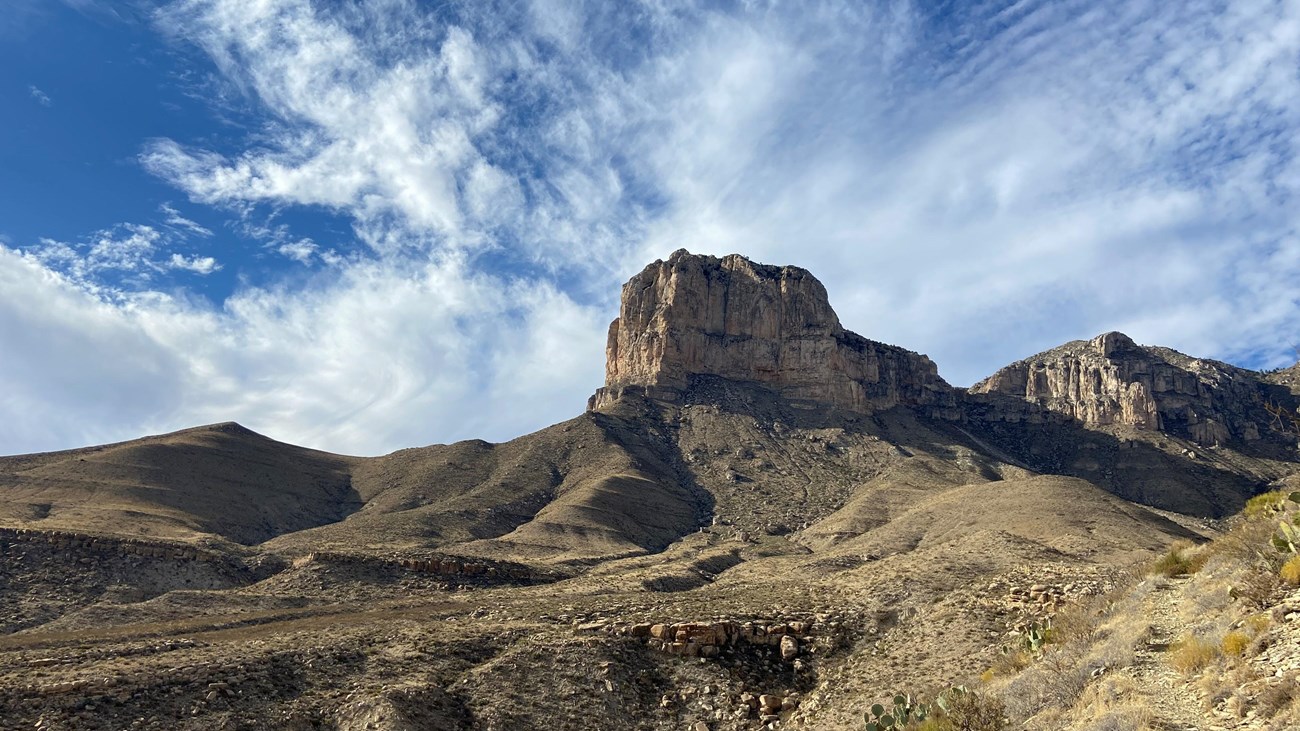
Highway 54 To The Guadalupes
NPS photo
". . . . traversing one of the most desolate yet weirdly beautiful stretches of country to be found in Texas. Far ahead lifts the blunt nose of the Guadalupe Range where it shoves its triangle of lofty peaks across the State Line from New Mexico." ~ From the 1940 WPA Guide to Texas
No roads pass through the heart of Guadalupe Mountains National Park. However, a series of roads lead to, and provide access within the park.
From the south, Texas State Highway 54 leads directly to the Guadalupes from Van Horn, Texas. Running between the Delaware Mountains to the east and Sierra Diablo on the west, the highway provides a dramatic approach to the Guadalupe Mountains, and on a clear day, you can see the mountains ahead of you for forty miles.
Details
Duration
1-2 Hours
Activity
Scenic Driving
A 55-mile scenic drive leading to the park, beginning in Van Horn, Texas.
Pets Allowed
Yes with Restrictions
Pets disturb wildlife and are not allowed on trails. Your pets must remain in your vehicle as opportunities for pets are very limited in the park.
Activity Fee
Yes
While highway 54 has no fee to travel, a park entry fee is required for all adult visitors.
Location
Not a drive-through park
No roads pass through the heart of Guadalupe Mountains National Park. However, a series of roads lead to, and provide access within the park.
U.S. Highway 62/180 provides the primary access to the park, with a number of spur roads leading into the park. From the south, Texas State Highway 54 leads directly to the Guadalupes from Van Horn, Texas. The Dell City Agricultural Loop consisting of FM1437 and 1576 connect to the Williams Road and access to the Salt Basin Dunes. New Mexico State Road 137 and the Dark Canyon Road (CR 408) provide access to Dog Canyon from U.S. Highway 62/180 in New Mexico.
U.S. Highway 62/180 provides the primary access to the park, with a number of spur roads leading into the park. From the south, Texas State Highway 54 leads directly to the Guadalupes from Van Horn, Texas. The Dell City Agricultural Loop consisting of FM1437 and 1576 connect to the Williams Road and access to the Salt Basin Dunes. New Mexico State Road 137 and the Dark Canyon Road (CR 408) provide access to Dog Canyon from U.S. Highway 62/180 in New Mexico.
Reservations
No
Season
Year Round
Conditions on Guadalupe Pass can vary due to seasonal weather conditions and high winds. Use caution.
Time of Day
Day, Dawn, Dusk
Be mindful of wildlife crossing the highway, especially at dawn and dusk.
Accessibility Information
Highway 54 is paved. Pullouts along the highway will have variable conditions, ranging from dirt to accessible facilities.