Last updated: June 21, 2025
Thing to Do
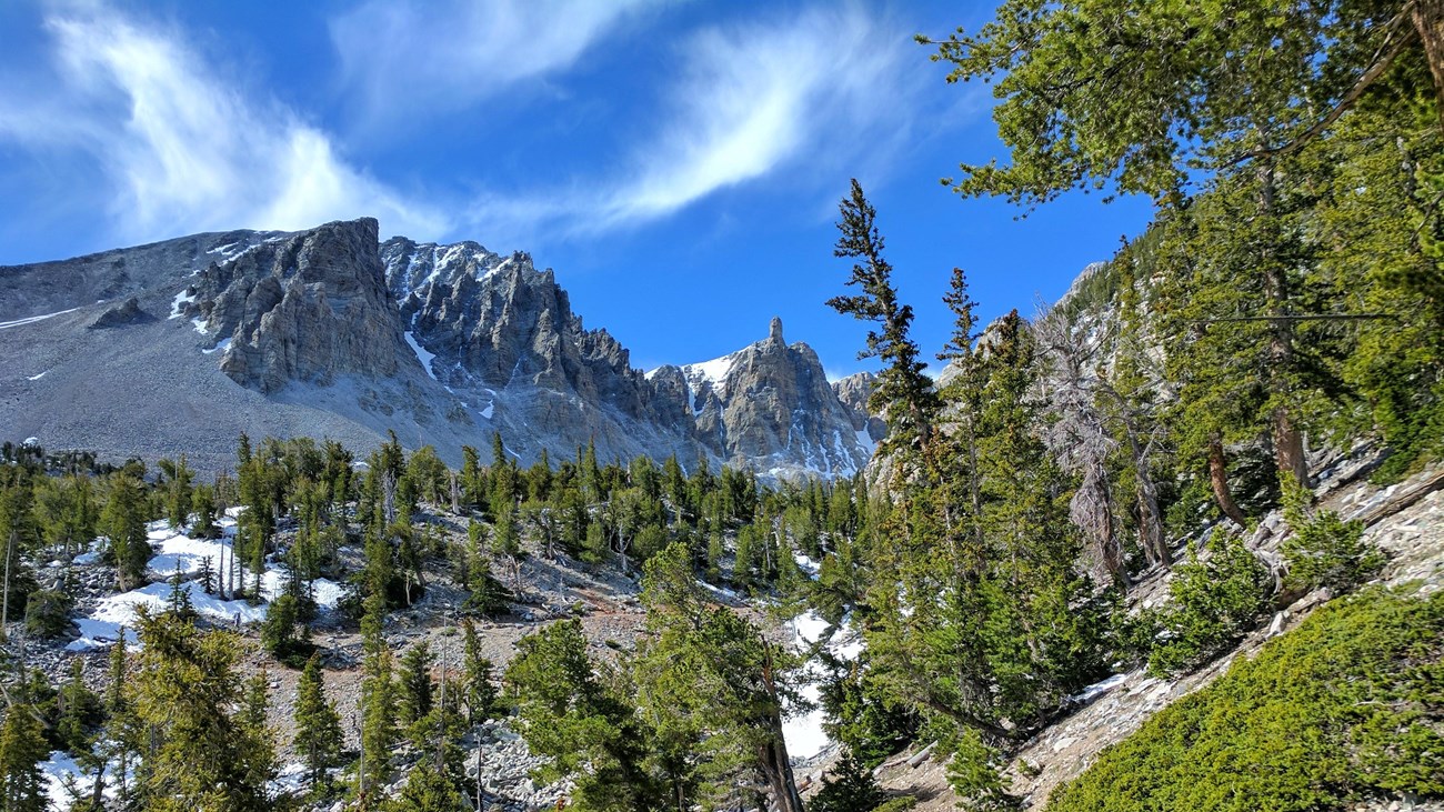
Hike to the Glacier
NPS / B. Mills
Trail Overview
Total Distance: 4.8 miles / 7.7 kilometers
Starting elevation: 9,890 feet / 2,987 meters
Elevation Gain: 1,040 feet / 317 meters
Difficulty: Moderate
Time: 2 hours - 4 hours
Begin at: Bristlecone Trailhead/End of the Scenic Drive
Great Basin National Park is unique for many reasons, but one rare sight in the deserts of the southwest are glaciers. The Wheeler Peak Glacier is the last surviving glacier in Nevada and getting smaller by the year due to the effects of human caused climate change. Nowadays referred to as a "Rock Glacier," The Wheeler Glacier is an amalgamation of rock and ice, slowly drifting down the sides of the Wheeler Cirque, once solid but slowly carved out by glaciers like the surviving one. Follow the trail past the Bristlecone Pine grove to see the glacial remnants and read interpretive signs about this park's long history of glacial formation.
The Bristlecone Trail overlaps the first 1.4 miles of this trail and the total distance above includes the Bristlecone Trail in its calculations. See the trail map below (unavailable on NPS app) for clarification on the overlapping sections.
Beginning at an elevation of just under 10,000 feet, these trails provide both a respite from the summer heat of the Snake Valley, but also added dangers in the form of altitude sickness and afternoon thunderstorms. Be prepared with plenty of water and salty snacks, or to return to your vehicle if you become symptomatic of altitude sickness or see thunderclouds rolling in.
This hike starts at the Bristlecone Trailhead at the end of the Wheeler Peak Scenic Drive. Parking outside of designated spaces or along the road is prohibited.
No pets permitted on park trails. Trained service animals allowed. Learn more about service animal regulations at this link.
Water
Potable water is not available along the Wheeler Peak Scenic Drive. Pack sufficient water with you, about one gallon per person per day. Water is available year-round at the nearby Lehman Caves Visitor Center or seasonally at the dump station.
Restrooms
The nearest restrooms are pit toilets with no running water at the Bristlecone Trailhead.
Details
Duration
2-4 Hours
Activity
Hiking
Pets Allowed
No
Activity Fee
No
Entrance fees may apply, see Fees & Passes information.
Location
Bristlecone Trailhead
Reservations
No
Season
Spring, Summer, Fall
Time of Day
Day, Dawn
Accessibility Information
This trail is not accessible.

NPS
Trail Map
Find the Glacier Trail on the trail map emerging from the end of the Wheeler Peak Scenic Drive. The Wheeler Peak Scenic Drive's entrance is located off Highway 488 leading to the Lehman Caves Visitor Center. The road is paved with an 8% grade. Vehicles longer than 24 feet are not permitted past the Upper Lehman Creek Campground.
Ranger Tip: The glacier is hard to see, and the snowfields lingering throughout much of the year are often mistaken for the last glacier in Nevada. As a rock glacier, the ice is essentially binding many of the rocks to one side of the cirque together, and may be buried under recent rockfall or snow.