Last updated: April 29, 2024
Thing to Do
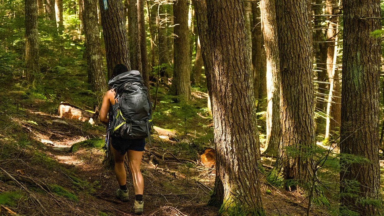
Hike the International Appalachian Trail
NPS / Sarah King
TheInternational Appalachian Trail (IAT) covers approximately 28.9 miles of trail within Katahdin Woods and Waters NM. The IAT follows old logging roads, crosses Wassataquoik Stream, and meanders through dense boreal forest. The IAT is overgrown in various sections with tall grasses, shrubs, and trees. It is recommended to carry a waterproof map with you, especially if you plan to through hike the entire length of the trail. Signage may be difficult to find in some areas and cell reception is very unreliable. There is no potable water-you will need to pack enough water or purify your own water before drinking. Late spring and summer months typically have high concentrations of biting and stinging insects.
Trail Details
The IAT starts at either the North Gate or at Barnard Mountain Trailhead, located in the southern section. Choose your own adventure by starting at either end; hike a little, or hike the whole thing, it is up to you. The following trail details start at the Barnard Mountain Trailhead parking area. Reverse the steps if you are starting from the north section of the monument.
- Park at Barnard Mountain Trailhead, a small dirt and gravel parking area located on the Katahdin Loop Road (GPS coordinate: 45.91512, -68.76034). There are no facilities here. The closest vault toilets are at Katahdin Loop Road Overlook or Deasey Pond Trails.
- Hike north on the IAT following an old logging road for approximately 1 mile and veer right to continue on the IAT. Although the road appears to continue north, follow the sign and veer right to stay on the IAT.
- From that point, continue to hike north/north-east for approximately 2.5 miles until you reach an intersection. Turn right and hike approximately 1 mile east to access the Wassataquoik Ford.
- The Wassataquoik Ford is a river crossing. Safely cross the Wassataquoik Stream to continue on the IAT, or this can also be a good time to turn around. Review the information on stream crossings before visiting.
- After crossing, look for the small rectangular white and blue IAT sign to continue north. From the Wassataquoik Ford, you will travel approximately 24.5 more miles before reaching the North Gate. As you hike, continue to look for the small rectangular white and blue IAT signs (usually found attached to trees). Areas may become very dense with vegetation in this section of the trail with rocky, slippery, muddy, and uneven surfaces. Enjoy the scenic vistas on top of Deasey Mountain and Lunksoos Mountain as you hike towards the North Gate.
- Lunksoos Lean-to is approximately 0.5 miles from Lunksoos Mountain. This is a recommended camping spot when through hiking the IAT. Reserve online and enjoy the beauty of the night sky in an International Dark Sky Sanctuary.
- From Lunksoos Lean-to it is important to pay close attention to the trail and map due to areas with old logging roads and dense brush. Continue to follow the small rectangular white and blue signs to make sure you are on the IAT.
- Once you get to the intersection of the IAT and Telos Tote Trail, turn left to stay on the IAT. Hike north along the East Branch of the Penobscot River to the North Gate. There are some smaller stream crossings ahead and areas of deep mud. You will reach a suspension bridge, after approximately 3.4 miles from the IAT/Telos Tote Trail intersection. Continue north to stay on the IAT. (Note: private property across the bridge.)
- From this point on, continue to hike north on the IAT. You will pass Haskell Gate and continue onto New River Road. Proceed with caution, since New River Road is a gravel road shared with motor vehicles. The monument segment of the IAT ends at the North Gate parking area where you can find a vault toilet. If you plan to continue past the monument to follow the IAT/SIA outside of Katahdin Woods and Waters, please contact the Maine Chapter of the IAT.
Camping
Camping is only allowed in designated campsites. Walk-ups are welcomed, but reservations through recreation.gov are encouraged. Most sites have a pit toilet available. The following are recommended sites along the IAT:
- Katahdin Brook Lean-to
- Wassataquoik Lean-to or Wassataquoik Campsite
- Lunksoos Lean-to
- Grand Pitch Lean-to
- Pond Pitch Campsite
- Haskell Deadwater Campsite
- Stair Falls Campsite
Details
Duration
2-3 Days
Activity
Hiking
Pets Allowed
Yes with Restrictions
Pets must be on a 6ft leash at all times.
Activity Fee
No
Entrance fees may apply, see Fees & Passes information.
Location
Barnard Mountain Trailhead
Hikers can start at Barnard Mountain Trailhead or at the North Gate.
Reservations
No
Season
Spring, Summer, Fall
Accessibility Information
This trail is uneven with gravel and rocky surfaces. The IAT crosses the Wassataquoik Stream and some smaller stream crossings. Sections of trail become quite narrow and are very overgrown and dense with vegetation. Be aware of areas of deep mud and exposed roots. New River Road is shared with motor vehicle traffic.