Last updated: January 30, 2025
Thing to Do
Hike to Miller Point
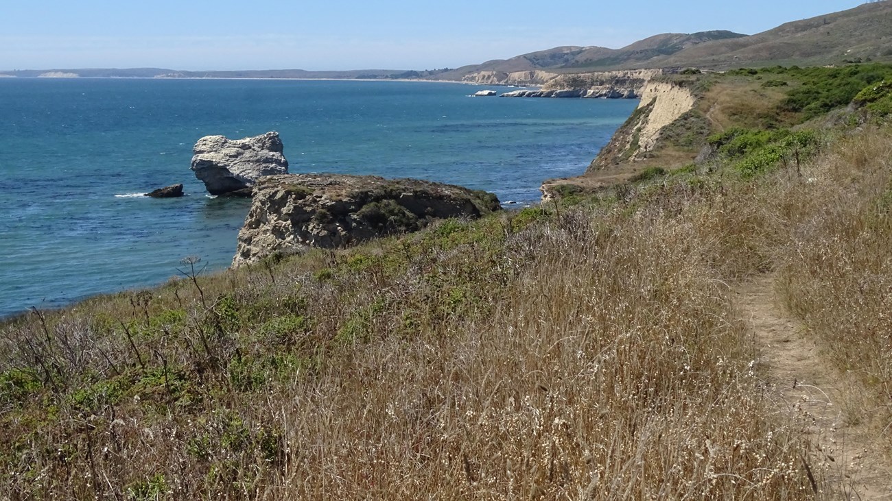
NPS Photo
Distance: 9 miles (15.4 km) roundtrip, moderate
Miller Point is a small headland deep within the Phillip Burton Wilderness in the central part of the national seashore. From Miller Point, one can look northwest past the site of Arch Rock (which collapsed in 2015) to Drakes Bay, Limantour Beach, and the Point Reyes Headlands. Climb the Coast Trail uphill from Miller Point to view numerous sea stacks and Wildcat Beach stretching to the south. There are no safe beach access routes within 4 miles (6.4 km) of Miller Point.
The closest place to park is the Bear Valley Trailhead. Follow the Bear Valley Trail south for 1.6 miles (2.6 km) through a Douglas fir forest along Bear Valley Creek to Divide Meadow. Vault toilets are located at Divide Meadow—there are no other facilities beyond Divide Meadow, so please be sure to use the toilets before proceeding further.
Beyond Divide Meadow, the Bear Valley Trail re-enters the forest and begins to parallel Coast Creek as it flows downhill toward the coast. After another 1.5 miles (2.4 km), the Bear Valley Trail intersects with the Glen Trail and the Baldy Trail. If you are riding a bicycle, you will need to dismount and lock your bicycle to the bike rack at this junction. Beyond this junction, the Bear Valley Trail enters the Phillip Burton Wilderness and bicycles (and other wheeled devices, like strollers) are prohibited in Wilderness.
Continue on the Bear Valley Trail for 0.9 miles (1.5 km) to its junction with the Coast Trail, which is 4.1 miles (6.5 km) from the Bear Valley Trailhead. Bear left onto the Coast Trail and follow it south for 0.4 miles (0.6 km) to where the Coast Trail turns sharply left and starts heading steeply uphill. Many hikers turn around here, but feel free to continue uphill and further southeast along the Coast Trail for views of Wildcat Beach to the south and to connect to the Glen Trail or Stewart Trail for a longer "lollipop" hike back to Bear Valley.
Please stay on the official, maintained trail; do not leave it to get close to the unstable bluff top. Unfortunately, many hikers have trampled and killed the vegetation in a number of locations in this area to get views of the collapsed arch rock.
Retrace your steps to return to the Bear Valley Trailhead.
This route description alone is not a substitute for a trail map. Print out the Point Reyes National Seashore's South District trail map (3,422 KB PDF) before your visit, or pick one up at the Bear Valley Visitor Center on your way.
Always check current conditions before heading out into the park and familiarize yourself with park regulations. Please practice Leave No Trace principles.
Visit the park's Hiking at Point Reyes National Seashore page for hiking tips and information about trail etiquette and safety.
Visit the park's Trail Advisories and Closures page for current information about closed trails, trails blocked by trees, or other temporary hazards or advisories.
Details
Duration
4-6 Hours
Allow 4 to 5 hours to hike to and from Miller Point.
Activity
Hiking
Age(s)
All ages.
Pets Allowed
No
Pets are prohibited at Miller Point and along all of the trails that lead to Miller Point. Visit the park's Pets page to learn more about where pets are welcome at Point Reyes National Seashore.
Activity Fee
No
Entrance fees may apply, see Fees & Passes information.
Location
Miller Point is located within the Phillip Burton Wilderness, Point Reyes National Seashore
Miller Point is a small headland deep within the Phillip Burton Wilderness in the central part of Point Reyes National Seashore. The closest place to park is the Bear Valley Trailhead.
Directions to Bear Valley
Reservations
No
Season
Winter
The heaviest rainfall occurs in the winter months. Come prepared for rain and drizzle to possibly last for several days. In between winter rains, it is often sunny, calm, and cool.
Spring
Most spring days are windy and this area frequently experiences fresh to strong breezes. Expect cool temperatures in March. By late May and early June, temperatures can be quite pleasant, even warm.
Summer
Although there is very little rain during summer months, there is often dense fog throughout the day in July, August and September with temperatures often 20 degrees cooler than at Bear Valley.
Fall
The coastal areas of Point Reyes experience some of the clearest days in late September, October and early November. The occasional storm will start rolling through in late October, bringing clouds, wind, and rain. The strongest winds occur in November and December during occasional southerly gales.
Time of Day
Day, Dawn, Dusk
Point Reyes National Seashore is open for day-hiking from 6 am to midnight. Camping and overnight parking is only permitted with a valid camping permit.
Accessibility Information
The Bear Valley trail has a flat or mild grade (less than 5% slope) for most of its duration, although there are a couple sections with grades of more than 5%. The trail surface is packed dirt and gravel, and is approximately 8 feet (2.4 meters) wide, depending on the section. The trail serves as a service road for NPS vehicles. The steeper sections and a few somewhat rocky sections are passable for those in wheelchairs with assistance. While the trail does not technically meet accessibility standards, it can accommodate some wheelchairs. Strollers and bicycles are also permitted on the Bear Valley Trail from the trailhead to the Glen Trail Junction. The vault toilets at Divide Meadow do not meet accessibility standards. After the first 3 miles (5 km) the trail narrows, and the surface becomes more inconsistent and uneven.