Last updated: October 7, 2022
Thing to Do
Kid-Friendly Hikes at Mount Rainier
NPS photo, by Emily Brouwer
Remember to stay on the maintained trail and do not pick any flowers no matter how pretty they might be! Check trail conditions before heading out on your hike, as some of these trails are under snow for a good section of the year.
Longmire Area
Twin Firs Trail: 0.4 miles/0.6 km loop trail. Average hiking time: 20 min. Discover some old growth trees as you walk along this trail. Trail begins about 4 miles after the Nisqually Entrance.
Trail of Shadows: 0.7 miles/1.1 km loop trail. Average hiking time: 30 min. Enjoy exploring some of the early history of the Longmire Springs Resort as well as viewing the Longmire Meadow. Tail begins across the main park road from the Longmire Museum.
Paradise Area
Myrtle Falls: 1 mile/1.6 km round trip, 100 feet elevation gain. Average hiking time: 35 min. Hike out to see a waterfall with a view of Mount Rainier behind it if clouds are not blocking the view. The trailhead is located on the north side of the upper parking lot, next to the visitor center.
Nisqually Vista: 1.2 miles/2 km round-trip, 200 feet elevation gain. Average hiking time: 45 min. Explore views of the Nisqually glacier. Trailhead is located at the northwest end of the lower parking lot.
Ohanapecosh area
Silver Falls - Please note: Fatalities have occurred near the falls. For your safety, stay behind the fences and on the trails at all times! Silver Falls can be accessed from three trailheads:
-
From Ohanapecosh Campground: 2.7 mile/ 4.3 km loop, 300 feet elevation gain. Average hiking time: 90 min. Enjoy views of a forest on your way to see a waterfall. This loop starts from the “B” loop of the Ohanapecosh Campground. At the falls, cross the bridge and follow the signs back to the campground.
-
From Stevens Canyon: 1 mile/1.6 km round-trip, 300 feet elevation change. Average hiking time: 45 min. Trailhead is located just northwest of the Stevens Canyon Entrance Station (across the road from the trailhead for Grove of the Patriarchs).
-
From SR123: 0.6 mile/0.96 km round-trip, 300 feet elevation change. Average hiking time: 45 min. Drive 1.6 miles north from the Ohanapecosh Campground on State Route 123. Park at the pullout on the west side of the road. Hike 0.3 mile down the steep trail to the junction with the loop trail, turn right at the junction, and continue 75 yards to the falls.
Sunrise Area
Tipsoo Lake: 0.5 mile/ 0.8 km round-trip. Average hiking time: 20 min. As you hike around the lake, enjoy views of Tipsoo Lake as well as views of Mount Rainier if it is clear and wildflowers if they are in bloom. Tipsoo Lake is off limits for fishing and wading/swimming as it is protected amphibian habitat. Did you see any amphibians on your hike? This popular area also has sensitive riparian vegetation. Please stay on the trails! Trail starts at the Tipsoo Lake trailhead, located off SR410 by Chinook Pass.
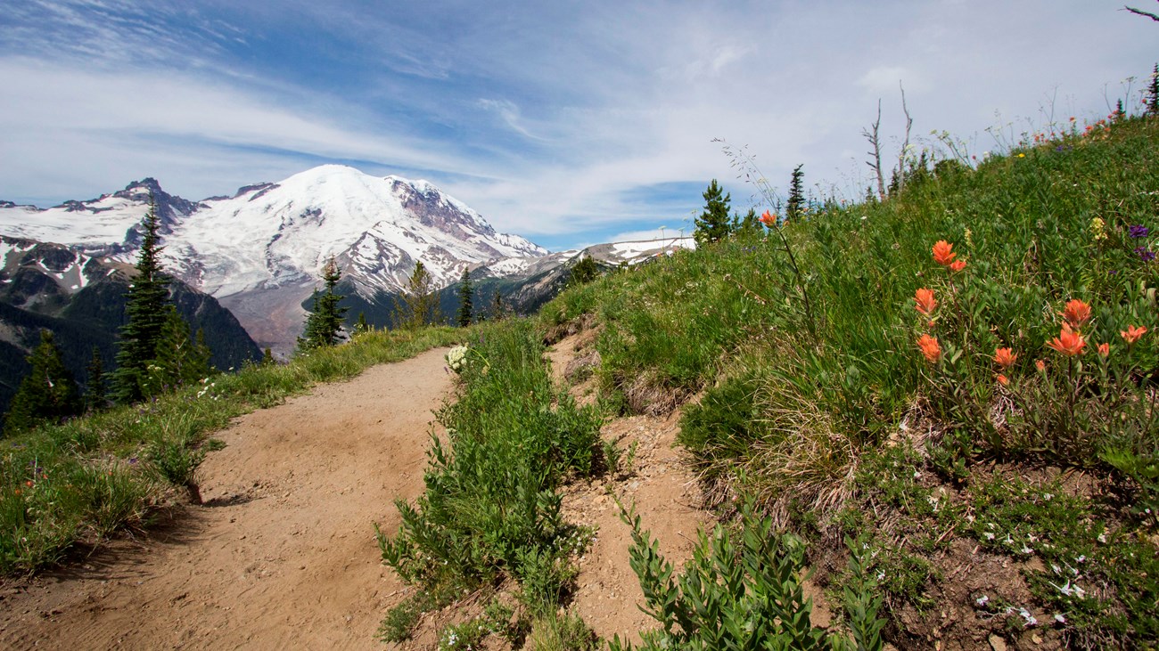
Silver Forest Trail: 2 miles/3.2 km round-trip, 150 feet elevation gain. Average hiking time 45 min. Enjoy views of Mount Rainier, Emmons Glacier, White River Valley, and wildflower meadows as you hike along this trail. Trail starts on the south side of the Sunrise parking lot, follow the Sunrise Rim Trail, then when the trail splits stay to the left towards Emmons Vista and Silver Forest. There are two Emmons Vista Viewpoints at the beginning of the Silver Forest Trail, make sure to check those out!
Emmons Vista Overlooks: 1 mile/1.6 km round-trip. Average hiking time 30 min. Enjoys views of Mount Rainier, the Emmons Glacier, and the White River Valley from these two viewpoints. Both viewpoints offer interpretive signs. Trail starts on the south side of the Sunrise parking lot, follow the Sunrise Rim Trail, then when the trail splits stay to the left towards Emmons Vista and Silver Forest. The two viewpoints are at the very beginning of the Silver Forest Trail.
Carbon River Area
Carbon River Rain Forest Loop: 0.25 mile/0.4 km loop trail. Discover nurse logs and other rainforest characteristics along the self-guided loop trail. Trail located by the Carbon River Entrance.
Details
Duration
20-90 Minutes
Hikes will range in average hiking time from 20 min to 90 min. However, some hikes may take longer or shorter depending on how fast the group hikes and how many breaks are taken for pictures, rest, etc. Driving time between the different hikes may vary depending on road work.
Activity
Hiking
Kid-friendly day hiking options are available in the developed areas of the park.
Age(s)
Suitable for all ages.
Pets Allowed
No
No, pets are not allowed on trails. Service Animals are allowed.
Activity Fee
Yes
Park entrance fee required. No fees for the activity.
Location
Parkwide
There are kid-friendly hikes in all areas of the park. See main text for recommendations and details.
Reservations
No
No reservations are needed.
Season
Summer
Some of the trails listed are in areas that receive large amounts of snow that lingers into July. Check in at a visitor center to learn what trails are snow free and more accessible.
Time of Day
Day, Dawn, Dusk
Most trails are best to do dawn, day, dusk. Trails at Sunrise provide opportunities to see stars at night if interested, just make sure to have a light source and back up light source to be able to see to stay on trail.
Accessibility Information
Trails in the park are typically dirt and broken up by rock or log steps and often have some form of elevation gain. Myrtle falls trail is paved and suitable for wheelchairs with help and strollers. The two Emmons Vista overlooks each have a wayside sign. Approximately half of the un-paved Trail of the Shadows (roughly 0.3 miles) is wheelchair accessible, though the trail can be covered in deep snow in winter. Many roads in the park close to vehicles during the winter.