Last updated: March 30, 2021
Thing to Do
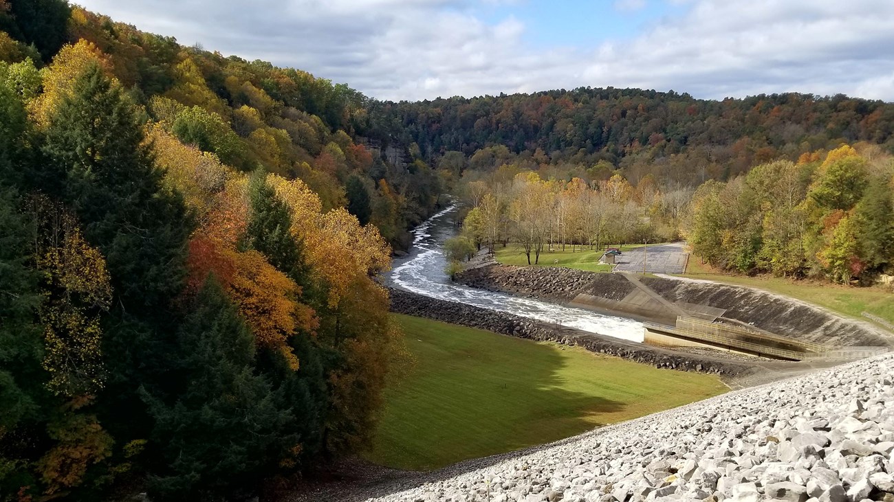
Nolin River Dam to Houchin Ferry
Trip Distance: 11.1 miles (17.8 km)
Approximate Travel Time: 4 to 6 hours
This trip starts at the Tailwater Recreation Area below the Nolin River Dam north of the park. The trip will take paddlers below tall cliffs and steep river banks. Paddlers will continue down the Nolin River approximately 7.5 miles (12 km) to the confluence with the Green River. Once at the confluence with the Green River, turn left onto the Green River and paddle upstream 1.7 miles (2.7 km) to Houchin Ferry.
An alternate take out spot is the former site of Lock and Dam #6 or the boat ramp in the town on Brownsville, 3.2 miles (5.1 km) downstream from the confluence of the Nolin and Green Rivers.
The Nolin River is a dynamic river system with a narrow river channel that changes each year. Use caution while recreating on the rivers and steer clear of downed trees and logjams.
About the Nolin River
7.5 miles (12 km) of the Nolin River span from the Tailwater Recreation Area, part of the US Army Corps of Engineers Nolin River Lake and Dam Area, to the confluence with the Green River in the park.
In 2016 there was a failure of Lock and Dam No. 6 on the Green River, downstream of the confluence with the Nolin River, and the dam was ultimately removed. The removal of the dam has resulted in lower water levels and swifter river currents. Water levels can change rapidly due to weather (i.e. rise 20-50 feet in the hours and days after a rain event) or due to water release schedules from the Nolin River Dam. Serious hazards such as fallen or submerged trees and rocks, drifting debris and swift currents can exist. Paddlers on the river should be familiar with operating paddle craft on moving water as part of a dynamic river system.
About the Green River
The Green River is one of the most biodiverse rivers in the country. It is home to more than 150 fish species, more than 70 species of mussel including many threatened or endangered species. The river spans 25 miles (40.2 km) through the park and is dotted with sandbars, islands, and subsurface springs. The river averages 200 feet ( 61 m) wide and 10 feet (3 m) deep, though its depth may be much greater in places.
While considered a flat-water river, the current can still be very swift and prior paddling experience is recommended. Regardless of water level, always be alert to hazards such as submerged trees and rocks, drifting debris, and the park's ferry.
Details
Duration
4-6 Hours
Trip Distance: 11.1 miles (17.8 km)
Approximate Travel Time: 4 to 6 hours
Activity
Paddling
Pets Allowed
Yes
Owners must keep pets on leashes no longer than 6 feet and clean up after their pets.
Activity Fee
No
Entrance fees may apply, see Fees & Passes information.
Location
Tailwater Recreation Area
Tailwater Recreation Area below the Nolin River Dam is located north of the park and is managed by the US Army Corps of Engineers.
Reservations
No
Season
Summer
Time of Day
Day
Accessibility Information
River paddling is accessible with the proper adaptive paddling gear provided by the participant.
River most access points in the park include steep ramps or stairs that can often be covered in mud.