Last updated: May 14, 2024
Thing to Do
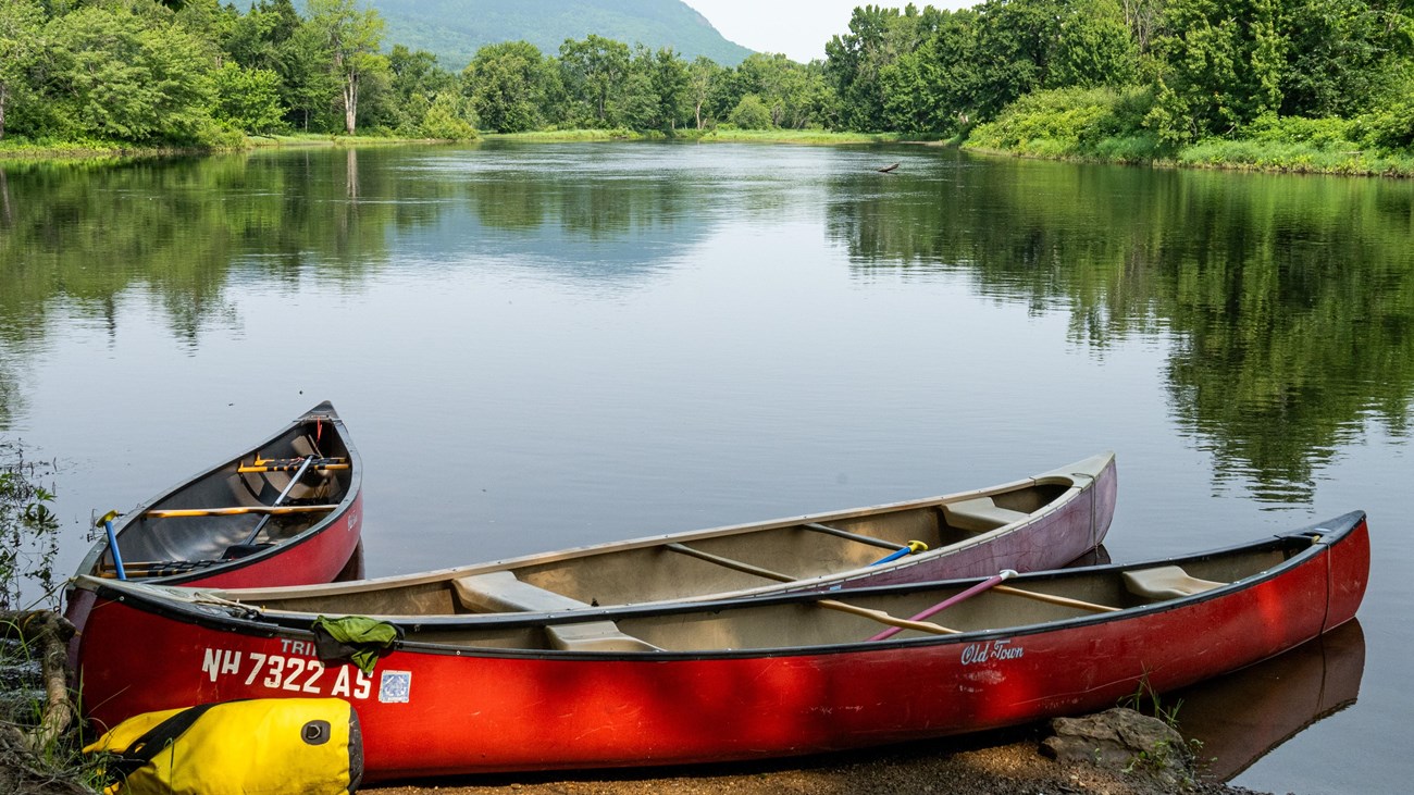
Paddle the East Branch of the Penobscot River (From Lunksoos Boat Launch to Big Seboeis)
NPS / Gin Majka
Katahdin Woods and Waters National Monument is at the center of connecting watersheds, which provided important travel routes for the Wabanaki peoples of Maine. Experience spectacular views from a different perspective by paddling a beautiful stretch of river from the Lunksoos Boat Launch to the Big Seboeis Campsite. River travel is typically done by canoe (there are no rental services at the monument).
You will begin this trip by paddling 2.25 miles upriver. There are no rapids on this stretch of river, but be aware that seasonal changes, as well as recent weather events can change the river’s flow rate and make paddling upriver a challenge. Always wear a personal floatation device (PFD). View “Seasonal Description” for more information about paddling during the river’s different flow rates.
After 2.25 miles traveling up river, look for a brown sign saying “Big Seboeis Campsite”. The Big Seboeis Campsite is on the west bank of the river and is visible from the water. This is a great spot to take a break on land and enjoy the scenery. The boat landing at the Big Seboeis Campsite is unpaved, steep, and can often be slippery so use caution when entering and exiting your boat. Keep an eye out for wildlife; the East Branch of the Penobscot River is an excellent location to look for wildlife including the endangered Atlantic Salmon!
*Be prepared for the journey out to Big Seboeis to last longer than the return journey down river. Refer to "duration description" for more information. In general, plan for the paddle upriver to last about twice as long as the trip downriver. Remember to stay hydrated!
Details
Duration
3-5 Hours
At high water levels plan for upwards of 2 hours to paddle up river and a half hour to paddle down river. At low water levels, plan for an hour to paddle up river and 45 minutes to paddle down river. All of these estimates are dependent on CFS and the experience of the paddlers.
Activity
Paddling
Start trip: Lunksoos Boat Launch
Stop: Big Seboeis Campsite
End trip: Lunksoos Boat Launch
Stop: Big Seboeis Campsite
End trip: Lunksoos Boat Launch
Age(s)
When boating, always wear a PFD! A helmet is recommended when paddling through the rapids.
Pets Allowed
Yes
Pets must be on a 6ft leash or shorter.
Activity Fee
No
Paddlers must prepare their own equipment and transportation for this activity.
Location
Lunksoos Boat Launch
Begin at: 45.908400674743035, -68.61495532985383
Big Seboeis Campsite: 45.9321301496862, -68.63575504874817
Big Seboeis Campsite: 45.9321301496862, -68.63575504874817
Enter the National Monument via Swift Brook Road from Route 11. All roads in the National Monument are unpaved and high clearance vehicles are recommended. Please drive with caution and abide by the speed limits. Be alert for cyclists, hikers, and wildlife. After 5 miles on Swift Brook Road, take a right at the fork onto Seboeis Road. Follow the Seboeis Road for 2 miles until you arrive at the Lunksoos Campground.
The boat launch to the East Branch of the Penobscot River will be on your left, and the campground will be on your right. Please use the boat launch turn around to unload your supplies before parallel parking your vehicle along the road by the campsites. Parking permits are not required to leave a vehicle at the Lunksoos parking area.
Reservations
No
Season
Spring, Summer, Fall
The flow of East Branch of the Penobscot River varies substantially throughout the year. For up to date information about water levels in the river please visit: East Branch Penobscot River at Grindstone, Maine - USGS Water Data for the Nation. Flow rates from the Matagamon Dam can be found from a USGS real-time streamgage.
- At levels less than 250 CFS paddling is not recommended.
- 550-950 CFS is excellent flow rate for paddling.
- At Levels above 3000 CFS, paddling is dangerous. Be aware that there may be rapids with large, breaking diagonal waves where there is normally none.
- Paddling upriver may not be possible at CFS levels above 3000 CFS.
Time of Day
Day
Be aware of the local sunset time! Make sure to calculate enough time for the round trip paddle. Allow for plenty of time before the sun sets.
Accessibility Information
Both the landing at Lunksoos Boat Launch and at Big Seboeis Campsite are unpaved. There are no services available at these areas. The landings are both a mixture of dirt and gravel that slope down into the water. The ground may be slick and/or uneven. The inclines of both boat launch landings may exceed accessibility standards for wheelchair use. There is an accessible restroom at the Lunksoos Boat Launch.