Last updated: October 7, 2022
Thing to Do
See the Rio Grande
NPS
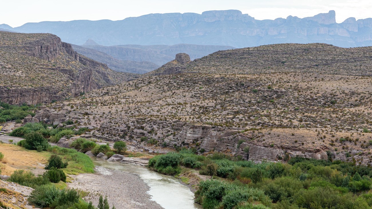
For over 100 miles, the Rio Grande serves as the southern boundary of Big Bend National Park and the international border with Mexico. The river is vital for the survival of the plants, animals, and human inhabitants of the Chihuahuan Desert.
The river and its tributaries are set in one of the most dramatic and storied landscapes in the West—from stunning narrow and deep canyons, dense riparian vegetation, and striking cliffs to long and unobstructed views. Open stretches of desert give way to vault-like canyons that carry travelers along the free-flowing Rio Grande Wild and Scenic River.
A highlight of any trip to Big Bend is to spend time along the banks of the Rio Grande. A number of short trails provide excellent views and access to our watery border with Mexico. Grand vistas of canyons and wide desert panoramas fill your view while the sounds and smells of water in the desert tantalize your senses.
Many visitors choose to enjoy the river as a float trip, either with their own gear, or through the help of local outfitters. Trips vary from easy day floats to challenging multi-day expeditions.
Details
Activity
Hiking
Popular trails that offer river access include:
Boquillas Canyon
|
Difficulty:Moderate; Distance: 1.4 miles round trip The Boquillas Canyon trail climbs from the parking to the top of a cliff overlooking the Rio Grande. On this bluff, mortar holes from ancient inhabitants can be seen. Continue down to the river's edge and into the canyon until the canyon walls meet the river. Sandy slopes in the canyon are fun for children.
|
|
Rio Grande Village Nature TrailDifficulty: Easy; Distance: 0.75 mile loop Although short and easy, the trail is very scenic and has fantastic opportunities for wildlife viewing, especially birds. The first 100 yards is wheelchair accessible and crosses a boardwalk through a spring-fed wetland. Then the trail gradually climbs a limestone hill with panoramic vistas of the Rio Grande, and the Chisos and Del Carmen Mountains. This trail is great for sunsets. |
Santa Elena Canyon TrailDifficulty: Moderate; Distance: 1.7 miles round trip This trail leads into the mouth of stunning Santa Elena Canyon. After crossing Terlingua Creek, the trail ascends on paved steps to a vista, then descends back to the water's edge, continuing into the canyon until the canyon walls meet the water. A Big Bend classic. Be prepared for mud. Trail is impassable when Terlingua Creek floods. |
Pets Allowed
No
Activity Fee
No
National Park Entrance Fee required
Reservations
No
Season
Year Round
Accessibility Information
The following locations within Big Bend National Park provide fairly easy access to the banks of the Rio Grande by visiting a roadside overlook or taking a short walk.
Santa Elena Canyon Trail
Santa Elena Canyon River Takeout
Hot Springs Trail
Boquillas Canyon Trail
Boquillas Overlook
Rio Grande Village River Takeout
Daniels Ranch Picnic Area
Santa Elena Canyon Trail
Santa Elena Canyon River Takeout
Hot Springs Trail
Boquillas Canyon Trail
Boquillas Overlook
Rio Grande Village River Takeout
Daniels Ranch Picnic Area