Last updated: October 10, 2024
Thing to Do
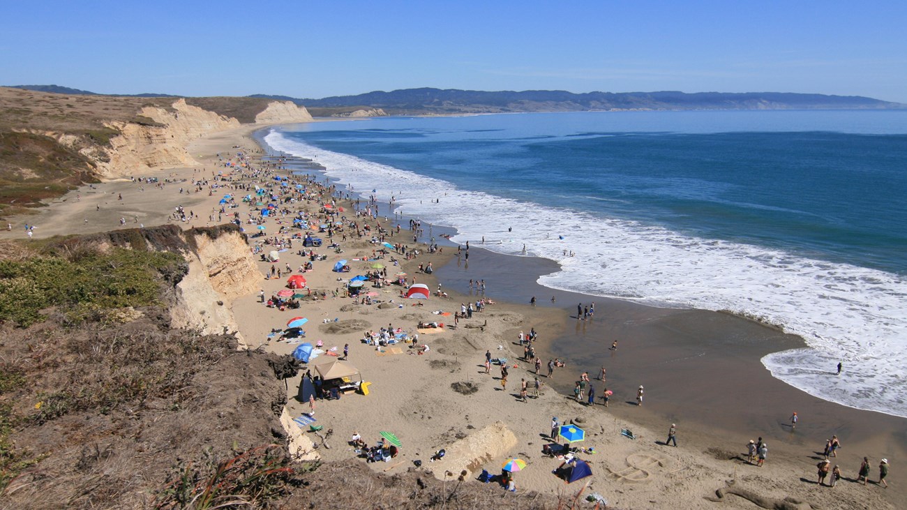
Swimming at Point Reyes
NPS / A. Kopshever
What comes to mind when you think about the beach? Surf, sand, sun, and swimming are a few associations...however, swimming is not recommended at most of the beaches in Point Reyes!!! The pounding surf, rip currents, and severe undertow are treacherous, especially at McClures Beach, Kehoe Beach, and Point Reyes Beaches North and South. Visit our Beach Safety page to learn more.
While getting close to the water's edge—much less swimming—is strongly discouraged at the beaches listed above, there are a few beaches along the more sheltered Drakes Bay and the even more protected Tomales Bay at which it is relatively safe to swim. Be aware that there are no lifeguards at any of these beaches and one swims at one's own risk.
Swimming in Drakes Bay
Limantour and Drakes Beach provide the easiest beaches to reach and relatively safe places at which to swim—so long as there are no beach hazard statements or high surf advisories or warnings in effect. Be forewarned: the ocean temperatures tend to range from 50°F to 60°F (10–16°C) year-round.
Swimming in Tomales Bay
The water is shallower, warmer, and safer in Tomales Bay. Several beaches maintained by California State Parks and Marin County Parks offer swimming opportunities.
Tomales Bay State Park
This day-use park (fee required) features multiple gently sloping, surf-free beaches, protected from winds by Inverness Ridge, the backbone of the Point Reyes Peninsula. Tomales Bay State Park is composed of 3 distinct use areas:
- Heart's Desire - The Heart's Desire area is the heart of Tomales Bay State Park. Here you will find the park's Ranger Station, Heart's Desire Beach, the Vista Point Picnic Area, and hiking trails to Indian Beach, Pebble Beach, and Shell Beach. Dogs are not permitted on any beaches or trails in this area.
- Shell Beach - Shell Beach offers two small beaches with access to the Johnstone trail which connects to Heart's Desire. The beaches are only accessible by hiking trail from the parking lot and spaces in the lot are very limited. Dogs are not permitted on any beaches or trails in this area.
- Millerton Point - Millerton Point sits on the inland side of the bay and features Alan Sieroty Beach along with a loop trail. Dogs are not permitted on the beach, but are allowed on the loop trail while on leash.
Chicken Ranch Beach
Chicken Ranch Beach is a Marin County park that offers calm waters that warm up in the summer. Friendly dogs on leash are welcome. County rangers recommend swimming, picnicking, and kayaking on this beach.
Details
Activity
Swimming
Age(s)
All ages.
Pets Allowed
Yes with Restrictions
Pets are permitted on a six-foot-long or shorter leash on Limantour Beach from the Limantour Beach access trail (e.g., the path from the main parking lot) southeast (e.g., to the left if you are facing Drakes Bay) to where rock outcrops begin to rise above the sand south of Coast Campground.
Dogs are prohibited at Drakes Beach and at all of Tomales Bay State Park's beaches.
Friendly dogs on leash are welcome at Chicken Ranch Beach.
Visit the park's Pets page to learn more about where pets are welcome at Point Reyes National Seashore.
Activity Fee
Yes
Fees are collected at Tomales Bay State Park. There is an $8 per vehicle entrance fee ($7 for anyone 62 or over) required for parking at Heart’s Desire Beach and Vista Point. Payment is accepted by credit/debit card only. Self registration is required.
Day-use fees are not collected at Point Reyes National Seashore or Chicken Ranch Beach.
Location
Various beaches on the Point Reyes peninsula, California.
Point Reyes National Seashore Beaches
- Limantour
Location: southwestern end of Limantour Road, Point Reyes Station, CA.
Geographic Coordinates: 38.0288, -122.8822 - Drakes Beach
Location: south end of Drakes Beach Road, Inverness, CA.
Geographic Coordinates: 38.0279, -122.9619
Tomales Bay State Park beaches
- Heart's Desire Beach
Location: 1100 Pierce Point Road, Inverness, CA.
Geographic Coordinates: 38.1320, -122.8936 - Shell Beach
Location: 0.2 miles (0.3 km) northwest of the small parking lot at the north end of Camino Del Mar, Inverness, CA.
Geographic Coordinates: 38.1173, -122.8746 - Alan Sieroty Beach at Millerton Point
Location: 15475 Hightway 1, Point Reyes Station, CA.
Geographic Coordinates: 38.1069, -122.8483
Chicken Ranch Beach
Location: 13000 Sir Francis Drake Boulevard, Inverness, CA.
Geographic Coordinates: 38.1094, -122.8654
Reservations
No
Season
Spring, Summer, Fall
Spring
Most spring days are windy and this area frequently experiences fresh to strong breezes. Expect cool temperatures in March. By late May and early June, temperatures can be quite pleasant, even warm.
Summer
Although there is very little rain during summer months, there is often dense fog throughout the day in July, August and September with temperatures at ocean-facing beaches often in the 60°s F (16–21°C).
Fall
The coastal areas of Point Reyes experience some of the clearest days in late September, October and early November. The occasional storm will start rolling through in late October, bringing clouds, wind, and rain. The strongest winds occur in November and December during occasional southerly gales.
Winter
The heaviest rainfall occurs in the winter months. Come prepared for rain and drizzle to possibly last for several days. In between winter rains, it is often sunny, calm, and cool.
Time of Day
Day
Point Reyes National Seashore is open for day use from 6 am to midnight.
Tomales Bay State Park is open from 8 am to sunset.
Chicken Ranch Beach is open from sunrise to sunset.
Accessibility Information
Limantour Beach
A flat, wide paved beach access path leads south from the accessible parking spaces for 270 feet (82 meters) to a wide footbridge with a wooden surface. Beyond the footbridge to a junction with Limantour Spit Trail, the trail is covered in sand, progressively getting deeper the closer one gets to the beach. Beyond the junction, one will need to climb up and over a small sand dune and then traverse dozens of yards/meters to reach the water's edge. There are two designated accessible parking spaces. There are six vault toilets adjacent to the accessible parking spaces, which in and of themselves were designed to be accessible, but the surface between the parking spaces and the vault toilets is unpaved soil that gets muddy when wet, and, therefore, is not smooth.
Drakes Beach
The parking lot at Drakes Beach is immediately adjacent to the beach, but there are no routes onto the beach that would qualify as accessible. There are a number of short sandy paths ranging in length from a few yards (meters) to close to 50 yards (45 meters) leading from the paved sidewalk to the sandy section of the beach. Most paths tend to be narrow, rutted, lined with ice plant, and may be strewn with driftwood. The shortest route to the sandy beach is free of most of these obstacles, but has a slope that far exceeds 5%. Accessible toilets are available in the restrooms adjacent to the Kenneth C. Patrick Visitor Center.
Heart's Desire
Heart's Desire Beach has three accessible parking spaces. A paved path leads 100 feet (30 meters) toward the beach. Depending on the level of the tide, the water's edge is another 70 feet (21 meters) or more beyond the end of the paved path across sand. The restrooms are accessible, although the asphalt path leading to restrooms does not fully meet accessibility standards. Along the paved path from the parking lot to the beach is a paved picnic area with three picnic tables, a bench, and two charcoal grills (as of April 2022).
Shell Beach
There are no accessible facilities at Shell Beach. Shell Beach is 0.3 miles (0.5 kilometers) via a an earthen trail from the small paved parking lot at the north end of Camino del Mar.
Alan Sieroty Beach at Millerton Point
The parking lot at Millerton Point is largely composed of gravel, but there is a paved accessible parking spot adjacent to an accessible vault toilet building. Otherwise, there are no accessible facilities at Millerton Point. Paths to the beach are earthen and vary in width and grade.
Chicken Ranch Beach
There are no accessible facilities at Chicken Ranch Beach. The parking area is a wide section of roadside shoulder that is mostly composed of gravel. A steep, narrow, earthen path leads down from the road, crosses a foot bridge, and arrives at a sandy section of beach after about 50 yards (45 meters). At lower tides, there may be a fair distance of muddy sand (or just mud) to cross to get to the water's edge.