What is Yukon-Charley Rivers?

Visit our keyboard shortcuts docs for details
Duration:
15 minutes, 52 seconds

"Freedom... it's very difficult to explain the feeling when you are here. You have to come and see and live here to know of the real feeling of when you are here." -Eric Petitalot, upriver kayaker A journey on these rivers passes through an ancient landscape. Here, the shallow crystal clear waters of the Charley meet the mighty silt laden Yukon. Stunning cliffs and rock formations rise above the river basins, home to the Han Athabascan people. Aspiring miners came here in the 1898 Gold Rush, leaving behind ghost towns and dreams. Peregrine falcons nest in the high bluffs overlooking the rivers. Visitors float the rivers for the solitude and for glimpses of historic sites left after the gold rush era.

View the Audio-Described Version of the Video

 
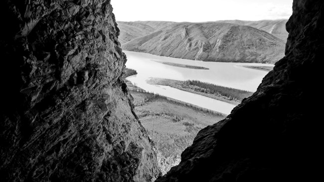
View of the Yukon River from the entrance of a cave high on a bluff

NPS/Josh Spice

Deep in Interior Alaska, the great Yukon River strikes through bluffs and mountains of an ancient landscape to unmask rocks whose histories reach back a billion years to life's beginnings on Earth.

Axis of the region, the silt-laden Yukon here flows constricted and swift through a great geologic fault. Side-streams tumble from the hinterlands - further passageways long inviting human traffic. Chief among these crystal rivers are the Charley, Kandik, and Nation. Flowing first through upland valley, then through stream-cut valley, and finally onto mature flood-plain, the Charley River offers spectacular unspoiled wilderness scenery.
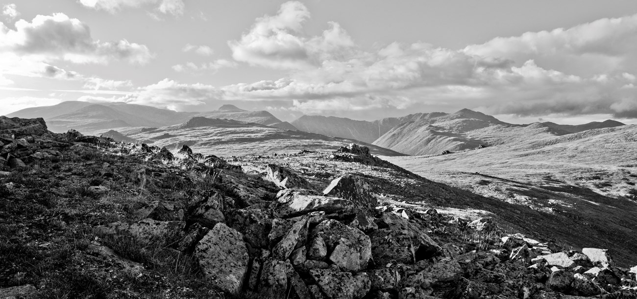
Arising at 4,000 feet of elevation, the Charley empties into the Yukon 700 feet above sea level, for an average gradient of 31 feet per mile and average current of four to six miles per hour. Side-streams have worn away old heights, softening the shapes of all but a few alpine peaks. The 2.5-million-acre Yukon-Charley Rivers National Preserve includes all 106 river miles of the Charley and encompasses its entire 1.1-million-acre watershed.
 
Black and white photograph of the Charley River Headwaters

NPS/Josh Spice

Eons have passed here without catastrophic change. Today Yukon-Charley persists as a haven largely untouched by glaciation and mostly free of human imprint. Here are prime breeding grounds of the endangered peregrine falcon, calving grounds of the Fortymile caribou herd, choice paleontological sites, superb recreational waters, and the timeless presence of the mighty and historic Yukon River.

The preserve lies between the communities of Eagle and Circle, Alaska. New Jersey with its 7.5 million residents would fit between these towns, but there are only 20 year-round residents here. Truly isolated, the preserve is wilder and less populated now than it was 50 or 80 years ago. The late-1800s Klondike and Nome gold rushes turned Circle - 2000 population 100 - into the Paris of the North, boasting an opera house. Pokes of gold were legal tender. This was the stuff of Jack London's stories and Robert Service's poetry. Eagle's population - about 130 in 2000 - was 800. Fort Egbert had electric lights and hot-and-cold running water.

Circle and Eagle were south-bank trade centers on the great Yukon River thoroughfare that bisects Alaska east to west for 1,250 river miles and stretches for 1,979 river miles from its headwaters near Whitehorse, in Canada's Yukon Territory, to its mouth at the Bering Sea. When not choked with stupendous, lethal spring and fall ice floes, the Yukon serves as summer waterway or frozen winter highway. Ancient hunters had traveled through the unglaciated Yukon corridor. Those who stayed probed the uplands for game via the stream-carved valleys. Forays upland took them first through thickets of willow and alder, through stands of white spruce and cottonwood screening the rivers, then across boggy flats punctuated by stunted black spruce. mixed white spruce, birch, and aspen gave way to brush as the hunters climbed toward dry tundra on the ridges. Above them loomed always the barren mountains scored by scree slopes and topped by granite pinnacles.
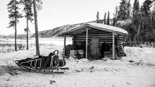
 
Black and white photograph of a dogsled at a public use cabin on the Yukon River in winter

NPS/Josh Spice

What scientists think may be remnant Ice Age vegetation occurs as patches of arctic steppe on sun-drenched benches and bluffs. Now, winter's darkness and cold conspire to isolate this land abutting the Arctic Circle. Animals go to ground or migrate, or, like the mountain sheep, stand hunched against arctic winds. Rivers and streams freeze over. Deprived of silt from these frozen sources, the winter Yukon runs clear under as much as 6 feet of ice.

But the sun returns. The rivers break. Bird calls herald spring. Peregrine falcons refurbish old cliff eyries, and the swift flight and stoop of these winged hunters take their toll on migrating birds. Salmon begin their runs, first the big kings and then the dog salmon. Here, 1,200 miles from the sea but with many miles left to swim, the powerful fish are still firm of flesh. And as they have for centuries, people gather at fish camps along the Yukon.

People who stayed after the glory days of gold faded - Han Indians already home and recent arrivals who had found a home - settled back into a slower pace, trapping, hunting, fishing, gardening. With easily exploited placer deposits of gold exhausted, mining, too, changed from a rush to long toil. Even today along the Yukon a fish camp may lie just around the bend - fishwheel or net in the water, fish drying on stream-side racks. Hunters track moose and caribou, and trappers test their mettle against the unforgiving land.

Life, in all its flintiness, persists here as it has for ages, and a few hardy souls still pit their fortunes against a true frontier wilderness.
 

New Park Brochure Text

Deep in Alaska, the great Yukon River strikes through bluffs and mountains of an ancient landscape. The Charley River and many streams tumble from the highlands, providing additional passageways into these wild lands. Congress set aside these 2.5 million acres in 1980 to protect the rivers, fish and wildlife populations and habitat, the area's cultural heritage, and to allow people to continue hunting and fishing as they have for thousands of years.
 

The Rivers

The Yukon runs 2,000 miles from its headwaters in Canada across Alaska to the Bering Sea, flowing about 130 miles through the preserve. During the short summer, silt from glaciers turns the water brown. The river deposits the silt, along with gravel, at points along its path while wearing away at rock in other places. In winter, the water runs clear beneath the ice that can be six feet thick.

Shorter and steeper than the Yukon, the Charley drops over 3,000 feet before broadening into a floodplain and emptying into the Yukon. People who want to float the 106-mile-long river usually fly to an airstrip near its source. They are rewarded with a spectacular trip where each bend presents another view of unspoiled, wild country. The Charley is the only National Wild and Scenic River with its entire watershed - 1.1 million acres - protected.
 

The Place

At its northernmost point, Yukon-Charley Rivers National Preserve lies about 50 miles from the Arctic Circle. It is a haven for life that can withstand long, cold, dark winters and prosper during the perpetual daylight and warmth of the short summers. Migrating caribou browse on fast-growing sedges, grasses, and other vegetation. The Fortymile herd also gives birth here. Songbirds and shorebirds migrate from tropical winter homes to nest. Peregrine falcons, once endangered, thrive here. King and chum salmon swim up the Yukon to their spawning beds. For generations, people have gathered at fish camps to capture the salmon that will help sustain their families and sled dogs through winter.
 

The People

Ancient people traveled the unglaciated Yukon corridor during the ice ages to take advantage of abundant plants and wildlife. They traversed thickets of willow and alder, dense stands of white spruce and cottonwood, and across boggy flats as they moved upward. The higher elevation forest of white spruce, birch, and aspen gave way to brush as the hunters climbed to the low, dry tundra on rocky ridges in search of prey. These ancestors of the Han Athabascans eventually settled in this land.

The gold rushes of the late 1800s brought thousands of gold seekers to the region. Circle, population currently around 100 people, gained a reputation as "the largest log-cabin city in the world" and earned the nickname "Paris of the North" because of its opera house. Eagle, population now also around 100, swelled to over 1,000 people. Pokes (small bags) of gold were legal tender. This wild time lives on in the writings of Jack London and Robert Service.

Most newcomers left almost as quickly as they arrived. Those who remained adopted the practices of the Alaska natives who already called this place home - trapping, hunting, fishing, and gathering plants in order to survive.

Today the preserve is wilder and less populated than it was during the gold-rush days. Life, in all its flintiness, persists as it has for ages. Welcome to this timeless land.
 

What to See and Do

At Yukon-Charley Rivers National Preserve, you can explore remnants of Alaska history, observe a variety of wildlife, and travel through remote country by river or overland. Obtain information about all of these opportunities here on our website, and by visiting or calling the Alaska Public Lands Information Center in Fairbanks or the Eagle Visitor Center (open daily in summer).

Most visitors come here during the brief summer to experience the Yukon or Charley rivers. Both require wilderness experience, appropriate equipment, and current maps. Other options inclue exploring the historic Coal Creek drainage; dog mushing, cross country skiing, snowmachining, snowshoeing, and other forms of winter travel; hunting and fishing; and visiting the historic towns near the preserve.

Weather

In summer (mid-June to mid-August), expect hot days and cool nights. Watch out for thunderstorms that bring lightning, downpours, and high winds. During dry years, wildland fires may be burning. Rivers begin freezing in October. Winter brings snow and extreme cold. Ice on the Yukon River breaks up in mid-May, making travel impossible until the ice floes have dissipated, which can take a couple weeks.

Plan Ahead

Start with this website, which has planning details and tips. The preserve is not directly connected to the state road system. You can drive to Circle year-round, and to Eagle mid-April to mid-October. Limited services and supplies are available in these and other small towns along the way. Eagle has year-round commercial air service. Air taxis and authorized guides can take you into the preserve. In the preserve, you are on your own. Park staff are usually at Slaven's Roadhouse and Coal Creek Camp mid-June to mid-September.

You Must Be Self-Reliant

No services or supplies are available inside the preserve, except for public-use cabins, which are free and first-come, first-served. Bring sturdy outdoor clothing and gear in good condition: weather-resistant outerwear, thermal layers, rain gear, tents with rainflies and mosquito netting that can withstand strong winds. Insect repellent, head nets, and sunscreen are highly recommended. Always carry emergency food rations in case you or your scheduled pick-up are delayed by weather.

Keep Food From Bears

Black and grizzly bears live here and will be attracted to food and scented items. Use bear-resistant food containers (BRFCs) to store these items. The Alaska Public Lands Information Center and Eagle Visitor Center have BRFCs you can use for free. Other bear safety tips are on the website.

Travel Safely

Use US Geological Survey topographic maps that cover the preserve: Eagle, Circle, Charley River, Big Delta. Read the safety tips on this website. Know how to prevent or avoid encounters with moose and bears. Always filter or treat drinking water. Adjust travel plans to the level of the least experienced member of your group. Always leave a travel plan with a trusted person, and check-in with them when you get back. There is no cell phone coverage here. Consider renting a satellite phone for your trip.

Respect Private Property

Many rural Alaskans live a subsistence way of life. Their camps, fishnets, traps, and equipment are private property. Native Corporation and private lands exist in the preserve. They are not open to the public.

Know the Rules

Park regulations, including those for firearms, fishing, and hunting, are available on this website.

Emergencies

Call (907) 683-2276 to reach emergency dispatch at the Alaska Regional Communication Center. Learn more on our Contact Us webpage.
 
Visit our Significance page to learn what makes Yukon-Charley Rivers unique and why it's protected.
 
Social Media links

Last updated: January 27, 2020

Park footer

Contact Info

Mailing Address:

101 Dunkel St
Suite 110

Fairbanks, AK 99701

Phone:

907-459-3730

Contact Us