NPS
Overview
The Southern Plains Network (SOPN) and its parks are located in the central grassland region of North America— one of the largest contiguous grassland environments on Earth (Lauenroth et al. 2008). Most ecologists consider there to be at least three distinct grassland types in this region, representing a gradient from tallgrass prairie on the eastern plains, to mixed-grass prairie in the central regions, and shortgrass prairie in the west. The parks in the SOPN are in either mixed-grass prairie or shortgrass prairie, with one park in the ecotone between shortgrass prairie and pinyon-juniper forest.
The North American prairie is also among the continent’s most endangered resources (Samson and Knopf 1994, Rickletts et al. 1999). Grasslands have been subjected to degradation and the loss of genetic diversity due to exotic species invasions, expanding row-crop agriculture, overgrazing, mineral exploration, establishment of woodlots and shelterbelts, and changes in the natural fire regime.
Fire is one of the most influential disturbance processes in the grassland ecosystem. Fire, along with climate, is the biggest determinant of whether grasslands preclude forests, and fire is a primary influence on the plant and wildlife communities of the parks. Fire can influence plant succession and distribution, wildlife habitat, aspects of the soil, hydrology, water quality, and air quality. Monitoring grassland vegetation communities and the effects of fire helps SOPN park managers better understand the dynamic nature of these grassland ecosystems, the processes that influence them, and their condition. This information can help managers make effective decisions, including the planning of prairie restoration efforts.
Measurements and Objectives
The SOPN has teamed with the Southern Plains Fire Group to carry out collaborative monitoring of grasslands in all SOPN parks. Our specific objectives are to:
- Determine status and trends in plant species composition (richness and diversity) and community structure (relative abundance, frequency, distribution, and ground cover) of remnant, disturbed, and/or restored grasslands, and
- Determine the relationship between status and trends of species composition and community structure and environmental variables (i.e., long-term management actions, climate, and atmospheric deposition).
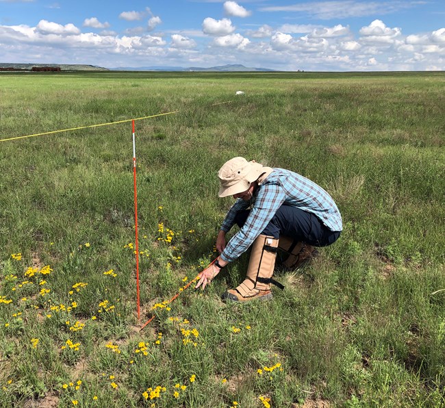
We conduct our monitoring by sampling along 50-m transects established in grassland habitat within each park. The number of transects in a given park is between about 4 and 14, depending on the number and type of habitats in a park. A variety of measurements are taken on or adjacent to the transects using two methods– point-line intercept sampling, and sampling at randomly-selected points.
- Point-line intercept sampling: During a transect visit, our field crew collects data along the first 30 m of the 50-m transect. A vertical pole is placed every 0.3 m along the transect, and we collect: height and species of the tallest plants touching the pole; species identification of additional, lower-growing plants; and ground layer condition (e.g., bare ground, litter, bedrock).
- Sampling at randomly-selected points: 15 random points are selected (and numbered) prior to monitoring within both the designated plant community and 100 m around the transect. At the transect, crew members visit the first 10 points, listing the species found within a 1-m radius of the point. A Density Class is also recorded for each species. If one (or more) of the first 10 points falls outside of the plant community, or is otherwise unsuitable, a substitute point is used from one of the remaining five points (i.e., starting with Point 11).
For more information, contact Merran Owen, Biologist, Southern Plains Network
Monitored at the Following Parks:
- Bent’s Old Fort National Historic Site
- Capulin Volcano National Monument
- Chicasaw National Recreation Area
- Fort Larned National Historic Site
- Fort Union National Monument
- Lake Meredith National Recreation Area (including adjacent Alibates Flint Quarries
- National Monument)
- Lyndon B. Johnson National Historical Park
- Pecos National Historical Park
- Sand Creek Massacre National Historic Site
- Washita Battlefield National Historic Site
Last updated: June 12, 2024
Success
Thank you. Your feedback has been received.
Error
alert message

