|
Capitol Reef
Cultural Landscape Report |

|
ANALYSIS AND EVALUATION (continued)
VEGETATION RELATED TO LAND USE (continued)
(Orchard Summaries)
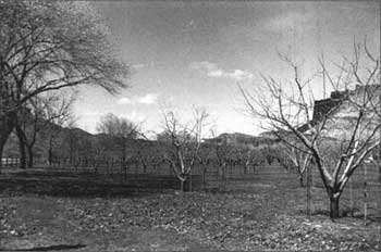
Current Name: Mott's Orchard
Other Name(s): Brimhall Orchard
Park Code: 0-02
Location: Located .2 miles east if the visitor center, on the north side of the Scenic Drive.
Tract: 8
Acres Cultivated:
| Orchard | 8.2 |
| Field | 1.5 |
| Total | 9.7 |
Number of Trees: 300+ (approximate—isolated and scattered trees not documented)
Date Recorded: January 1990, March 1993
| |
| Mott's Orchard | |
Historical Documentation:
Originally part of the Elijah Behunin homestead of 120 acres, most of this land was farmed longest by Leo Holt's brother, Aaron Holt (1914-1939). Orval Mott bought Holt's land (40 acres) and an additional 14 acres in 1940, then sold the combined 54 acres to Dean Brimhall in 1943. In 1940 as much as 21 acres were farmed, with approximately 8 acres in orchard, and 13 acres in field crop. The construction of State Highway 24 required 1 acre on the north edge of the property, and the development of park housing took approximately 9.5 acres out of production between 1964 and 1965.
Historic Crops:
Peach (161)
Apple (75)
Apricot (52)
Cherry (35)
Pear (12)
Prune (5)
Almond (5)
Quince (2)
Mulberry (1)
Current Crops:
Almond (9)
Apple (263)
Apricot (39)
Peach (66)
Cherry (27)
Pear (8)
Plum (7)
Walnut (5)
Quince (2)
| <<< Previous | <<< Contents >>> | Next >>> |
http://www.nps.gov/care/clr/clr4d9.htm
Last Updated: 01-Apr-2003