|
GLACIER
Final Master Plan May 1977 |

|
MAJOR ELEMENTS THAT AFFECT PLANNING
Many factors, both natural and man-induced, affect the resource, influence its use, and modify any endeavor to manage or plan for the future.
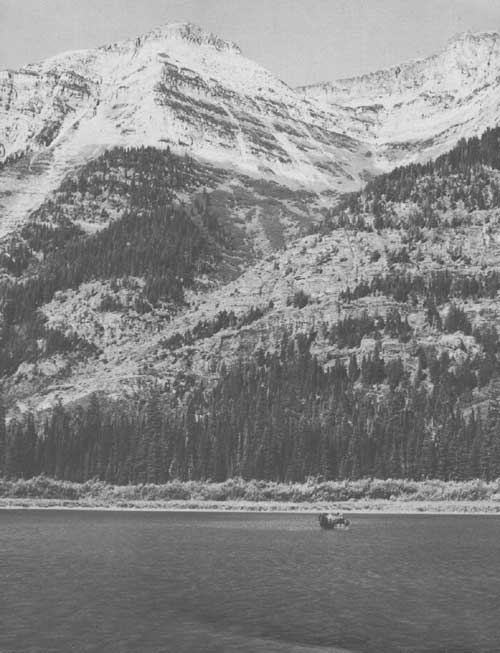
MOUNTAINS
With its highest peaks delineating the Continental Divide, the Rocky Mountain range constitutes a formidable barrier in this region; Glacier, as part of that barrier, is split into two quite different environments. Most precipitation falls west of the divide, where the landscape exhibits dense forest, numerous lakes and streams, and an associated complex of glacier-carved valleys. Moisture-laden air from the west is forced upward by the mountains and loses 25 to 30 inches of annual precipitation to the lower elevations, while the upper elevations receive 80 to 100 inches, mostly as snow. Continental air masses influence the climate east of the divide, finding their expression in colder temperatures and less precipitation. The eastern slopes are almost constantly buffeted by winds, frequently of high velocity, while the western valleys enjoy a comparatively gentle climate. Temperatures fluctuate in extremes between -50deg and 1000 Fahrenheit. Mean annual temperature for the west side is 420, for the east side 40deg.
VEGETATION
Park vegetation is represented by a mosaic of alpine, coniferous forest, and grassland communities. Alpine tundra of the high country is encompassed by extensive conifer forests at lower elevations. Grasslands, meadows, bogs, and other types occur less extensively, in response to local soil and moisture conditions. Frequent snowslides reflect the rugged nature of park terrain and create shrubfields in many areas. Fire must be viewed as one of the most significant natural factors with potential for affecting park vegetation.
WILDLIFE
In his diary, Meriwether Lewis wrote, "the wonderful power of life which these animals possess renders them dreadful... we had rather encounter two Indians than meet a single bear." The bear to which Lewis refers is of course the grizzly bear — a creature that perhaps symbolizes the marvelous array of wildlife in Glacier National Park. Over 200 species of birds and 57 species of mammals have been recorded. The park remains a sanctuary for the endangered wolf (Canis lupus irremotus) and relatively rare grizzly bear (Ursus arctos).
Because wildlife occurs throughout the park, it affects all programs — interpretation, management, development, and use. While it is important for visitors to view the wildlife, the notability of this resource amplifies the importance of maintaining as much of the park as wilderness or near-wilderness as possible.
LAKES AND RIVERS
Water from lakes, streams, and glaciers has carved the land into its present form. These water resources are destination points for visitors, offering views, transportation, fishing, and boating. This aquatic resource totaling some 31,000 acres is an integral part of the park. Many of the high-country lakes were originally devoid of fish; however, exotic and native fishes have been so liberally distributed by man that many of the park's aquatic ecosystems bear little resemblance to those originally present. Additionally, pollution from a variety of sources looms as a threat to the integrity of these water resources.
HISTORIC RESOURCES
In compliance with Executive Order 11593, Protection and Enhancement of the Cultural Environment, and the National Historic Preservation Act of 1966, an inventory and evaluation of cultural resources has been accomplished. Among the historic properties to be nominated to the National Register of Historic Places in 1975 are: the Many Glacier and Lake McDonald Hotels operated by Glacier Park, Inc.; the St. Mary Ranger Station, and Granite Park and Sperry Chalets. All other historic resources, including inholder property, acquired by the National Park Service will be evaluated to assure compliance with historic preservation legislation before any action is taken.
MAN-INDUCED ELEMENTS
Man's use of this region has brought about changes in the environment, and those changes, such as the division of land into various management units, created patterns that will remain important factors in park use and management.
Hungry Horse Dam and Reservoir, Libby Dam, and Lake Koocanusa, and Bob Marshall Wilderness provide major recreation resources for the region. Other high-use areas are Big Mountain ski area, and Whitefish and Flathead Lakes.
The international boundary, although not following a natural landform, does affect land use and development. Finally, the large national forest holdings and the Blackfeet Indian Reservation abutting park land are a major influence in management and development programs.
Recreational development by the private sector, by other land management agencies, and by the National Park Service are interdependent. Locations and extent of service require continued cooperative planning to ensure protection of resources and provision of appropriate facilities.
VISITATION
Travel to Glacier continues to increase. Visitation exceeded 1.4 million during 1974, representing a mean annual growth of over 6% since 1960 (724,538 visitors). The park is not adjacent to any metropolitan area, and visitation is, in large measure, tied to transcontinental vacation travel. Throughout the week approximately 25% of these visitors stay in the park overnight at various lodges and campgrounds. Day use is best described as a wilderness threshold experience, with penetration of the wilderness dependent upon the desire and capability of the visitor. Augmenting use of the park road system are excellent opportunities for nature walks and long hikes, as well as horseback riding and boat trips into the heart of the prime resources. Visitor concentrations during the day are most apparent at Many Glacier, which is the hub of the wilderness trails; along Going-to-the-Sun Road, especially at Logan Pass; and at Lake McDonald and Two Medicine Lake.
Glacier's vast wilderness is also receiving heavier use, and resource deterioration is already apparent in some areas. Nearly 28,257 camper days were recorded in the wilderness in 1974, and a continued increase is expected. Two high-country chalets, Granite Park and Sperry, offer food and lodging.
SURROUNDING LANDS
Glacier is the larger portion of Glacier-Waterton Lakes International Peace Park, which constitutes the core of a vast mountain complex that forms the Continental Divide in this area of the Rocky Mountain range and includes superb resources in both Canada and the United States. Much of the complex within Montana is national forest and has been included within the framework of recreation planning. The Blackfeet Indian Reservation, bordering the park on the east, completed a comprehensive plan for the reservation in December 1972 that includes provisions for recreational facilities. The park, however, is the central attraction in the region. As visitation increases, new overnight and day-use facilities will be needed. Adequate space exists for these future developments in locations convenient to all resources outside the park boundaries.
| <<< Previous | <<< Contents>>> | Next >>> |
glac/final_master_plan/sec1.htm
Last Updated: 01-Jul-2010