|
GLACIER
Final Master Plan May 1977 |

|
PLANNING GUIDEPOSTS
In order to provide for and encourage varied types of resource use in accordance with the objectives stated in the appendix of this report, certain concepts have been accepted as controls for planning.
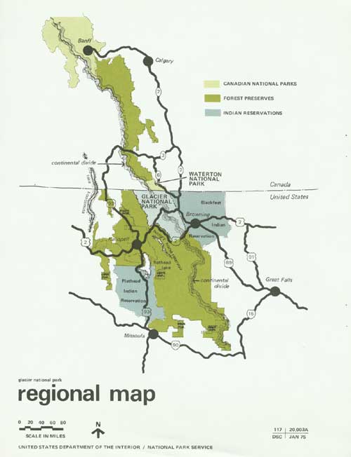
Park boundaries are considered essentially adequate, except for minor revisions to accommodate such changes as road and railroad realignment. The west and south boundaries follow the Flathead River, a major natural feature. The north boundary is common to the international boundary, and the east boundary borders the Blackfeet Indian Reservation, where no change is anticipated.
|
| REGIONAL MAP. (click on image for a PDF version) |
The Burlington Northern Railroad, part of the nationwide system of Amtrak, stops daily during the summer near the park boundary at East Glacier Park and West Glacier. It is anticipated that visitors will continue to come to the park by means of rail transportation, either singly or in tour groups. For those visitors arriving or departing by air, commercial transportation is available on a regularly scheduled basis at Glacier International Airport, situated in the Flathead Valley west of the park, and at Great Falls, Montana, to the southeast. The 892 acres acquired by the Service outside the park near East Glacier Park for the purpose of developing an airport is dependent upon relevant environmental considerations.
The general route of the Going-to-the-Sun Road will be a primary location for park interpretation, particularly for visitors who see the park by mechanical transportation or short walks. Flanking this interpretive corridor and occupying much of the park's acreage will be one small and two very large wilderness areas that will be managed to maintain their wilderness character.
Both overnight and day use have been traditional at Glacier; this pattern is considered a desirable part of the park experience and is expected to continue.
Portions of the Flathead River, if considered sufficiently significant by Congress to be included in the National Wild and Scenic Rivers System, will influence park use and development. A compatible use plan involving lands on both sides of the river should be developed by the Forest Service and the National Park Service at the local level.
| <<< Previous | <<< Contents>>> | Next >>> |
glac/final_master_plan/sec2.htm
Last Updated: 01-Jul-2010