PECOS
From Folsom to Fogelson:
The Cultural Resources Inventory Survey of Pecos National Historical Park
|

|
APPENDIX E:
1,100 YEARS OF CONSTRUCTION WOOD USE IN THE UPPER PECOS VALLEY
|
|
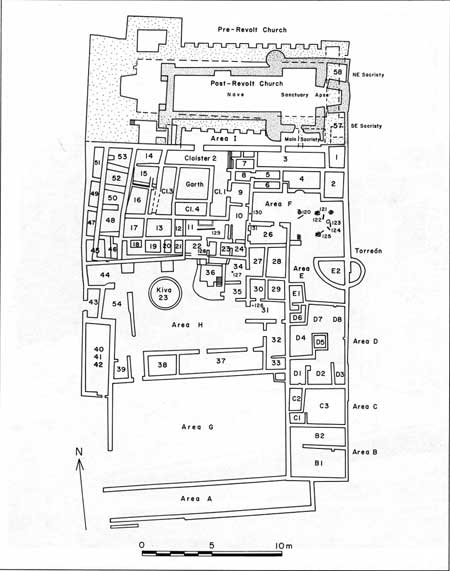
E.7. Pecos Mission Church
and Convento (click on image for an enlargement in a new window)
|

|
|
E.8. Pecos Mission
Church, looking east through the nave to the sanctuary and apse
|
|
|
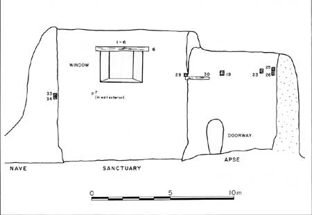
E.9. Elevation view of
the interior south wall of the apse, sanctuary, and nave, Pecos Mission
Church (click on image for an enlargement in a new window)
|
|
|
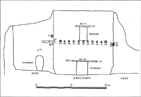
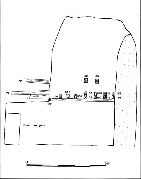
E.10. Elevation view of
the interior north wall of the nave, sanctuary, and apse, Pecos Mission
Church (click on image for an enlargement in a new window)
|
|
|
E.11. Elevation view of
the interior south and east walls of the northeast sacristy (Room 58),
Pecos Mission Church (click on image for an enlargement in a new window)
|
|
|
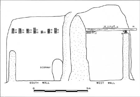
E.12. Elevation view of
the interior west wall of the southeast sacristy (Room 57), Pecos
Mission Church (click on image for an enlargement in a new window)
|
peco/cris/appe3.htm
Last Updated: 13-Feb-2006
|


