PECOS
From Folsom to Fogelson:
The Cultural Resources Inventory Survey of Pecos National Historical Park
|

|
APPENDIX E:
1,100 YEARS OF CONSTRUCTION WOOD USE IN THE UPPER PECOS VALLEY
|
|
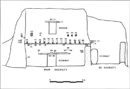
E.13. Elevation view of
the interior north wall of the main sacristy, Pecos Mission Church (click on image for an enlargement in a new window)
|
|
|
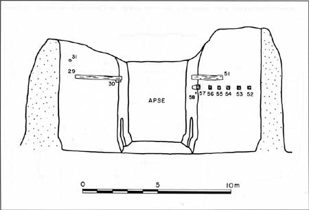
E.14. Elevation view of
the interior east walls of the sanctuary and apse, Pecos Mission
Church (click on image for an enlargement in a new window)
|
|
|
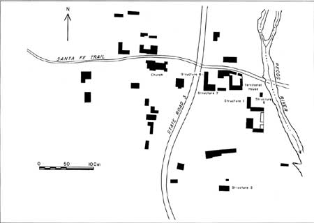
E.15. Plan view of the
San Miguel del Vado plaza area (click on image for an enlargement in a new window)
|
|
|
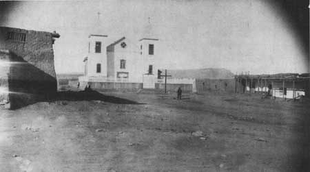
E.16. San Miguel del
Vado church. View looking west from near the crossing of the Pecos River
along the Santa Fe Trail
|

|
|
E.17. San Miguel del
Vado church
|

|
|
E.18. The San Miguel del
Vado church sanctuary
|
peco/cris/appe4.htm
Last Updated: 13-Feb-2006
|


