PECOS
From Folsom to Fogelson:
The Cultural Resources Inventory Survey of Pecos National Historical Park
|

|
APPENDIX E:
1,100 YEARS OF CONSTRUCTION WOOD USE IN THE UPPER PECOS VALLEY
|
|
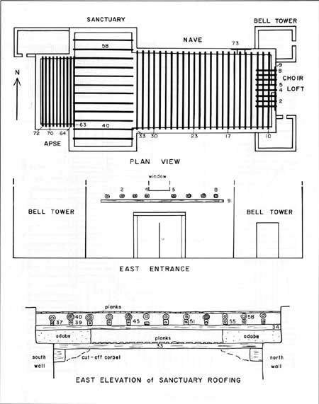
E.19. San Miguel del
Vado church (click on image for an enlargement in a new window)
|
|
|
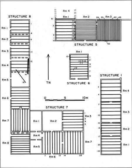
E.20. Plan of sampled
structures at San Miguel del Vado (click on image for an enlargement in a new window)
|
|
|
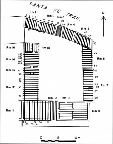
E.21. Plan of the
Territorial House in San Miguel del Vado bordering the Santa Fe
Trail (click on image for an enlargement in a new window)
|
|
|
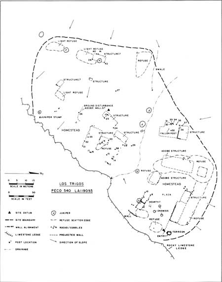
E.22. Plan view of the
PECO-540 homestead (click on image for an enlargement in a new window)
|
|
|
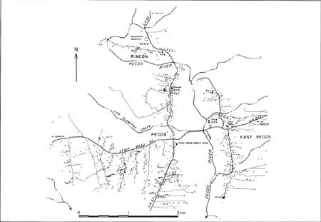
E.23. Plan view of the
Village of Pecos (click on image for an enlargement in a new window)
|

|
|
E.24. House behind
Harrison's (now Adelos Town and Country Store and the Shell gas station)
similar to the Pablo Martinez House sampled next to the St. Anthony's
Parish in the Village of Pecos
|
peco/cris/appe5.htm
Last Updated: 13-Feb-2006
| 


