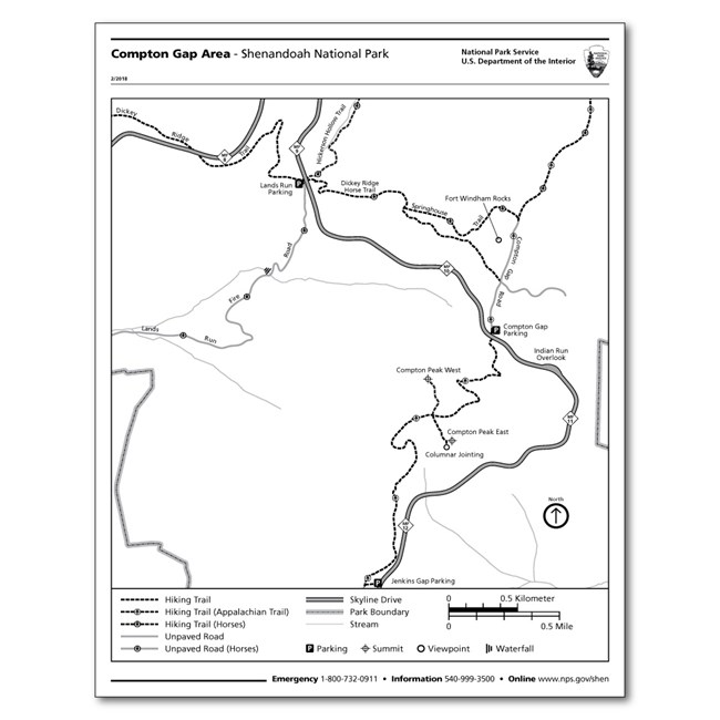
Trail MapsWith over 500 miles of trails, choosing your next hike in Shenandoah can be a little daunting. Not to fear! We've put together trail maps with recommended day hikes for different areas of the Park. Print them out, or download the accessible PDFs to take with you on your mobile device. Note that all of these maps are intended for short, day hikes only. If you're planning a longer backcountry hike, we recommend purchasing a topographic map at one of our visitor centers or online from the Shenandoah National Park Association or the Potomac Appalachian Trail Club (PATC). 
If you'd rather browse all of our trail maps, you can find the complete list here: Park BrochureThis is the official guide to Shenandoah National Park. It contains a map of all of the available services and amenities in the Park, as well as an introduction on what this place is all about. 
To download official maps in PDF, Illustrator, or Photoshop file formats, visit the National Park Service cartography site. Campground MapsCamping in one of our campgrounds is an amazing experience with the right preparation. These maps show where each numbered site is and provide an overview of the amenities available at each campground. They are listed geographically, going from the northern section of the Park to the southern section. Mathews Arm Campground Official NPS AppOur mobile app is another great wayfinding option, featuring a map of the hiking trails, overlooks, services, and other points of interest in Shenandoah National Park, as well as all 400+ sites in the National Park Service system. Just remember to download offline content before arriving at the Park, as cell reception is unreliable. Backcountry Planning Web MapPlanning an overnight backpacking trip? Use this backcountry web map to help choose your starting/ending location, your route, and what backcountry zone you will be camping in each night. Other map layers include areas where camping is prohibited as well as the Shenandoah Wilderness. A well-planned trip is essential to obtaining your backcountry camping permit on Recreation.gov. USGS Topographic MapsYou can download 7.5 minute quadrangle topographic maps of the park for free on the US Geological Survey's (USGS) website. |
Last updated: January 14, 2026
